Near Arnoldsville in Oglethorpe County, Georgia — The American South (South Atlantic)
William Bartram Trail
Traced 1773-1777
| — | Deep South Region | — |
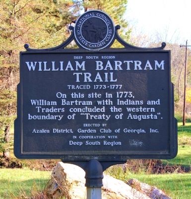
Photographed by David Seibert, November 15, 2009
1. William Bartram Trail Marker
Erected by Azalea District, Garden Club of Georgia, Inc. in Cooperation with Deep South Region.
Topics and series. This historical marker is listed in these topic lists: Colonial Era • Exploration • Horticulture & Forestry • Indigenous Peoples and Communities • Industry & Commerce. In addition, it is included in the William Bartram Trails series list. A significant historical year for this entry is 1773.
Location. 33° 53.94′ N, 83° 14.454′ W. Marker is near Arnoldsville, Georgia, in Oglethorpe County. It is at the intersection of Athens Road (U.S. 78) and Moss Creek Road, on the right when traveling west on Athens Road. Touch for map. Marker is in this post office area: Arnoldsville GA 30619, United States of America. Touch for directions.

Regionally, this marker is in Georgia’s Antebellum Trail, in the Classic City Area, and in the Piedmont. It is also in the American South and specifically in the Deep South. Globally, it is in North America, the Western
this page online
Other nearby markers. At least 8 other markers are within 8 miles of this marker, measured as the crow flies: William Harris Crawford (approx. 4.4 miles away); A Memorial to William Harris Crawford (approx. 4.4 miles away); Veterans of Oglethorpe County (approx. 5 miles away); Wm H Crawford (approx. 5 miles away); Pittard Park (approx. 5.2 miles away); Ben T. Epps (approx. 6 miles away); Historic Oglethorpe County Jail (approx. 7.6 miles away); Governor Gilmer’s Home (approx. 7.7 miles away).
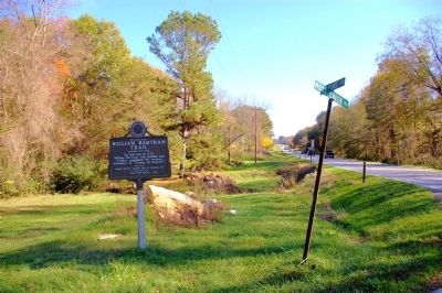
Photographed by David Seibert, November 15, 2009
2. William Bartram Trail Marker
Looking east on US Highway 78 toward Crawford and Lexington
Credits. This page was last revised on November 17, 2019. It was originally submitted on December 27, 2009, by David Seibert of Sandy Springs, Georgia. This page has been viewed 1,533 times since then and 32 times this year. Photos: 1, 2. submitted on December 27, 2009, by David Seibert of Sandy Springs, Georgia. • Kevin W. was the editor who published this page.
