Tahlequah in Cherokee County, Oklahoma — The American South (West South Central)
History of the Cherokee National Capitol Square

Photographed by Cosmos Mariner, September 11, 2024
1. History of the Cherokee National Capitol Square Marker
In 1839, after the forced removal from their homeland in the southeastern United States, the Cherokee people began to settle on their new land in Indian Territory. A few years later, the tribe decided that Tahlequah would become the capitol city of the Cherokee Nation.
The first gatherings of the chief and council were held in an open air unit, a log shelter with open sides. Eventually, four log cabins were built in the center of the town for governmental purposes. In 1843, the famous International Indian Council was held in capitol square. At least eighteen Indian tribes in the West sent representatives and pledged peace and friendship among themselves and with the Cherokees. Historians say the meeting was the most important Indian council ever held on the North American continent. It was captured on canvas by artist John Mix Stanley, whose painting is located at the Smithsonian Institution.
For several years Tahlequah was a mere campground with no structure until 1844, when the tribe platted the town. That same year a modest brick building was built in the southeastern corner of the square to house the Cherokee National
this page online
In 1863, during the Civil War, Confederate Brigadier General Stand Watie, a Cherokee citizen who was one of the signers of the Treaty of New Echota, burned the Council houses down. After the war, the tribal council made provisions for a new building. Architect C.W. Goodlander was paid $31.30 for his plans for a two-story brick structure, known as the Capitol Building. It was completed in 1869 at a cost of over $17,000. The building was quite a sight as it rose above the center of Capitol Square, towering over nearby buildings.
In 1875, another new official building joined the Square when the Cherokee National Penitentiary was built. The prison was the only such facility in the entire Indian

Photographed by Cosmos Mariner, September 11, 2024
2. History of the Cherokee National Capitol Square Marker
The marker is located along the walkway overlooking Tahlequah Creek.
Scattered around the Square at various times were taverns, cabins, hotels, cookhouses, blacksmiths and mercantile stores. At first, wooden buildings were built around the Square, but this changed after a devastating fire in 1895 destroyed many stores and homes. An ordinance was passed after that stating all new buildings should be made of brick.
A fire destroyed the interior of the building in the winter of 1904, but it was quickly refurbished. The Capitol held the executive and legislative offices of the Nation until 1906, when the Five Civilized Tribes began dismantling their tribal judicial system in accordance with the Curtis Act of 1898. The final treaties with the U.S. Government in the late 1800's were ratified in the Capitol Building, and the last of the principal chiefs to serve under the 1839 Cherokee Constitution took oath of office here.
The Capitol Building was once damaged by fire in 1928 but was rebuilt shortly after. The original

Photographed by Cosmos Mariner, September 11, 2024
3. Cherokee National Supreme Court
Located 3 blocks southwest of this interpretive panel.
Cherokee County acquired the Capitol Building and grounds after statehood and used the property for county offices for many years. The building has gone through several refurbishing's and was reacquired by the Cherokee Nation in 1979, along with the Supreme Court Building and the National Penitentiary. Currently the building is known as the Cherokee National History Museum that tells the Cherokee story through immersive exhibits and augmented reality.
Topics. This historical marker is listed in these topic lists: Architecture • Indigenous Peoples and Communities • Settlements & Settlers • War, US Civil. A significant historical year for this entry is 1839.
Location. 35° 54.76′ N, 94° 58.128′ W. Marker is in Tahlequah, Oklahoma, in Cherokee County. It is at the intersection of South Park Avenue and East Delaware Street,

Photographed by Cosmos Mariner, September 12, 2024
4. Cherokee National Penitentiary (northeast elevation)
Located 5 blocks southwest of this interpretive panel.

Regionally, this marker is in the Cherokee Nation and in Northeast Oklahoma—Green Country. It is also in the American South, specifically in the Ozarks, on the prairies, and on the Southern Plains. Globally, it is in North America, the Western Hemisphere, the Western World, and the Anglosphere. Historically, it finds itself in what was once the territory of the Mississippian Culture and also the Louisiana Purchase.
Other nearby markers. At least 8 other markers are within walking distance of this marker: Cherokee Advocate (about 500 feet away, measured in a direct line); Judge John Martin, Jr. (about 600 feet away); Cherokee National Capitol (about 600 feet away); John Ross ᎫᏫᏍᎫᏫ (about 600 feet away); Veterans Memorial (about 600 feet away); First Telephone in Oklahoma (about 600 feet away); John Brian Stapler (about 600 feet away); Replica of the Statue of Liberty

Photographed by Cosmos Mariner, September 12, 2024
5. Cherokee National Penitentiary (north/front elevation)
Related markers. Click here for a list of markers that are related to this marker.
Also see . . . Cherokee National Capitol (Wikipedia).
Excerpt: The Cherokee Nation Courthouse stands in the center of Courthouse Square, bounded by East Delaware Street, South Water Avenue, East Keetoowah Street, and South Muskogee Avenue. Early government meetings of the Nation were held out in the open, with later meetings in log structures. A courthouse was built in the 1840s, but most of the city's public buildings were destroyed during the American Civil War.(Submitted on October 25, 2024, by Cosmos Mariner of Cape Canaveral, Florida.)
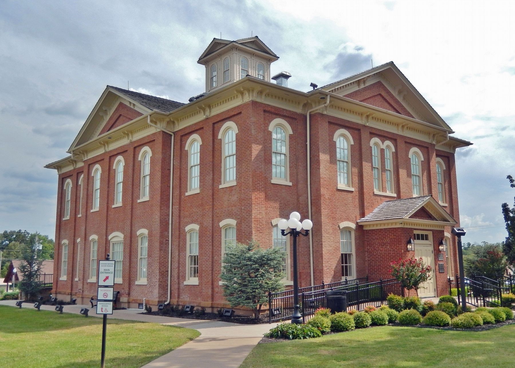
Photographed by Cosmos Mariner, September 11, 2024
6. Cherokee National Capitol
Located 1 block west of this interpretive panel and known today as the Cherokee National History Museum.
Credits. This page was last revised on October 25, 2024. It was originally submitted on October 24, 2024, by Cosmos Mariner of Cape Canaveral, Florida. This page has been viewed 305 times since then and 79 times this year. Photos: 1, 2, 3, 4, 5, 6. submitted on October 25, 2024, by Cosmos Mariner of Cape Canaveral, Florida.
