Upper Shockoe Valley in Richmond, Virginia — The American South (Mid-Atlantic)
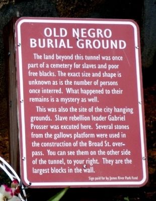
Old Negro Burial Ground
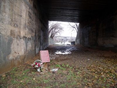
The land beyond this tunnel was once part of a cemetery for slaves and poor free blacks. The exact size and shape is unknown as is the number of persons once interred. What happened to their remains is a mystery as well.
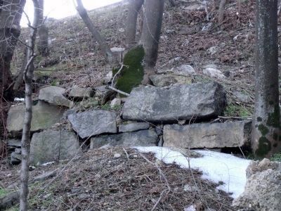
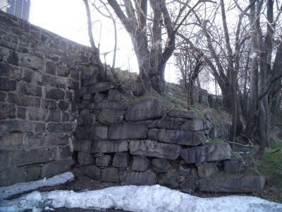
This was also the site of the city hanging grounds. Slave rebellion leader Gabriel Prosser was executed here. Several stones from the gallows platform were used in the construction of the Broad St. overpass. You can see them on the other side of the tunnel, to your right. They are the largest blocks in the wall.
Erected by James River Park Fund.
Topics. This historical marker is listed in these topic lists: African Americans • Cemeteries & Burial Sites • Law Enforcement.
Location. This marker has been replaced by another marker nearby. It was located near 37° 32.226′ N, 77° 25.673′ W. Marker was in Richmond, Virginia. It was in Upper Shockoe Valley. Marker could be reached from East Marshall Street, 0.1 miles west of North 16th Street. The marker is located in a tunnel underneath Broad St. The burial grounds site is in the parking lot south of E Marshall St. Touch for map. Marker was in this post office area: Richmond VA 23219, United States of America. Touch for directions.
Other nearby markers. At least 8 other markers are within walking distance of this location. Slave Rebellion leader Gabriel Prasser… (a few steps from this marker); Execution of Gabriel (a few steps from this marker); Lumpkin's Jail (about 300 feet away, measured in a direct line); Richmond's African Burial Ground (about 300 feet away); Winfree Cottage (about 400 feet away); First African Baptist Church (about 700 feet away); a different marker also named First African Baptist Church (about 700 feet away); Monumental Church (approx. 0.2 miles away). Touch for a list and map of all markers in Richmond.
Related marker. Click here for another marker that is related to this marker. This marker has been painted over with the linked "guerilla marker."
Also see . . . Burial Gounds for Negroes - Sacred Ground Historical Reclamation Project. (Submitted on December 28, 2009.)
Credits. This page was last revised on February 19, 2023. It was originally submitted on December 28, 2009, by Bernard Fisher of Richmond, Virginia. This page has been viewed 2,460 times since then and 58 times this year. Photos: 1, 2. submitted on December 28, 2009, by Bernard Fisher of Richmond, Virginia. 3, 4. submitted on February 21, 2010, by Bernard Fisher of Richmond, Virginia.


