
Kernstown near Winchester in Frederick County, Virginia — The American South (Mid-Atlantic)
Site of the Original Pritchard Barn
Few Traces Remain of this Historic Structure

Photographed by Bradley Owen, October 12, 2024
1. Site of the Original Pritchard Barn Marker
The original Pritchard family's barn pictured below stood here throughout the Civil War until about 1969, when it was torn down.
The barn served as a shelter for the soldiers, as a hospital area and as a morgue. There is a story from a Union soldier's diary which related an occurance in the midst of the battle of First Kernstown during which Union troops were taking shelter in the barn. A shot from a Confederate cannon just south of the village went through the barn's main door causing a quick exodus by the troops.
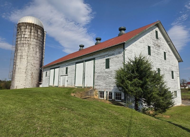
The original two-level farm barn stood on this embankment until being replaced by the white Amish-built barn you see 200 yards to the west. The foundation rocks are still visible near the base of the bank.
During the razing of the barn in the late 1960s the workers noted that the flooring boards were still soaked with the blood of casualties from the three battles fought here.
The original barn, shown in the image below, was 40-feet wide by 76-feet long for an area of 3,040 square feet per floor and ably served as storage for the farm's crops. Silos had not yet been introduced here.
(Caption):
Portion of the only known photo of the original Pritchard barn, built prior to the Civil War. Photo taken in the 1960s.
Erected 2023
this page online
Topics. This historical marker is listed in these topic lists: Notable Places • War, US Civil. A significant historical year for this entry is 1969.
Location. 39° 8.607′ N, 78° 11.863′ W. Marker is near Winchester, Virginia, in Frederick County. It is in Kernstown. It is on Battle Park Drive 0.3 miles west of Saratoga Drive, on the right when traveling west. Marker is located on the Pritchard Farm Trail at the Kernstown Battlefield. Touch for map. Marker is at or near this postal address: 610 Battle Park Drive, Winchester VA 22601, United States of America. Touch for directions.

Regionally, this marker is in Virginia’s Shenandoah Valley. It is also in the American South, specifically in the Upper South, and in the Mid-Atlantic. Globally, it is in North America, the Western Hemisphere, the Western World, and the Anglosphere. Historically, it finds itself in what was once the territory of the Mississippian Culture, one of the original Thirteen Colonies, one of the Confederate States of America, and the Antebellum South.
Other nearby markers. At least 8 other
Photographed by Bradley Owen, October 12, 2024
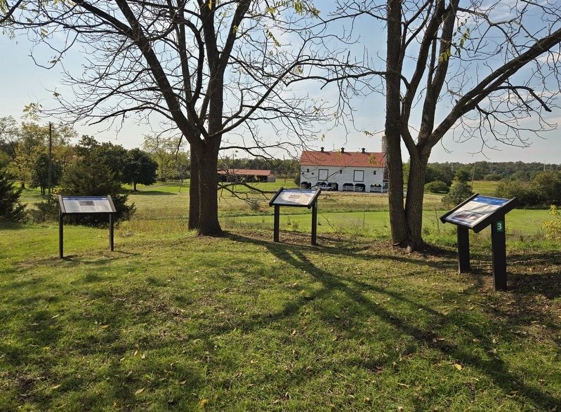
2. Site of the Original Pritchard Barn Marker
Marker is located on the far right.
Photographed by Bradley Owen, October 12, 2024
3. Amish Built Barn Mentioned on the Marker
Credits. This page was last revised on November 2, 2024. It was originally submitted on October 31, 2024, by Bradley Owen of Morgantown, West Virginia. This page has been viewed 207 times since then and 19 times this year. Photos: 1, 2, 3. submitted on November 2, 2024, by Bradley Owen of Morgantown, West Virginia.
