Near Richmond in Henrico County, Virginia — The American South (Mid-Atlantic)
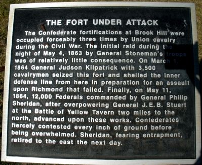
The Fort Under Attack
Photographed by Bernard Fisher, February 1, 2009
1. The Fort Under Attack Marker
The Confederate fortifications at Brook Hill were occupied forceably (sic) three times by Union cavalry during the Civil War. The initial raid during the night of May 4, 1863 by General Stoneman’s troops was of relatively little consequence. On March 1, 1864 General Judson Kilpatrick with 3,500 cavalrymen seized this fort and shelled the inner defense line from here in preparation for an assault upon Richmond that failed. Finally, on May 11, 1864, 12,000 Federals commanded by General Philip Sheridan, after overpowering General J.E.B. Stuart at the Battle of Yellow Tavern two miles to the north, advanced upon these works. Confederates fiercely contested every inch of ground before being overwhelmed. Sheridan, fearing entrapment, retired to the east the next day.
Topics. This historical marker is listed in this topic list: War, US Civil. A significant historical date for this entry is March 1, 1864.
Location. 37° 36.659′ N, 77° 27.519′ W. Marker is near Richmond, Virginia, in Henrico County. It can be reached from Brook Road (U.S. 1) 0.1 miles west of Brook Road (U.S. 1), on the left when traveling north. This marker is located at the
this page online

Regionally, this marker is in the Piedmont and in Central Virginia. It is also in the American South, specifically in the Upper South, and on the Eastern Seaboard. Globally, it is in the North Atlantic Region, North America, the Western Hemisphere, the Western World, and the Anglosphere. Historically, it finds itself in what was once the territory of the Mississippian Culture, one of the original Thirteen Colonies, one of the Confederate States of America, and the Antebellum South.
Other nearby markers. At least 8 other markers are within walking distance of this marker: Gabriel’s Insurrection (here, next to this marker); Confederate Fortifications (a few steps from this marker); a different marker also named Stuart's Ride (within shouting distance of this marker); Richmond Defences (about 500 feet away, measured in a direct line); Brook Road (about 500 feet away); Outer Fortifications (about 500 feet away); Campaign of 1781 (about 500
Photographed by Bernard Fisher, February 7, 2009
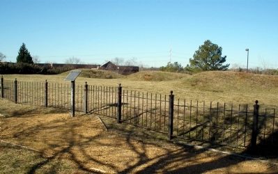
2. Brook Hill Fortifications
Another marker is no longer nearby. Stuart's Ride (was within shouting distance of this marker but has been replaced with another marker now near it).
Also see . . .
1. Stoneman's 1863 Raid (April 13 – May 10, 1863). Wikipedia entry (Submitted on February 21, 2024, by Larry Gertner of New York, New York.)
2. Kilpatrick-Dahlgren Raid (February 28–March 3, 1864). Encyclopedia Virginia entry (Submitted on February 21, 2024, by Larry Gertner of New York, New York.)
3. Battle of Yellow Tavern (May 11, 1864). Encyclopedia Virginia website entry (Submitted on February 21, 2024, by Larry Gertner of New York, New York.)
Photographed by Bernard Fisher, February 1, 2009
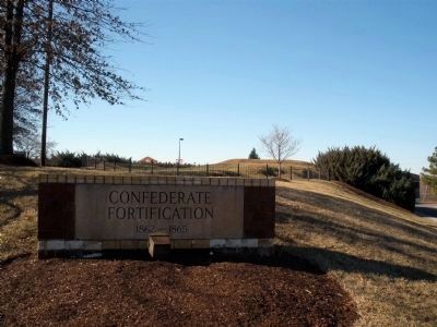
3. Brook Hill Fortifications site.
Credits. This page was last revised on November 4, 2024. It was originally submitted on February 8, 2009, by Bernard Fisher of Richmond, Virginia. This page has been viewed 1,701 times since then and 90 times this year. Last updated on November 3, 2024, by Carl Gordon Moore Jr. of North East, Maryland. Photos: 1, 2, 3. submitted on February 8, 2009, by Bernard Fisher of Richmond, Virginia.
