Fineview in Pittsburgh in Allegheny County, Pennsylvania — The American Northeast (Mid-Atlantic)
The Story of a "Fine View"
Fineview Overlook
Photographed by Bradley Owen, October 21, 2024
1. The Story of a "Fine View" Marker
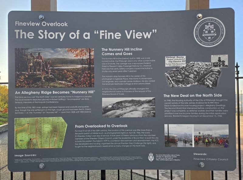
An Allegheny Ridge Becomes "Nunnery Hill"
The land we now call "the North Side" was for centuries home to indigenous peoples. The local residents depicted [above] in Robert Griffing's "Unconquered" are likely Seneca, members of the Iroquois Confederacy.
By the time of this 1851 map, springs had been tapped and coal pits and quarries dug, though the only settlement on this high, rough ground had been the St. Clare's Seminary - or, the "nunnery" on "Nunnery Hill" - open from 1828 until 1835 [below]
The Nunnery Hill Incline Comes and Goes
The Nunnery Hill Incline [below], built in 1888, was a rare curved incline; the Pittsburgh area's only other curved incline was in Knoxville. The carriage was a repurposed Federal Street & Pleasant Valley Passenger Railway Co. streetcar. Fare was five cents. Safety concerns caused the incline to shutter only seven years after it opened.
The mansion atop Nunnery Hill in the center of this photograph is Ingleside Place, then home to stonemason, civil engineer, and capitalist James Andrews. He also owned the landmark Heathside Cottage at 416 Catona Street.
In 1915, the City
this page online
From Overlooked to Overlook
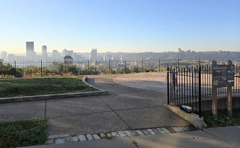
For most if not all of the 20th century, the location of this overlook was little more than a fenced-in patch of hillside brush, as photographed [right] on April 30, 1966, the iconic 21-Fineview trolley's last day of service. It took years of tireless advocacy from the volunteer members of the Fineview Citizens Council, under the leadership of Bruce West, to push the city to build this parklet. Founded in 1979 to counteract disinvestment and abandonment, the FCC has developed new housing, organized the annual Fineview Step Challenge [far right], and fought for the neighborhood's needs amid so many changes on the North Side.
The New Deal on the North Side
In 1940, the Housing Authority of the City of Pittsburgh bought the vacant estate of the late James Andrews for its fifth New Deal-funded low-income housing project: Allegheny Dwellings. The Second World War intervened before construction on the project was complete, so defense workers and their families were prioritized over low-income
Photographed by Bradley Owen, October 21, 2024
2. The Story of a "Fine View" Marker
Image Sources:
Image sources: Robert Griffing. "Unconquered." ...Schuchman & Haunlein (1851). "Plan of Lots in Benvilla." Thompson Bell Papers, Detre Library and Archives.... Samuel Diescher (1897). "American Inclined Plane Railways". Cassier's Magazine....Robert R. Hagy. Jr. (1941). "Pittsburgh Housing Project Scheduled Atop Fineview Hill." Pittsburgh Post-Gazette....Marks, Fisher, Simboli (1941). "Allegheny Dwellings." Housing Authority of the City of Pittsburgh Records, University of Pittsburgh Library System....Frank Fairbanks, Jr. (1966). "Pittsburgh Railways 1697 II." Frank B. Fairbanks Rail Transportation Archive, Pittsburgh History & Landmarks Foundation....Unknown (2018). "Fineview Step Challenge." Fineview Citizens Council.
Erected 2023 by The City of Pittsburgh.
Topics. This historical marker is listed in these topic lists: Government & Politics • Indigenous Peoples and Communities • Parks & Recreational Areas • Railroads & Streetcars. A significant historical date for this entry is April 30, 1966.
Location. 40° 27.632′ N, 80° 0.252′ W. Marker is in Pittsburgh, Pennsylvania, in Allegheny County. It is in Fineview. It is at the intersection of Catoma Street and Lanark Street, on the right when traveling east on Catoma Street. Touch for map. Marker is at or near this postal address: 308 Catoma Street, Pittsburgh PA 15212, United States of America. Touch for directions.

Regionally, this marker is in the American Northeast, in the Mid-Atlantic, in the Ohio River Valley, in Appalachia, and specifically in Northern Appalachia. Globally, it is in North America, the Western Hemisphere, the Western World, and the Anglosphere. Historically, it finds itself in what was once the Viceroyalty of New France, the Haudenosaunee (Iroquois) Confederacy, and one of the original Thirteen Colonies.
Other nearby markers. At least 8 other markers are within walking distance of this marker: Heathside Cottage (within shouting distance of this marker); Brown Chapel AME Church (approx. ¼ mile away); Lois Weber (approx. 0.3 miles away); Dorothy Mae Richardson (approx. 0.3 miles away); Founding Convention of the CIO (approx. 0.4 miles away); Perry's Hall (approx. half a mile away); St. Boniface Roman Catholic Church (approx. half a mile away); James Hay Reed (approx. half a mile away). Touch for a list and map of all markers in Pittsburgh.
Credits. This page was last revised on November 3, 2024. It was originally submitted on November 3, 2024, by Bradley Owen of Morgantown, West Virginia. This page has been viewed 496 times since then and 106 times this year. Photos: 1, 2. submitted on November 3, 2024, by Bradley Owen of Morgantown, West Virginia.
