Salem in Essex County, Massachusetts — The American Northeast (New England)
West Salem Witchcraft Heights
Photographed by Duane and Tracy Marsteller, October 1, 2024
1. West Salem Witchcraft Heights Marker
Inscription.
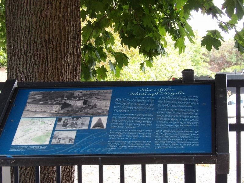
West Salem Witchcraft Heights. . Salem's long history of fine public education started in 1637 when John Fiske opened Salem's first school. It continued in 1768 when Salem's public school system was created, and thrives in West Salem today. Salem High School was founded in 1827, Collins Middle School opened in 1909, Witchcraft Heights Elementary School was built in 1970, and the Nathaniel Bowditch School (formerly the Federal Street School) was built in 2001. , Salem's most famous tie to public education is Elizabeth Peabody, a teacher and publisher who founded kindergartens in America in 1861. Her sister, Mary Peabody, also a teacher, married Horace Mann, considered the “Father of American Public Education.” Horace Mann was instrumental in establishing “normal schools” nationwide where young women would be taught the professional “norms” of teaching. , Located where the Collins Middle School now stands was Lookout Hill, the site of annual July 4 midnight bonfires, made from as many as 2,000 barrels stuffed with “combustibles,” before safety regulations stopped the practice in 1909. , Before 19th century development, this area was known as the Great Pasture. Today's Highland Avenue was originally the Salem and Boston Turnpike, which opened in 1802 complete with toll booth, receiving its current name before 1890. The Boston and Maine Railroad ran nearby. In the early 1900s, with the popularity of the automobile and regular train service, West Salem attracted more and more businesses and industries until it saw an explosion of retail in the 1990s. In the 1960s, a new residential subdivision “Witchcraft Heights” was developed. , Founded in 1863 by Capt. John Bertram, Salem Hospital was initially located on Charter Street. In 1879, a training school for nurses opened on the upper floor – the seventh in the country. Severely damaged by the Great Fire of 1914, Salem Hospital moved to a newly constructed brick building on Highland Avenue in 1916-17. In the 1960s, the North Shore Babies Hospital moved its facility here from Dearborn Street, becoming the North Shore Children's Hospital and now under the umbrella of the North Shore Medical Center. , Salem Woods was for centuries home to Native Americans before colonists arrived to use the pasture to feed their animals. The City of Salem purchased the land in 1906 to use as a park, naming it Highland Park. In 1933, the City opened Old Salem Greens Golf Course, a 9-hole course on 75 acres built as a Works Progress Administration project. Abutting Salem, Lynn and Peabody is Spring Pond, formerly known as Mineral Spring or Mineral Pond for the supposed medicinal qualities of its iron-rich water. , [Caption] Clockwise from top left: Salem Hospital, ca. 1940s; Bonfire on Lookout Hill, ca. 1907; Salem and Boston Turnpike toll booth, ca. 1890; Salem High School debating team, 1926.
Salem's long history of fine public education started in 1637 when John Fiske opened Salem's first school. It continued in 1768 when Salem's public school system was created, and thrives in West Salem today. Salem High School was founded in 1827, Collins Middle School opened in 1909, Witchcraft Heights Elementary School was built in 1970, and the Nathaniel Bowditch School (formerly the Federal Street School) was built in 2001.
Salem's most famous tie to public education is Elizabeth Peabody, a teacher and publisher who founded kindergartens in America in 1861. Her sister, Mary Peabody, also a teacher, married Horace Mann, considered the “Father of American Public Education.” Horace Mann was instrumental in establishing “normal schools” nationwide where young women would be taught the professional “norms” of teaching.
Located where the Collins Middle School now stands was Lookout Hill, the site of annual July 4 midnight bonfires, made from as many as 2,000 barrels stuffed with “combustibles,” before safety regulations stopped the practice in 1909.
Before 19th century development, this area was known as the Great
Click or scan to see this page online
Pasture. Today's Highland Avenue was originally the Salem & Boston Turnpike, which opened in 1802 complete with toll booth, receiving its current name before 1890. The Boston & Maine Railroad ran nearby. In the early 1900s, with the popularity of the automobile and regular train service, West Salem attracted more and more businesses and industries until it saw an explosion of retail in the 1990s. In the 1960s, a new residential subdivision “Witchcraft Heights” was developed.
Founded in 1863 by Capt. John Bertram, Salem Hospital was initially located on Charter Street. In 1879, a training school for nurses opened on the upper floor – the seventh in the country. Severely damaged by the Great Fire of 1914, Salem Hospital moved to a newly constructed brick building on Highland Avenue in 1916-17. In the 1960s, the North Shore Babies Hospital moved its facility here from Dearborn Street, becoming the North Shore Children's Hospital and now under the umbrella of the North Shore Medical Center.
Salem Woods was for centuries home to Native Americans before colonists arrived to use the pasture to feed their animals. The City of Salem purchased
Photographed by Duane and Tracy Marsteller, October 1, 2024
2. West Salem Witchcraft Heights Marker
the land in 1906 to use as a park, naming it Highland Park. In 1933, the City opened Old Salem Greens Golf Course, a 9-hole course on 75 acres built as a Works Progress Administration project. Abutting Salem, Lynn and Peabody is Spring Pond, formerly known as Mineral Spring or Mineral Pond for the supposed medicinal qualities of its iron-rich water.
[Caption] Clockwise from top left: Salem Hospital, ca. 1940s; Bonfire on Lookout Hill, ca. 1907; Salem & Boston Turnpike toll booth, ca. 1890; Salem High School debating team, 1926.
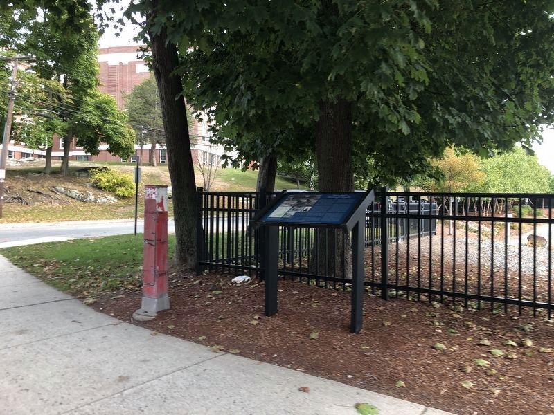
Location. 42° 30.842′ N, 70° 54.39′ W. Marker is in Salem, Massachusetts, in Essex County. It is at the intersection of Highland Avenue and Powder House Lane, on the right when traveling north on Highland Avenue. Touch for map. Marker is at or near this postal address: 40 Highland Ave, Salem MA 01970, United States of America. Touch for directions.
Regionally, this marker is on Massachusetts’ North Shore, in Greater Boston, and in the Merrimack Valley. It is also in the American Northeast and in New England. Globally, it is in the North Atlantic Region, North America, the Western Hemisphere, the Western World, and the Anglosphere. Historically, it finds itself in what was once one of the original Thirteen Colonies.
Credits. This page was last revised on November 10, 2024. It was originally submitted on November 10, 2024, by Duane and Tracy Marsteller of Murfreesboro, Tennessee. This page has been viewed 311 times since then and 48 times this year. Photos:1, 2. submitted on November 10, 2024, by Duane and Tracy Marsteller of Murfreesboro, Tennessee.