Schuylkill Haven in Schuylkill County, Pennsylvania — The American Northeast (Mid-Atlantic)
Bittle's Dam
Schuylkill Haven Heritage Trail
Photographed by William Fischer, Jr., November 12, 2024
1. Bittle's Dam Marker
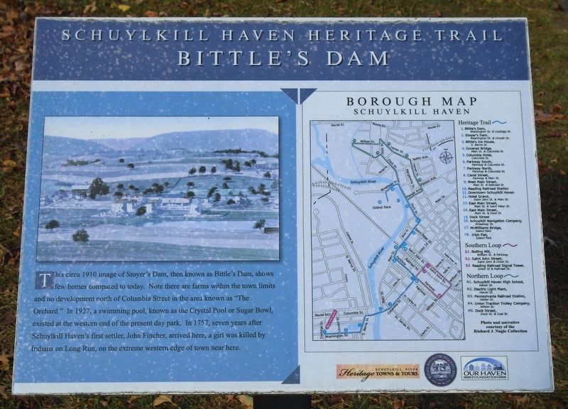
This circa 1910 image of Stoyer's Dam, then known as Bittle's Dam, shows few homes compared to today. Note there are farms within the town limits and no development north of Columbia Street in the area known as "The Orchard." In 1927, a swimming pool, known as the Crystal Pool or Sugar Bowl, existed at the western end of the present day park. In 1757, seven years after Schuylkill Haven's first settler, John Fincher, arrived here, a girl was killed by Indians on Long Run, on the extreme western edge of town near here.
Erected by Schuylkill River Heritage Towns & Tours, Schuylkill Haven Borough, and Our Haven Foundation. (Marker Number 1.)
Topics and series. This historical marker is listed in these topic lists: Industry & Commerce • Parks & Recreational Areas • Settlements & Settlers • Waterways & Vessels. In addition, it is included in the Pennsylvania, Schuylkill Haven Heritage Trail series list. A significant historical year for this entry is 1910.
Location. 40° 37.331′ N, 76° 10.76′ W. Marker is in Schuylkill Haven, Pennsylvania, in Schuylkill County. It is at the intersection of Washington Street
this page online

Regionally, this marker is in Anthracite Coal Region. It is also in the American Northeast, in the Mid-Atlantic, in Appalachia, and specifically in Northern Appalachia. Globally, it is in North America, the Western Hemisphere, the Western World, and the Anglosphere. Historically, it finds itself in what was once the Haudenosaunee (Iroquois) Confederacy and also one of the original Thirteen Colonies.
Other nearby markers. At least 8 other markers are within walking distance of this marker: War and Veterans Memorial (a few steps from this marker); John Fincher (about 300 feet away, measured in a direct line); Stoyer's Dam (about 500 feet away); Bittle's Ice House (approx. 0.2 miles away); Covered Bridge (approx. 0.3 miles away); Columbia Hotel (approx. 0.3 miles away); Canal Street (approx. half a mile away); War Memorial (approx. half a mile away). Touch for a list and map of all markers in Schuylkill
Photographed by William Fischer, Jr., November 12, 2024
2. Bittle's Dam Marker
Credits. This page was last revised on November 14, 2024. It was originally submitted on November 14, 2024, by William Fischer, Jr. of Reynoldsburg, Ohio. This page has been viewed 183 times since then and 17 times this year. Photos: 1, 2. submitted on November 14, 2024, by William Fischer, Jr. of Reynoldsburg, Ohio.
