
Near Quetico Provincial Park in Rainy River District, Ontario — Central Canada (North America)
The French Portage

Photographed by Cosmos Mariner, June 16, 2024
1. The French Portage Marker
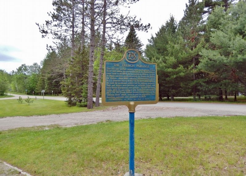
This two-mile portage around rapids in the nearby French River was among the most difficult on the Kaministiquia canoe route to the west, first recorded in 1688 by Jacques de Noyon and later used extensively by French and British fur traders. After 1867, following recommendations based on S.J. Dawson's survey of 1857-59, the government improved the route for westbound settlers and for military purposes. Tugs and barges were provided on navigable waters, and horse-drawn transport on some portages. Improved for wagon traffic, 1871-72, and equipped with storehouses and shelters, 1873-74, the French Portage became a way-station on the "Dawson Route" which, owing in part to competition from American railroads, was abandoned by 1879.
Erected by Archaeological and Historic Sites Board of Ontario.
Topics and series. This historical marker is listed in these topic lists: Industry & Commerce • Roads & Vehicles • Settlements & Settlers • Waterways & Vessels. In addition, it is included in the Canada, Ontario Heritage Trust series list. A significant historical year for this entry is 1688.
Location. 48° 40.197′ N, 91° 7.833′ W.
this page online

Regionally, this marker is in Northern Ontario and specifically in Northwest Ontario. It is also in Central Canada. Globally, it is in North America, the Great North Woods, the Western Hemisphere, the Western World, and the Anglosphere. Historically, it finds itself in what was once a British colony, the Viceroyalty of New France, the Haudenosaunee (Iroquois) Confederacy, and Rupert’s Land.
More about this marker. Both sides of this marker have the same English inscription.
Also see . . .
1. Path of the Voyageur.
Excerpt: The traditional fur trade route — the French River (Quetico Provincial Park) to Lake Nipissing and the Ottawa River to Montreal — is the route(Submitted on November 18, 2024, by Cosmos Mariner of Cape Canaveral, Florida.)that Radisson and des Groseilliers travelled in 1660. The two French traders played a vital role in expanding the fur trade in North America. It is also the same route that Aboriginal peoples travelled for hundreds of generations. In their canoes, they are all following humans’ natural desire to explore the region.Photographed by Cosmos Mariner, June 16, 20242. The French Portage MarkerLooking south along Dawson Trail Road from the French Portage trailhead.
2. Finding History on the French River.
(By Andrew Watson and Jim Clifford) Excerpt: From the late seventeenth century to the early nineteenth century, fur traders called ‘voyageurs’ travelled between Montreal and Rupert’s Land northwest of the Great Lakes. The French River served as a critical link between the Ottawa River in the east and Georgian Bay in the west. Traveling down the calm, relatively portage-free Voyageur Channel, it’s not hard to see why they chose this route over the wider, windier Main Channel. Voyageurs traveled the French in large 10 to 12-man canoes called cannot de maitre with 2-3 tons of cargo and as we struggled to lift our lightweight gear over some rocks, we understood their preference for the route(Submitted on November 18, 2024, by Cosmos Mariner of Cape Canaveral, Florida.)with no portages.Photographed by Cosmos Mariner, June 16, 20243. The French Portage MarkerLooking north; a shelter cabin and restrooms are in the background. The French Portage Trailhead is in the right background.

Photographed by Cosmos Mariner, June 16, 2024
4. The French Portage Trailhead
Don’t spare the insect repellent!

Photographed by Cosmos Mariner, June 16, 2024
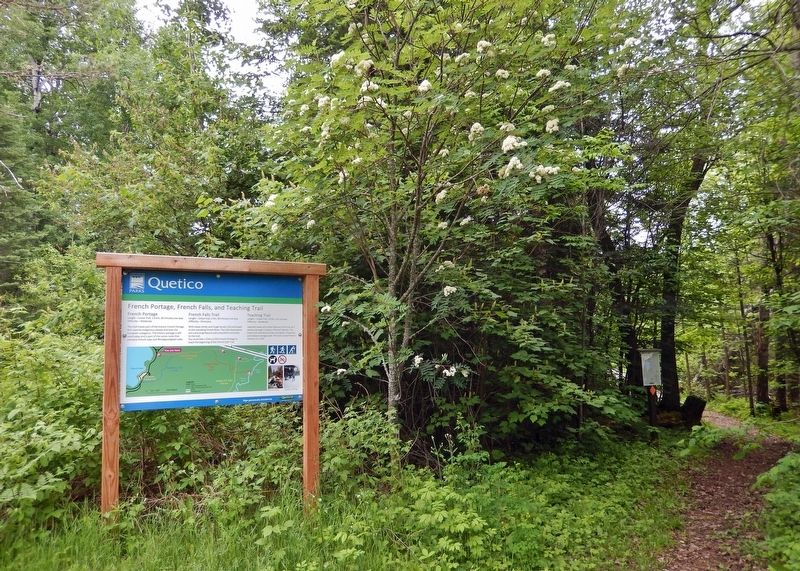
5. French Portage, French Falls, and Teaching Trail
French Portage
Length — Linear trail, 1.4 km, 30 minutes one way
Difficulty — Moderate
This trail traces part of the historic French Portage first used by Indigenous people and later the European voyageurs. The historic portage is still used today and is part of the canoe route that connects French Lake and Windigoostigwan Lake.
Length — Linear trail, 1.4 km, 30 minutes one way
Difficulty — Moderate
This trail traces part of the historic French Portage first used by Indigenous people and later the European voyageurs. The historic portage is still used today and is part of the canoe route that connects French Lake and Windigoostigwan Lake.
French Falls Trail
Length — Linear trail, 2 km, 30 minutes one way
Difficulty — Strenuous
With steep climbs and rough terrain, this trail leads to the cascading French River. The Falls themselves are a stunning feature and a beautiful conclusion to the trail. You must hike 1.4 km on the French Portage to reach the beginning of the French Falls Trail.
Teaching Trail
Length — Linear trail, 2.8 km, 1 hr one way
Difficulty — Moderate
Lakeside views are a main feature of this trail as it weaves through a variety of forest habitats. This linear trail connects the Day Use Beach, Chippewa, and Ojibwa Campgrounds. The trail can be hiked in sections or in full.

Photographed by Cosmos Mariner, June 16, 2024
6. Quetico Provincial Park Entrance
Turn south here from Trans-Canada Highway (Ontario Highway 11) to access the marker and the French Portage trail.
Credits. This page was last revised on December 23, 2025. It was originally submitted on November 17, 2024, by Cosmos Mariner of Cape Canaveral, Florida. This page has been viewed 149 times since then and 22 times this year. Photos: 1, 2, 3, 4, 5, 6. submitted on November 18, 2024, by Cosmos Mariner of Cape Canaveral, Florida.
