
Lincoln Park in Chicago in Cook County, Illinois — The American Midwest (Great Lakes)
Little Fort Road
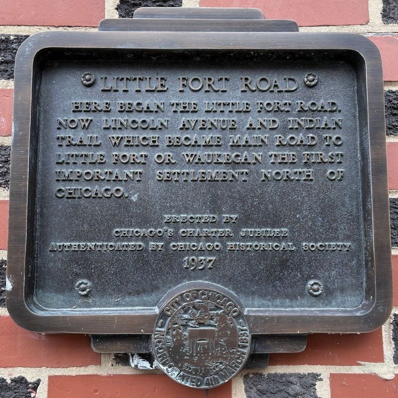
Photographed by Sean P. Flynn, November 18, 2024
1. Little Fort Road Marker
Chicago's Charter Jubilee
Authenticated by Chicago Historical Society
Erected 1937 by Chicago's Charter Jubilee.
Topics and series. This historical marker is listed in these topic lists: Forts and Castles • Indigenous Peoples and Communities • Roads & Vehicles • Settlements & Settlers. In addition, it is included in the Chicago's Charter Jubilee, and the Former U.S. Presidents: #16 Abraham Lincoln series lists.
Location. 41° 55.504′ N, 87° 38.883′ W. Marker is in Chicago, Illinois, in Cook County. It is in Lincoln Park. It is on Lincoln Avenue south of Fullerton Avenue. The marker is to the left of the Sweetgreen store in the Lincoln Common building. Touch for map. Marker is at or near this postal address: 2335 North Lincoln Avenue, Chicago IL 60614, United States of America. Touch for directions.

Regionally, this marker is in the American Midwest. Globally, it is in North
this page online
Other nearby markers. At least 8 other markers are within walking distance of this marker: Kaufmann Store and Flats (about 500 feet away, measured in a direct line); Richard Fassl (about 500 feet away); McCormick Row House District (about 600 feet away); Original Site of The Children's Memorial Hospital (about 600 feet away); Robert Berkhoff (about 600 feet away); Arlington-Deming (approx. 0.2 miles away); a different marker also named Arlington-Deming (approx. 0.2 miles away); Fremont Row Houses (approx. 0.3 miles away). Touch for a list and map of all markers in Chicago.
More about this marker. This plaque is one of 78 placed throughout the city in 1937 by Chicago’s Charter Jubilee, celebrating the 100th anniversary of Chicago’s city charter. Roughly 20 of these plaques are still on display in Chicago.
Regarding Little Fort Road. The historical veracity of this punctuation-light

Photographed by Sean P. Flynn, November 18, 2024
2. Little Fort Road Marker
That said, whether this road follows an old Indian trail could not be confirmed. Another diagonal Chicago road, Clark Street, is east of here along an old Indian path called Green Bay Trail, which also goes through Waukegan. It's also unclear whether Little Fort Road indeed originated at this exact spot; the modern Lincoln Avenue travels another mile or so south to its terminus at Clark and Wells streets. In total, Lincoln Avenue today is about 13 miles long, ending in suburban Morton Grove.
Also see . . . Ask Geoffrey: Historical Markers That Don’t Quite Hit the Mark. From WTTW-11 in Chicago, Geoffrey Baer looks at the Chicago Jubilee markers from 1937. (Submitted on November 19, 2024, by Sean P. Flynn of Oak Park, Illinois.)

Photographed by Sean P. Flynn, November 18, 2024
3. Little Fort Road Marker
Credits. This page was last revised on May 27, 2025. It was originally submitted on November 19, 2024, by Sean P. Flynn of Oak Park, Illinois. This page has been viewed 432 times since then and 132 times this year. Photos: 1, 2, 3. submitted on November 19, 2024, by Sean P. Flynn of Oak Park, Illinois.
