
Near Dillon in Beaverhead County, Montana — The American West (Mountains)
…the End of the Northwest Passage?
Change in Topography Across the Great Divide

Photographed by Barry Swackhamer, June 28, 2024
1. ...the End of the Northwest Passage? Marker
Captions: (middle left) The Salmon River Canyon west of the Great Divide; (lower left) You Are Here; (bottom center) The valley of "Jefferson's River" east of the Great Divide.; (side-bar) Simplified cross section across the Red Rock Valley and adjacent mountain ranges.
On the day he reached the "two forks" Lewis wrote in his journal, "I do not believe that the world can furnish an example of a river running to the extent which the Missouri and Jefferson's rivers do through such a mountainous country and at the same time so navigable as they are".
Lewis was describing a landscape that has been millions of years in the making! Over that time, the Earth's crust in this area has been pulled apart to form a landscape of towering mountains and broad valleys.
The placid rivers that follow these valleys made the notion of a Northwest Passage a possibility. Unfortunately for the Corps of Discovery, the geology to the west of the Great Divide produced deep canyons with raging rivers, ending all hopes for a safe "communication across the continent by water."
(across the bottom:)
The Geological Time Scale (not shown to scale)
Divisions of geological time were defined in the 19th Century by major changes in the fossil record.
Most of the boundaries are marked by worldwide extinction events.
Numerical dates were added in the 20th Century using modern rock-dating techniques.
this page online
Precambrian 4500 million years ago Earth began Formation of igneous and metamorphic rocks.
Paleozoic Era 542 million years ago Deposition of sedimentary rocks
Mesozoic Era 250 million years ago Deposition of sedimentary rocks, folding and thrust faulting
Cenozoic Era 66 million years ago Deposition of sedimentary and volcanic rock, extension of the Earth's crust and formation of the Red Rock Valley and Tendoy Mountains.
(sidebar:)
Making of the Landscape
On August 17, 1805, the historic meeting of cultures took place in this valley. The valley started forming about 4.0 million years ago as extension of the Earth's crust produced a fault that dropped the Red Rock Valley down and uplifted the adjacent Tendoy Mountains. Although this fault is considered by geologist to be active, it last ruptured the ground surface some 3,000 years ago. Fortunately for the Corps of Discovery, there was no activity on this fault on August 17, 1805
Erected by Reclamation, University of Montana, Western.
Topics and series. This historical marker is listed in these topic lists: Exploration • Natural Features •
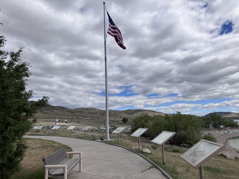
Photographed by Barry Swackhamer, June 2024
2. ...the End of the Northwest Passage? Marker
Location. 44° 59.668′ N, 112° 52.099′ W. Marker is near Dillon, Montana, in Beaverhead County. It can be reached from State Highway 324 near Lake View Road when traveling east. The marker stands at the Clark Canyon Reservoir Recreation Area near the Lewis & Clark Campground. Touch for map. Marker is at or near this postal address: 1016 Highway 324, Dillon MT 59725, United States of America. Touch for directions.

Regionally, this marker is in andspecifically outhwest Montana, in Gold West Country, in Mining Country. It is also in the American Mountain West and in the Lewis & Clark Corridor. Globally, it is in North America, the Rocky Mountains, the Western Hemisphere, the Western World, and the Anglosphere. Historically, it finds itself in what was once Rupert’s Land and also the Louisiana Purchase.
Other nearby markers. At least 8 other markers are within walking distance of this marker: The Route and Campsites of Lewis and Clark in Montana: A Geologic Perpective (here, next to this marker); Reunion at Camp Fortunate (here, next to this marker); it has a singular appearence (a few steps from this marker); Camp Fortunate (a few steps from this marker); The Lewis and Clark Expedition (approx. ¼ mile away); Fortunate Camp (approx. ¼ mile away); "it was mutually advantageous..." (approx. ¼ mile away); Sacajawea (approx. 0.6 miles away). Touch for a list and map of all markers in Dillon.
Credits. This page was last revised on November 25, 2024. It was originally submitted on September 1, 2024, by Barry Swackhamer of Brentwood, California. This page has been viewed 1,349 times since then and 131 times this year. Last updated on November 22, 2024, by Carl Gordon Moore Jr. of North East, Maryland. Photos: 1, 2. submitted on September 1, 2024, by Barry Swackhamer of Brentwood, California. • Devry Becker Jones was the editor who published this page.
