Cape Girardeau in Cape Girardeau County, Missouri — The American Midwest (Upper Plains)
1927
The Big Flood
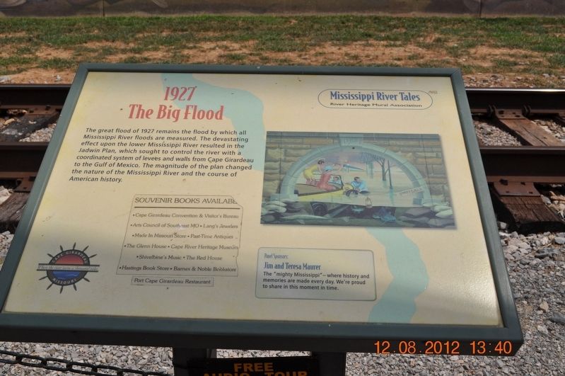
Photographed by Sandra Hughes, August 12, 2012
1. 1927 Marker
Erected by Mississippi River Tales / River Heritage Mural Association.
Topics. This historical marker is listed in these topic lists: Disasters • Environment • Waterways & Vessels. A significant historical year for this entry is 1927.
Location. This marker has been replaced by another marker nearby. It was located near 37° 18.244′ N, 89° 31.07′ W. Marker was in Cape Girardeau, Missouri, in Cape Girardeau County. It was on North Water Street. The marker stands along the Missouri Wall of Fame along the Mississippi River Front. Touch for map. Marker was at or near this postal address: 26 N Water St, Cape Girardeau MO 63701, United States of America. Touch for directions.

Regionally, this marker was in Southeast
this page online
Other nearby markers. At least 8 other markers are within walking distance of this location: A different marker also named 1927 (here, next to this marker); a different marker also named 1958 (a few steps from this marker); a different marker also named 1925 (a few steps from this marker); a different marker also named 1924 (a few steps from this marker); a different marker also named 1964 (within shouting distance of this marker); 1918 (within shouting distance of this marker); a different marker also named 1980 (within shouting distance of this marker); a different marker also named 1916 (within shouting distance of this marker). Touch for a list and map of all markers in Cape Girardeau.
Other markers no longer nearby. 1958 (was a few steps from this
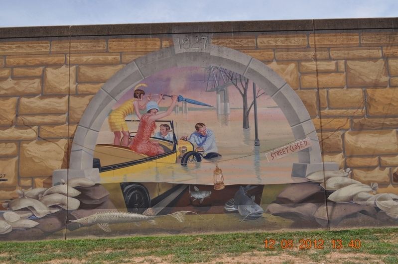
Photographed by Sandra Hughes, August 12, 2012
2. 1927 Marker
Related marker. Click here for another marker that is related to this marker. This marker has been replaced with this marker.
Also see . . .
1. Mississippi River Tales Mural. The Mississippi River Tales is a mural containing 24 panels covering nearly 18,000 square feet (1,700 m2) of the 15-foot (4.6 m)-high downtown floodwall in Cape Girardeau, Missouri. (Submitted on September 2, 2017, by Sandra Hughes Tidwell of Killen, Alabama, USA.)
2. Great Mississippi Flood of 1927. The Great Mississippi Flood of 1927 was the most destructive river flood in the history of the United States,[1] with 27,000 square miles (70,000 km2) inundated up to a depth of 30 feet (9 m). To try to prevent future floods, the federal government built the world's longest system of levees and floodways. (Submitted on September 2, 2017, by Sandra Hughes Tidwell of Killen, Alabama, USA.)
Credits. This page was last revised on February 16, 2026. It was originally submitted on September 2, 2017, by Sandra Hughes Tidwell of Killen, Alabama, USA. This page has been viewed 625 times since then and 50 times this year. Last updated on November 22, 2024, by Edward Troxel of Creal Springs, Illinois. Photos: 1, 2. submitted on September 2, 2017, by Sandra Hughes Tidwell of Killen, Alabama, USA. • Devry Becker Jones was the editor who published this page.
