
Winchester in Frederick County, Virginia — The American South (Mid-Atlantic)
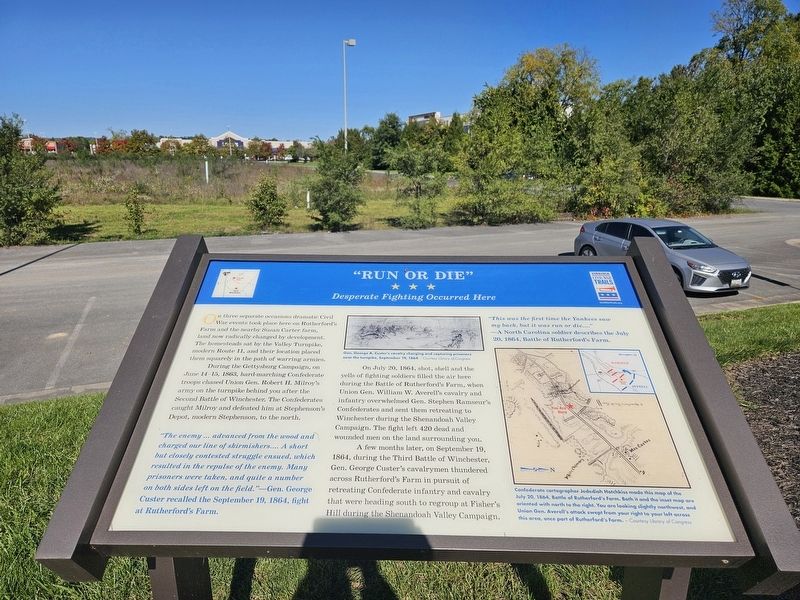
"Run or Die"
Desperate Fighting Occurred Here
Photographed by Mark P Brock-Cancellieri, October 11, 2024
1. "Run or Die" Marker
During the Gettysburg Campaign, on June 14-15, 1863, hard-marching Confederate troops chased Union Gen. Robert H. Milroy's army on the turnpike behind you after the Second Battle of Winchester. The Confederates caught Milroy and defeated him at Stephenson's Depot, modern Stephenson, to the north.
On July 20, 1864, shot, shell and the yells of fighting soldiers filled the air here during the Battle of Rutherford's Farm, when Union Gen. William W. Averell's cavalry and infantry overwhelmed Gen. Stephen Ramseur's Confederates and sent them retreating to Winchester during the Shenandoah Valley Campaign. The fight left 420 dead and wounded men on the land surrounding you.
A few month later, on September 19, 1864, during the Third Battle of Winchester, Gen. George Custer's cavalrymen thundered across Rutherford's Farm in pursuit
this page online
"The enemy... advanced from the wood and charged our line of skirmishers.... A short but closely contested struggle ensued, which resulted in the repulse of the enemy. Many prisoners were taken, and quite a number on both side left on the field."—Gen. George Custer recalled the September 19, 1864, fight at Rutherford's Farm.
"This was the first time the Yankees saw my back, but it was run or die...." —A North Carolina soldier describes the July 20, 1864, Battle of Rutherford's Farm.
(captions)
Gen. George A. Custer's cavalry charging and capturing prisoners near the turnpike, September 19, 1864 - Courtesy Library of Congress
Confederate cartographer Jebediah Hotchkiss made this map of the July 20, 1864, Battle of Rutherford's Farm. Both it and the inset map are oriented with north to the right. You are looking slightly northwest, and Union Gen. Averell's attack swept from your right to your left across this area, once part of Rutherford's farm. - Courtesy Library of Congress
Erected by Virginia
Photographed by Mark P Brock-Cancellieri, October 11, 2024
2. "Run or Die" Marker
Topics and series. This historical marker is listed in this topic list: War, US Civil. In addition, it is included in the Virginia Civil War Trails series list. A significant historical date for this entry is June 14, 1863.
Location. 39° 13.244′ N, 78° 7.873′ W. Marker is in Winchester, Virginia, in Frederick County. It is on Martinsburg Pike (U.S. 11) north of Merchant Street, on the left when traveling north. Touch for map. Marker is at or near this postal address: 1854 Martinsburg Pike, Winchester VA 22603, United States of America. Touch for directions.

Regionally, this marker is in Virginia’s Shenandoah Valley. It is also in the American South, specifically in the Upper South, and in the Mid-Atlantic. Globally, it is in North America, the Western Hemisphere, the Western World, and the Anglosphere. Historically, it finds itself in what was once the territory of the Mississippian Culture, one of the original Thirteen Colonies, one of the Confederate States of America, and the Antebellum South.
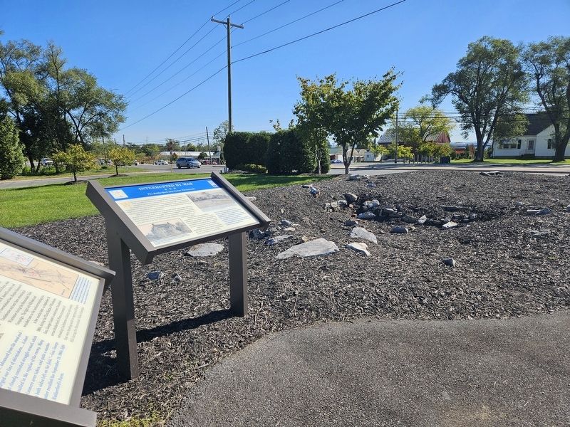
Other nearby markers. At least 8 other markers are within walking distance of this marker: Interrupted by War (here, next to this marker); The Great Indian (and Wagon) Road (here, next to this marker); Hackwood Park (here, next to this marker); Action of Rutherford’s Farm (a few steps from this marker); a different marker also named Three Battlefields (approx. 0.7 miles away); The First Battle of Kernstown (approx. 0.7 miles away); The First Battle of Winchester (approx. 0.7 miles away); The Second Battle of Winchester (approx. 0.7 miles away). Touch for a list and map of all markers in Winchester.
Other markers no longer nearby. Battle of Rutherford's Farm (was within shouting distance of this marker but has been replaced with another marker now near it); Rutherford's Farm (was within shouting distance of this marker but has been replaced with another marker now near it); John Rutherford's Farm (was within shouting distance of this marker but has been replaced with another marker now near it); Three Battlefields (was approx. 0.7 miles away but has been replaced with another marker now near it).
Related marker. Click here for another marker that is related to this marker. Old CWT Markers At This Location titled "Rutherford's Farm".
Credits. This page was last revised on November 26, 2024. It was originally submitted on November 22, 2024, by Mark P. Brock-Cancellieri of Baltimore, Maryland. This page has been viewed 373 times since then and 41 times this year. Photos: 1, 2. submitted on November 22, 2024, by Mark P. Brock-Cancellieri of Baltimore, Maryland. • Bernard Fisher was the editor who published this page.
