
Fort Frances in Rainy River District, Ontario — Central Canada (North America)
Lac La Pluie House
⎯⎯⎯
La Maison du lac la Pluie
1818-1903
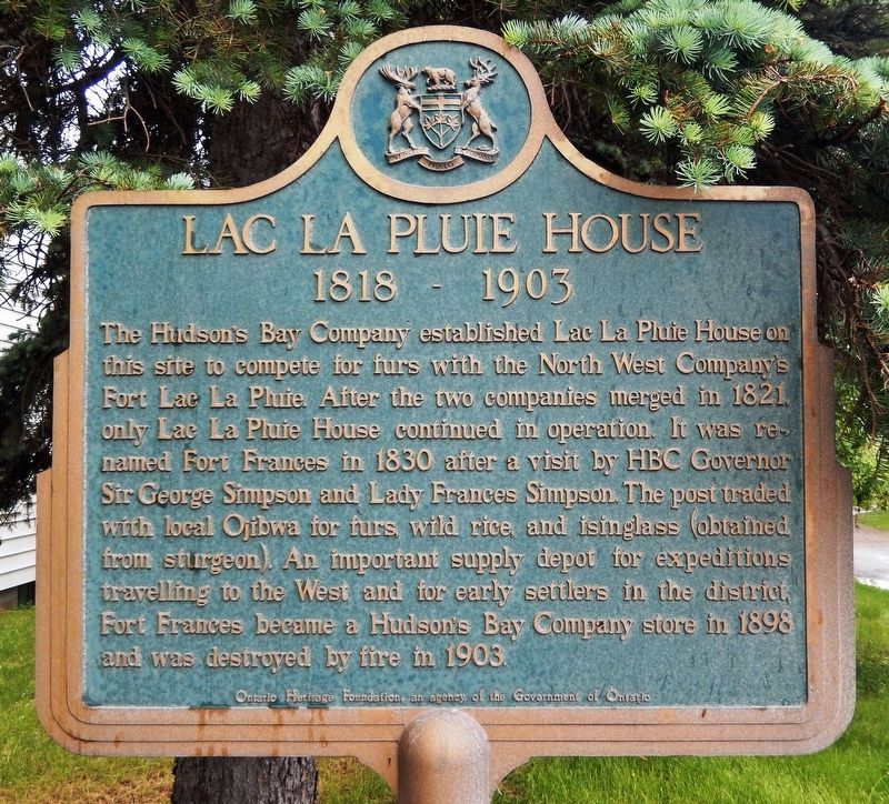
Photographed by Cosmos Mariner, June 16, 2024
1. Lac La Pluie House (marker north side • English)

Erected by Ontario
this page online
Topics and series. This historical marker is listed in these topic lists: Colonial Era • Indigenous Peoples and Communities • Industry & Commerce • Settlements & Settlers. In addition, it is included in the Canada, Ontario Heritage Trust series list. A significant historical year for this entry is 1818.
Location. 48° 36.742′ N, 93° 24.296′ W. Marker is in Fort Frances, Ontario, in Rainy River District. It is at the intersection of 3rd Street West (Trans-Canada Highway) (Provincial Highway 11) and Cornwall Avenue, on the right when traveling east on 3rd Street West (Trans-Canada Highway). The marker is located near the southeast corner of the intersection. Touch for map. Marker is at or near this postal address: 165 3rd Street West, Fort Frances ON P9A 3A3, Canada. Touch for directions.

Regionally, this marker is in Northern Ontario and specifically in Northwest Ontario. It is also in Central Canada. Globally, it is in North America, the Great North Woods, the Western Hemisphere, the Western World, and the Anglosphere. Historically, it finds itself

Photographed by Cosmos Mariner, June 16, 2024
2. La Maison du lac la Pluie (marker south side • Français)
Other nearby markers. At least 8 other markers are within walking distance of this marker: Lady Frances Ramsay Simpson (approx. 0.3 kilometers away); Old Fort Frances Cemetery Reinterment Site (approx. 0.3 kilometers away); Fort Frances Canal 1878 (approx. half a kilometer away); Bronko Nagurski (approx. one kilometer away in the U.S.); Route of the Voyageurs (approx. one kilometer away in the U.S.); Welcome to Smokey Bear Park (approx. 1.1 kilometers away in the U.S.); Steamboats on the Rainy River / Welcome to Minnesota (approx. 1.2 kilometers away in the U.S.); The Village of Koochiching & International Falls (approx. 1.2 kilometers away in the U.S.). Touch for a list and map of all markers in Fort Frances.
Also see . . . Fort Lac la Pluie (Wikipedia).
Excerpt: Fort Lac la Pluie was a fur trade depot established by the North West Company sometime between 1775 and 1787. It was located on a high bank on the west side of modern Fort Frances, Ontario across from International Falls, Minnesota(Submitted on November 28, 2024, by Cosmos Mariner of Cape Canaveral, Florida.)on the Rainy River downstream (west) of some rapids (Chaudière portage) where the river flows out of Rainy Lake.Photographed by Cosmos Mariner, June 16, 20243. Lac La Pluie House / La Maison du lac la Pluie MarkerLooking south across 3rd Street West; the marker is beside the tallest pine tree.The place was a depot rather than a trading post and served two purposes. By this time the trade had reached the rich Lake Athabasca country which was too far to reach from Montreal in one season. Each May, when the ice broke up, boats with trade goods would head west from Montreal and winterers with canoe-loads of fur would head east. They would meet at Grand Portage on Lake Superior, exchange goods and head back before the freezup. To further save time goods and furs would be shuttled between Grand Portage and Lac la Pluie. Second, it was a source of food. The voyageurs had no time to hunt and it was difficult to haul food from Montreal. Rainy Lake produced wild rice and fish.
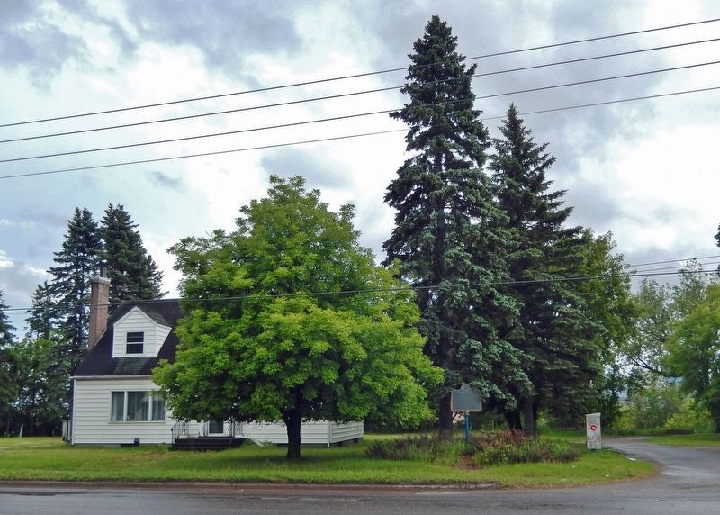

Photographed by Cosmos Mariner, June 16, 2024
4. Lac La Pluie House / La Maison du lac la Pluie Marker
Looking northeast; 3rd Street West is in the background.
Credits. This page was last revised on November 28, 2024. It was originally submitted on November 26, 2024, by Cosmos Mariner of Cape Canaveral, Florida. This page has been viewed 152 times since then and 20 times this year. Photos: 1, 2, 3, 4. submitted on November 28, 2024, by Cosmos Mariner of Cape Canaveral, Florida.
