
Fort Payne in DeKalb County, Alabama — The American South (East South Central)
Trail of Tears
John Benge Route
| — | Fort Payne, Alabama to Oklahoma | — |
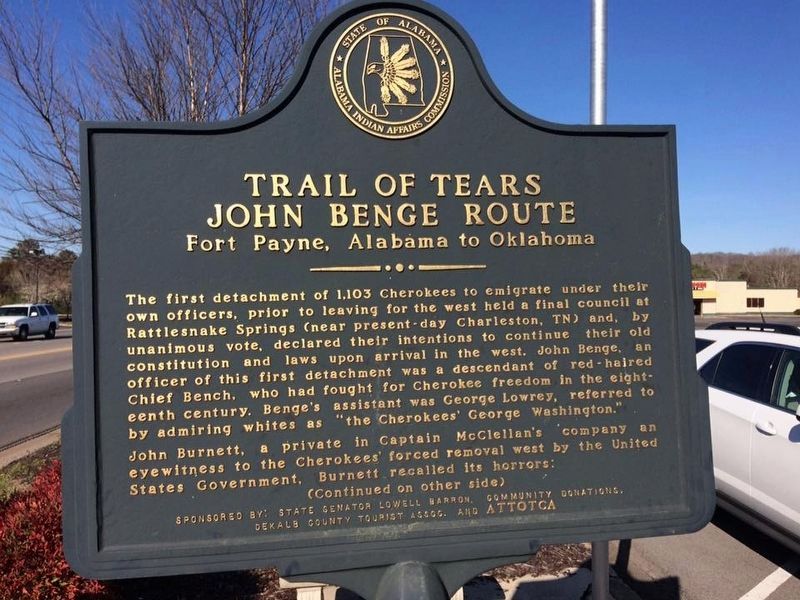
Photographed by Debra Oliver, March 5, 2017
1. Trail of Tears Marker (side 1)
The first detachment of 1,103 Cherokees to emigrate under their own officers, prior to leaving for the west held a final council at Rattlesnake Springs (near present-day Charleston, TN) and, by unanimous vote, declared their intentions to continue their old constitution and laws upon arrival in the west. John Benge, an officer of this first detachment was a descendant of red-haired Chief Bench, who had fought for Cherokee freedom in the eighteenth century. Benge's assistant was George Lowrey, referred to by admiring whites as the "Cherokee George Washington."
John Burnett, a private in Captain McClellan's company as an eyewitness to the Cherokees' forced removal west by the United States Government. Burnett recalled its horrors:
"I saw the helpless Cherokees arrested and dragged from their homes, and driven by bayonet into the stockades" now present-day Fort Payne. On October 3, 1838, Cherokee leader John Benge left Fort Payne, they followed what is now Highway 33 through Fort Payne to the top of Sand Mountain. Turning southwest at present-day Rainesville, they followed Highway 75 to Albertville, then U.S. Highway
this page online
They were ferried across the Tennessee River, then proceeding north to present-day Gurley before heading northwest along the Flint River, into Tennessee and west. Many died of hypothermia and starvation at the Three Forks of the Flint River.
Over 4,000 Cherokee Indians died on this forced removal known as the Trail of Tears, however many ancestors of American Indians reside in Alabama today.
Erected by State Senator Lowell Barron, community donations, DeKalb County Tourist Assoc. and ATTOTCA; Alabama Indian Affairs Commission.
Topics and series. This historical marker is listed in these topic lists: Indigenous Peoples and Communities • Law Enforcement. In addition, it is included in the Trail of Tears series list. A significant historical date for this entry is October 3, 1838.
Location. Marker has been reported missing. It was located near 34° 26.266′ N, 85° 45.152′ W. Marker was in Fort Payne, Alabama, in DeKalb County. It was at the intersection of Glenn Boulevard SW (Alabama Route 35) and Airport Road West, on the right when traveling west on Glenn Boulevard SW. Touch for map. Marker
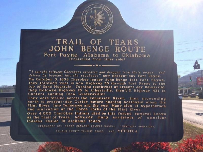
Photographed by Debra Oliver, March 5, 2017
2. Trail of Tears Marker (side 2)

Regionally, this marker was in North Alabama. It was also in the American South, specifically in the Deep South, in Appalachia, and specifically in Southern Appalachia. Globally, it was in North America, a Gulf of Mexico state, the Western Hemisphere, the Western World, and the Anglosphere. Historically, it found itself in what was once the original Cherokee Nation, the territory of the Mississippian Culture, one of the Confederate States of America, and the Antebellum South.
Other nearby markers. At least 8 other markers are within 2 miles of this location, measured as the crow flies: Fort Payne Cabin Historic Site (approx. 1.6 miles away); Main Street Historic District (approx. 1.7 miles away); Cherokee Indian Removal (approx. 1.7 miles away); Fort Payne Residential Historic District (approx. 1.8 miles away); Alabama (approx. 1.9 miles away); Whittler's Corner (approx. 1.9 miles away); Confederate Monument (approx. 1.9 miles away); Fort Payne Opera House (approx. 1.9 miles away). Touch for a list and map
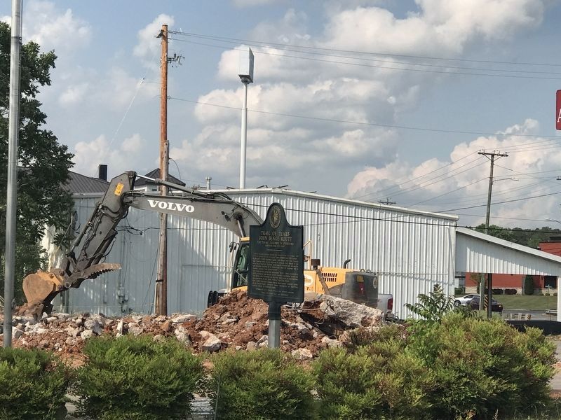
Photographed by Duane and Tracy Marsteller, May 5, 2022
3. Trail of Tears Marker
Other markers no longer nearby. Sequoyah (was approx. 1.9 miles away but has been confirmed missing); Wills Town Mission (was approx. 1.9 miles away but has been confirmed missing); Fort Payne’s Fort (was approx. 1.9 miles away but has been confirmed missing).
Credits. This page was last revised on December 5, 2024. It was originally submitted on February 8, 2018, by Debra Oliver of Jonesboro, Georgia. This page has been viewed 1,886 times since then and 103 times this year. Last updated on November 29, 2024, by Edward Troxel of Creal Springs, Illinois. Photos: 1, 2. submitted on February 8, 2018, by Debra Oliver of Jonesboro, Georgia. 3. submitted on May 9, 2022, by Duane and Tracy Marsteller of Murfreesboro, Tennessee. • Devry Becker Jones was the editor who published this page.
