Fort Frances in Rainy River District, Ontario — Central Canada (North America)
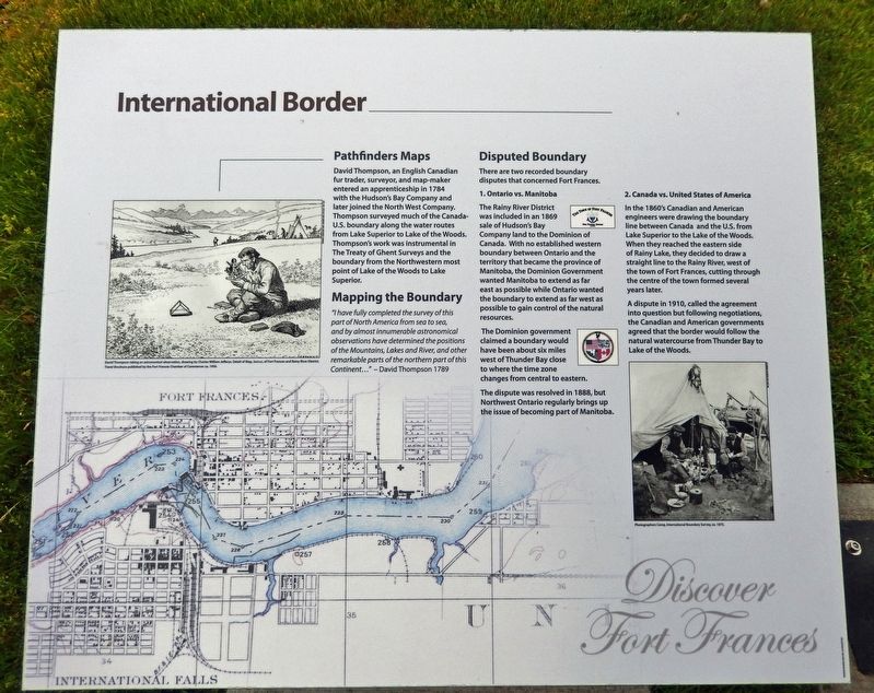
International Border
| — | Discover Fort Frances | — |
Photographed by Cosmos Mariner, June 16, 2024
1. International Border Marker
Pathfinders Maps
David Thompson, an English Canadian fur trader, surveyor, and map-maker entered an apprenticeship in 1784 with the Hudson's Bay Company and later joined the North West Company. Thompson surveyed much of the Canada-U.S. boundary along the water routes from Lake Superior to Lake of the Woods. Thompson's work was instrumental in The Treaty of Ghent Surveys and the boundary from the Northwestern most point of Lake of the Woods to Lake Superior.
Mapping the Boundary
“I have fully completed the survey of this part of North America from sea to sea, and by almost innumerable astronomical observations have determined the positions of the Mountains, Lakes and River, and other remarkable parts of the northern part of this Continent...” — David Thompson 1789
Disputed Boundary
There are two recorded boundary disputes that concerned Fort Frances.
1. Ontario vs. Manitoba
The Rainy River District was included in an 1869 sale of Hudson's Bay Company land to the Dominion of Canada. With no established western boundary between Ontario and the territory that became the province of Manitoba, the Dominion Government wanted Manitoba
this page online
The Dominion government claimed a boundary would have been about six miles west of Thunder Bay close to where the time zone changes from central to eastern.
The dispute was resolved in 1888, but Northwest Ontario regularly brings up the issue of becoming part of Manitoba.
2. Canada vs. United States of America
In the 1860's Canadian and American engineers were drawing the boundary line between Canada and the U.S. from Lake Superior to the Lake of the Woods. When they reached the eastern side of Rainy Lake, they decided to draw a straight line to the Rainy River, west of the town of Fort Frances, cutting through the centre of the town formed several years later. A dispute in 1910, called the agreement into question but following negotiations, the Canadian and American governments agreed that the border would follow the natural watercourse from Thunder Bay to Lake of the Woods.
Topics. This historical marker is listed in these topic lists: Colonial Era • Exploration • Political Subdivisions

Library & Archives of Canada, Acc. No. 1972-26-1406
2. Marker detail: David Thompson
David Thompson taking an astronomical observation, drawing by Charles William Jefferys.
Location. 48° 36.341′ N, 93° 23.504′ W. Marker is in Fort Frances, Ontario, in Rainy River District. It is on Front Street just east of Victoria Avenue, on the right when traveling east. The marker is beside an overlook shelter located along the walkway near the west end of the La Verendrye Parkway / Rainy River trail. Touch for map. Marker is in this post office area: Fort Frances ON P9A 1A3, Canada. Touch for directions.

Regionally, this marker is in Northern Ontario and specifically in Northwest Ontario. It is also in Central Canada. Globally, it is in North America, the Great North Woods, the Western Hemisphere, the Western World, and the Anglosphere. Historically, it finds itself in what was once a British colony, the Viceroyalty of New France, the Haudenosaunee (Iroquois) Confederacy, and Rupert’s Land.
Other nearby markers. At least 8 other markers are within walking distance of this marker: Crossing the Border (here, next to this marker); Fishing at the Falls (a few steps from this marker); Dianna Boileau, Dr. Harold Challis and Transgender Rights
Courtesy Fort Frances Chamber of Commerce
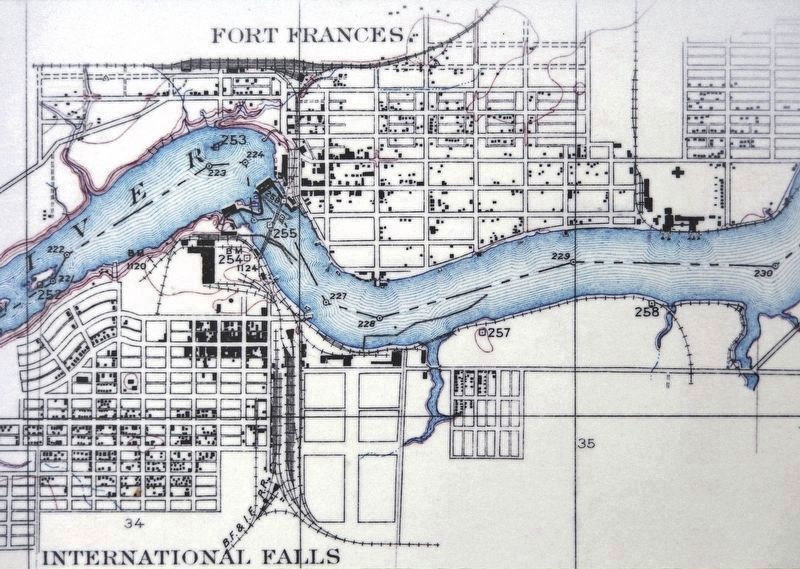
3. Marker detail: Detail of Map of Fort Frances and Rainy River District, ca. 1950
Also see . . .
1. David Thompson (Wikipedia).
Excerpt: David Thompson was an Anglo-Canadian fur trader, surveyor, and cartographer, known to some native people as "Koo-Koo-Sint" or "the Stargazer". Over Thompson's career, he travelled 56,000 mi across North America, mapping 1.9 million square miles of the continent along the way. For this historic feat, Thompson has been described as the "greatest practical land geographer that the world has produced".(Submitted on December 4, 2024, by Cosmos Mariner of Cape Canaveral, Florida.)
2. Treaty of Ghent (Wikipedia).
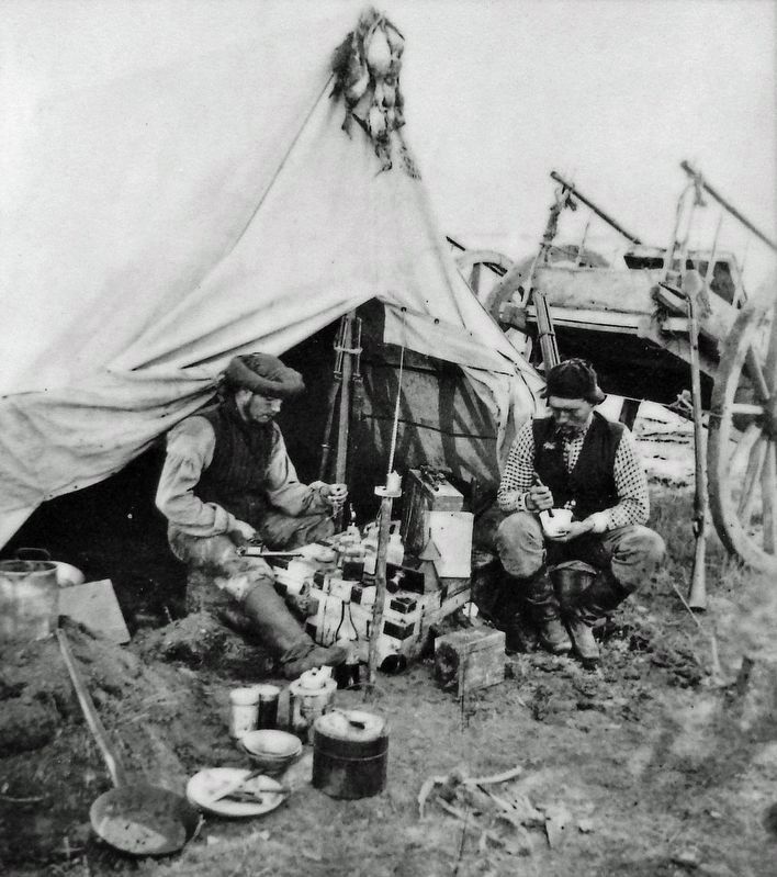
Excerpt: The Treaty of ended the War of 1812 between the United States and the United Kingdom. Both sides signed it on December(Submitted on December 4, 2024, by Cosmos Mariner of Cape Canaveral, Florida.)24, 1814, in the city of Ghent, United Netherlands (now in Belgium). The treaty restored relations between the two parties to status quo ante bellum by restoring the pre-war borders of June 1812. It ended when the treaty arrived in Washington and was immediately ratified unanimously by the United States Senate and exchanged with British officials the next day. The treaty was approved by the British Parliament and signed into law by the Prince Regent (the future King George IV) on December 30, 1814. U.S. President James Madison signed the treaty and exchanged final ratified copies with the British ambassador on February 17, 1815.Courtesy Glenbow Museum (NA-249-24)4. Marker detail: Photographers Camp, International Boundary Survey, ca. 1873
Photographed by Cosmos Mariner, June 16, 2024
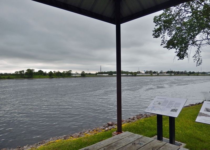
5. International Border Marker
Looking west along the Rainy River; International Falls, Minnesota, USA is visible to the left and across the river.
Photographed by Cosmos Mariner, June 16, 2024
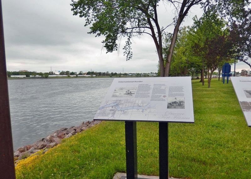
6. International Border Marker
Looking southwest across the Rainy River; International Falls, Minnesota, USA is visible across the river. This marker is the leftmost of 2 interpretive panels at this location.
Credits. This page was last revised on December 4, 2024. It was originally submitted on December 1, 2024, by Cosmos Mariner of Cape Canaveral, Florida. This page has been viewed 236 times since then and 30 times this year. Photos: 1, 2, 3, 4, 5, 6. submitted on December 4, 2024, by Cosmos Mariner of Cape Canaveral, Florida.
