
History of the Lookout Tower
| — | Discover Fort Frances | — |
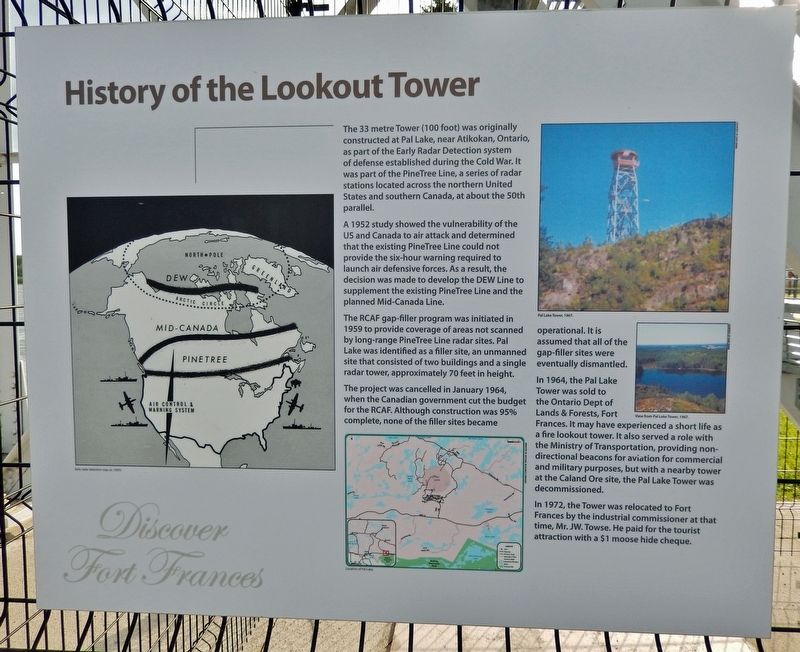
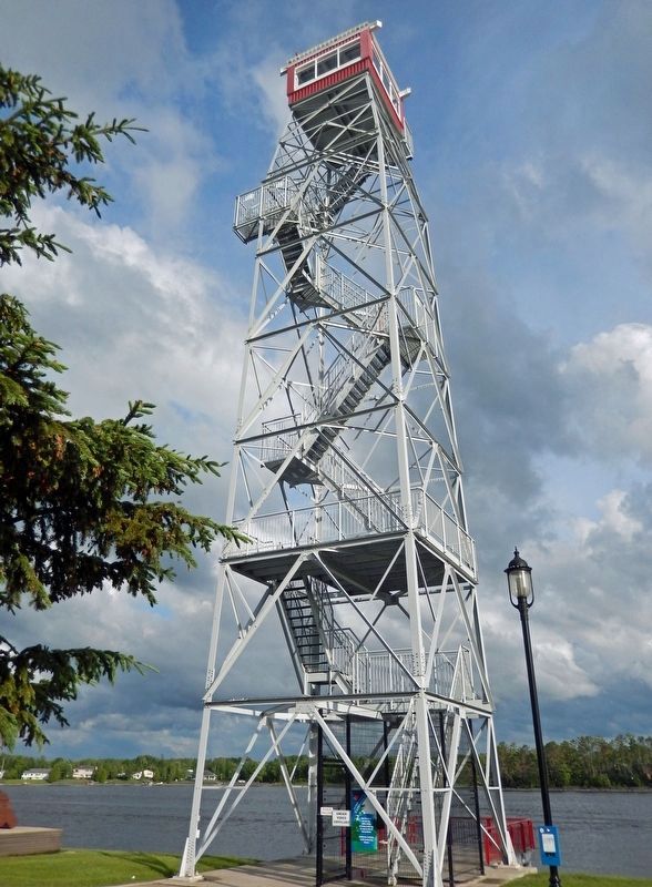
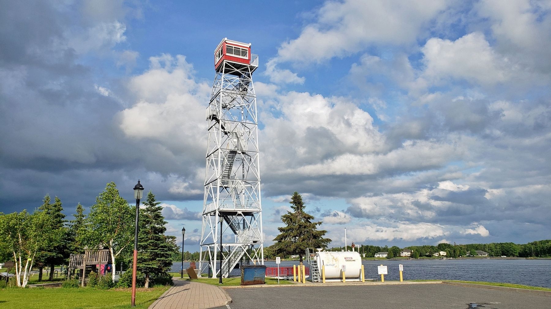
The 33 metre Tower (100 foot) was originally constructed at Pal Lake, near Atikokan, Ontario, as part of the Early Radar Detection system of defense established during the Cold War. It was part of the PineTree Line, a series of radar stations located across the northern United States and southern Canada, at about the 50th parallel.
A 1952 study showed the vulnerability of the US and Canada to air attack and determined that the existing PineTree Line could not provide the six-hour warning required to launch air defensive forces. As a result, the decision was made to develop the DEW Line to supplement the existing PineTree Line and the planned Mid-Canada Line.
The RCAF gap-filler program was initiated in 1959 to provide coverage of areas not scanned by long-range PineTree Line radar sites. Pal Lake was identified as a filler site, an unmanned site that consisted of two buildings and a single radar tower, approximately 70 feet in height.
The project was cancelled in January 1964, when the Canadian government cut the budget for the RCAF. Although construction was 95% complete, none of the filler sites became operational. It
this page online
In 1964, the Pal Lake Tower was sold to the Ontario Dept of Lands & Forests, Fort Frances. It may have experienced a short life as a fire lookout tower. It also served a role with the Ministry of Transportation, providing non-directional beacons for aviation for commercial and military purposes, but with a nearby tower at the Caland Ore site, the Pal Lake Tower was decommissioned.
In 1972, the Tower was relocated to Fort Frances by the industrial commissioner at that time, Mr. JW. Towse. He paid for the tourist attraction with a $1 moose hide cheque.
[photo captions]
• Location of Pal Lake
• Pal Lake Tower, 1967
• View from Pal Lake Tower, 1967
Topics. This historical marker is listed in these topic lists: Air & Space • Parks & Recreational Areas • War, Cold. A significant historical year for this entry is 1952.
Location. 48° 36.418′ N, 93° 22.551′ W. Marker is in Fort Frances, Ontario, in Rainy River District. It is on Front Street 0.1 kilometers west of Minnie Avenue, on the right when traveling east. The tower and marker are located along the La Verendrye


Regionally, this marker is in Northern Ontario and specifically in Northwest Ontario. It is also in Central Canada. Globally, it is in North America, the Great North Woods, the Western Hemisphere, the Western World, and the Anglosphere. Historically, it finds itself in what was once a British colony, the Viceroyalty of New France, the Haudenosaunee (Iroquois) Confederacy, and Rupert’s Land.
Other nearby markers. At least 8 other markers are within walking distance of this marker: Forest to Wood Yard (within shouting distance of this marker); The Shevlin Wood Yard (within shouting distance of this marker); The North West Mounted Police on the Dawson Route (within shouting distance of this marker); La Verendrye Parkway (approx. 0.3 kilometers away); Explore Fort Frances West (approx. 0.3 kilometers away); The Fur Trade Competition (approx. 0.3 kilometers away); Pelts, Paddles and Portages (approx. 0.3 kilometers away); The Sorting Gap
Also see . . .
1. Pinetree Line (Wikipedia).
Excerpt: The Pinetree Line was a series of radar stations located across southern Canada at about the 50th parallel north, along with a number of other stations located on the Atlantic and Pacific coasts. Run by North American Aerospace Defense Command (NORAD) (after its creation), over half were staffed by United States Air Force personnel with the balance operated by the Royal Canadian Air Force. The line was the first coordinated system for early detection of a Soviet bomber attack on North America, but before the early 1950s radar technology quickly became outdated and the line was in full operation only for a short time.(Submitted on December 5, 2024, by Cosmos Mariner of Cape Canaveral, Florida.)
2. Distant Early Warning (DEW) Line (Wikipedia).
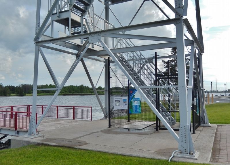
Excerpt: The shortest, or great circle, route for a Soviet air attack on North America was through the Arctic, across the area around the North Pole. The DEW Line was built during the Cold War to give early warning of a Soviet(Submitted on December 5, 2024, by Cosmos Mariner of Cape Canaveral, Florida.)nuclear strike, to allow time for United States bombers to get off the ground and land-based intercontinental ballistic missile (ICBMs) to be launched, to reduce the chances that a preemptive strike could destroy the United States' strategic nuclear forces.Photographed by Cosmos Mariner, June 16, 20244. Lookout TowerLooking southeast along the Rainy River.The DEW Line was the northernmost and most capable of three radar lines in Canada and Alaska. The first of these was the joint Canadian-United States Pinetree Line, which ran from Newfoundland to Vancouver Island just north of the Canada–United States border, but even while it was being built there were concerns that it would not provide enough warning time to launch an effective counterattack. The Mid-Canada Line (MCL) was proposed as an inexpensive solution using bistatic radar. This provided a "trip wire" warning located roughly at the 55th parallel, giving commanders ample warning time, but little information on the targets or their exact location. The MCL proved largely useless in practice, as the radar return of flocks of birds overwhelmed signals from aircraft.
Credits. This page was last revised on December 5, 2024. It was originally submitted on December 3, 2024, by Cosmos Mariner of Cape Canaveral, Florida. This page has been viewed 236 times since then and 27 times this year. Photos: 1, 2, 3, 4, 5. submitted on December 5, 2024, by Cosmos Mariner of Cape Canaveral, Florida.
