Brantford in Brant County, Ontario — Central Canada (North America)
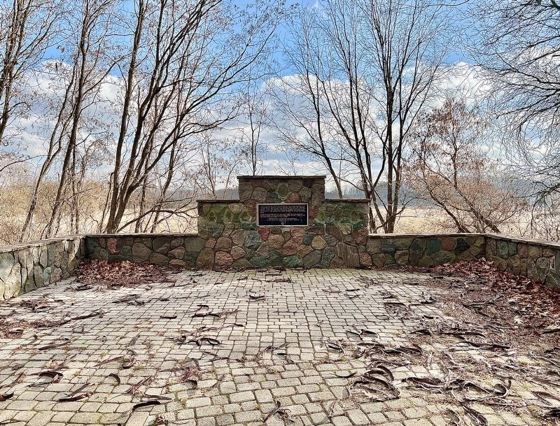
Original Canoe Landing for the Mohawk Village

Photographed by Tim Boyd, December 12, 2023
1. Original Canoe Landing for the Mohawk River Marker
From its construction in 1785 until 1829 the entrance to St. Paul's Chapel of the Mohawks faced east to this landing site, the main point of entry to the village.
Erected by the Rotary Club of Brantford on the 200th anniversary of the first landing 1784-1984
Erected 1984 by Rotary Club of Brantford.
Topics and series. This historical marker is listed in these topic lists: Indigenous Peoples and Communities • Religion & Religious Structures • Waterways & Vessels. In addition, it is included in the Rotary International series list. A significant historical year for this entry is 1785.
Location. 43° 7.457′ N, 80° 14.034′ W. Marker is in Brantford, Ontario, in Brant County. It is on Mohawk Street, on the right when traveling east. The marker is on the grounds of the Mohawk Chapel, on the Hamilton-Brantford Rail Trail, approx. 200 metres from the parking lot off Mohawk Street. Touch for map. Marker is at or near this
this page online

Regionally, this marker is in the Hamilton-Halton-Brant Area and in Southwestern Ontario. It is also in Central Canada. Globally, it is in North America, the Western Hemisphere, the Western World, and the Anglosphere. Historically, it finds itself in what was once a British colony, the Viceroyalty of New France, the Haudenosaunee (Iroquois) Confederacy, and Rupert’s Land.
Other nearby markers. At least 8 other markers are within 3 kilometers of this marker, measured as the crow flies: Tomb of THAYENDANEGEA (within shouting distance of this marker); Her Majesty’s Chapel of the Mohawks (about 90 meters away, measured in a direct line); Mohawk Village (about 120 meters away); St. Paul’s 1785 H.M. Chapel of the Mohawks / St. Paul’s 1785 Chapelle Royale des Mohawks (about 120 meters away); The Mohawk Institute (approx. 0.7 kilometers away); John Hicks Whale (approx. 1.6 kilometers away); Rev. Peter Jones (approx. 2.1 kilometers away); Royal Victoria Place (approx. 2.9 kilometers away). Touch for a list and map of all markers in Brantford.
Photographed by Tim Boyd, December 12, 2023
2. Original Canoe Landing for the Mohawk Village Marker

December 7, 2024
3. The area of the Mohawk Village, 1863
Showing the Oxbow and the “Mission Church” (the Mohawk Chapel) at the bank of the Grand River

Photographed by Tim Boyd, March 10, 2022
4. St. Paul’s His Majesty’s Chapel of the Mohawks
Built 1784-85, the oldest existing church building in Ontario

December 7, 2024
5. The Mohawk Village ca 1792
Birchbark drawing by Elizabeth Simcoe, showing the Mohawk Chapel with its original orientation towards the Grand River
Source: King George III collection, public domain
Credits. This page was last revised on December 21, 2024. It was originally submitted on December 7, 2024, by Tim Boyd of Hamilton, Ontario. This page has been viewed 260 times since then and 38 times this year. Photos: 1, 2, 3, 4, 5. submitted on December 7, 2024, by Tim Boyd of Hamilton, Ontario. • Andrew Ruppenstein was the editor who published this page.
