The Landing in Shakopee in Scott County, Minnesota — The American Midwest (Upper Plains)
Sugar Shack and Evaporator
Maple Sugaring Season
Photographed by McGhiever, November 8, 2024
1. Sugar Shack and Evaporator Marker
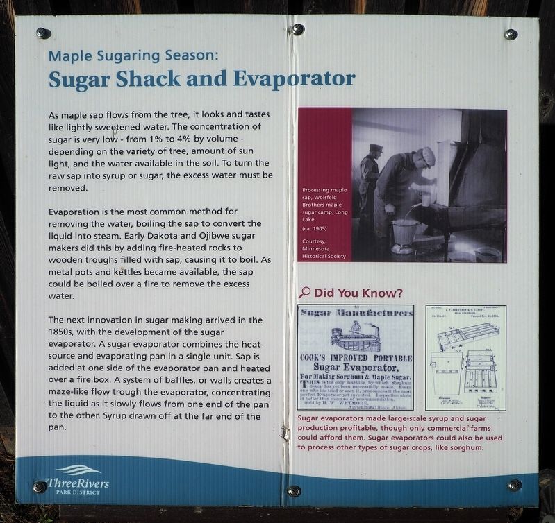
As maple sap flows form the tree, it looks and tastes like lightly sweetened water. The concentration of sugar is very low - from 1% to 4% by volume - depending on the variety of tree, amount of sun light, and the water available in the soil. To turn the raw sap into syrup or sugar, the excess water must be removed.
Evaporation is the most common method for removing the water, boiling the sap to convert the liquid into steam. Early Dakota and Ojibwe sugar makers did this by adding fire-heated rocks to wooden troughs filled with sap, causing it to boil. As metal pots and kettles became available, the sap could be boiled over a fire to remove the excess water.
The next innovation in sugar making arrived in the 1850s, with the development of the sugar evaporator. A sugar evaporator combines the heat-source and evaporating pan in a single unit. Sap is added at one side of the evaporator pan and heated over a fire box. A system of baffles, or walls creates a maze-like flow trough [sic] the evaporator, concentrating the liquid as it slowly flows from one end of the pan to the other. Syrup drawn off at the far end of the
this page online
Processing maple sap, Wolsfeld Brothers maple sugar camp, Long Lake.
(ca. 1905)
Courtesy, Minnesota Historical Society
Sugar evaporators made large-scale syrup and sugar production profitable, though only commercial farms could afford them. Sugar evaporators could also be used to process other types of sugar crops, like sorghum.
Erected by Three Rivers Park District.
Topics. This historical marker is listed in these topic lists: Agriculture • Indigenous Peoples and Communities • Industry & Commerce.
Location. 44° 48.237′ N, 93° 28.955′ W. Marker is in Shakopee, Minnesota, in Scott County. It is in The Landing. It can be reached from County Highway 101, on the right when traveling west. The marker is at The Landing heritage park, at the north end of a field near the east entrance. Touch for map. Marker is at or near this postal address: 2187 County Highway 101, Shakopee MN 55379, United States of America. Touch for directions.

Regionally, this marker is in the Minnesota River Valley and in the Twin Cities Metropolitan Area. It is also in the American
Photographed by McGhiever, November 8, 2024
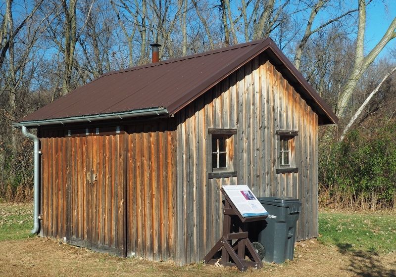
2. Sugar Shack and Evaporator Marker next to the sugar shack at The Landing
Other nearby markers. At least 8 other markers are within walking distance of this marker: Oak Savanna Restoration Project (about 400 feet away, measured in a direct line); Welcome to The Landing: Minnesota River Heritage Park (about 500 feet away); Cultural Exchange (about 500 feet away); Sunlight Wanted (about 700 feet away); Subsistence Existence (about 800 feet away); Clearing the Way (approx. 0.2 miles away); Growing Profits (approx. ¼ mile away); A Practical Education for All (approx. 0.3 miles away). Touch for a list and map of all markers in Shakopee.
More about this marker. The grounds of The Landing are free to access year-round.
Credits. This page was last revised on December 8, 2024. It was originally submitted on December 8, 2024, by McGhiever of Minneapolis, Minnesota. This page has been viewed 184 times since then and 14 times this year. Photos: 1, 2. submitted on December 8, 2024, by McGhiever of Minneapolis, Minnesota.
