
Agua Dulce in Los Angeles County, California — The American West (Pacific Coastal)
The Mexican & Early American Eras
The 1840s to the 1870s
| — | Vasquez Rocks | — |
Photographed by Craig Baker, December 9, 2024
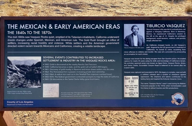
1. Mexican & Early American Eras Marker
The mid-1800s saw Vasquez Rocks quiet, emptied of its Tataviam inhabitants. California underwent drastic changes under Spanish, Mexican, and American rule. The Gold Rush brought an influx of settlers, increasing racial hostility and violence. White settlers and the American government directed violent racism towards Mexicans and Californios, creating a volatile landscape.
Several events contributed to increased settlement & industry in the Vasquez Rocks area:
• 1842: Gold is discovered at the nearby Rancho San Francisco.
• 1848: California becomes a state, and the gold rush at Sutter's Mill begins.
• 1861: Discovery of gold nearby in Ravenna and Acton draws settlers into this area.
• 1862: The Homestead Act is passed, increasing private land ownership.
• 1862-1864: A radical slot road cut in the Newhall Pass improves overland travel.
• 1850-1870: The federal government contracted surveyors to map the state of California.
• 1865: Oil discoveries in the Santa Clarita Valley grow local towns.
Tiburico Vasquez
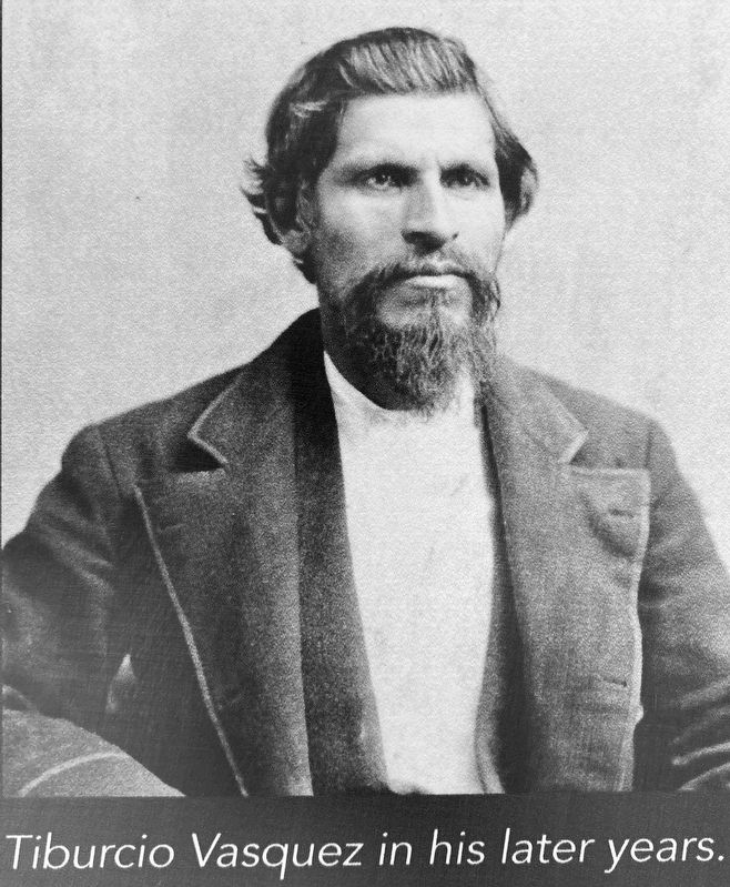
Tiburcio Vasquez's life was full of contradictions, set against
this page online
As California changed hands, so did Vasquez's path. Angered by the US government's treatment of Californios, he turned to crime, escalating from minor offenses to robbery and murder. His case set a precedent by prosecuting an accomplice for such crimes.
Vasquez was known for his daring escapes from San Quentin prison. He evaded capture for nearly 20 years using his skills and knowledge of California's terrain. His activities spanned areas now known as Agua Dulce, Vasquez Rocks, Acton, and Santa Clarita. Escondido Canyon Road is believed to be named after his evasion skills.
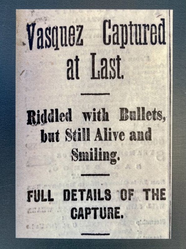
Vasquez was captured and executed in 1875. His legacy is complex, seen as both a ruthless criminal and a symbol of resistance against oppression. His charisma and talents contributed to his lasting fame and inspired the fictional character Zorro.
The name "Vasquez Rocks" wasn't used during his lifetime. It became popular
Photographed by Craig Baker, December 9, 2024
2. Marker Detail
photo captions:
Vasquez Rocks in the late 1920s or early 1930s. Image courtesy Krieg/Toney family.
An early survey map of the Agua Dulce area (Valley of la Serra Pelona), circa 1856. Courtesy Bureau of Land Management’s General Land Office records.
Tiburcio Vasquez in his later years.
A headline from the San Francisco Chronicle, May 15, 1874.
Erected 2024 by County of Los Angeles Department of Parks and Recreation.
Topics. This historical marker is listed in these topic lists: Hispanic Americans • Law Enforcement • Settlements & Settlers.
Location. 34° 29.272′ N, 118° 18.922′ W. Marker is in Agua Dulce, California, in Los Angeles County. It can be reached from Escondido Canyon Road half a mile east of Agua Dulce Canyon Road, on the right when traveling east. Located in Vazquez Rocks Natural Area, on the Pacific Crest Trail/Homestead Trail. Touch for map. Marker is at or near this postal address: 10700 Escondido Canyon Rd, Santa Clarita CA 91390,
Photographed by Craig Baker, December 9, 2024
3. Marker Detail

Regionally, this marker is in Greater Los Angeles and in the Transverse Ranges. It is also on the American Pacific Coast. Globally, it is in North America, on the Ring of Fire, in the Pacific Rim, in the Western Hemisphere, in the Western World, and in the Anglosphere. Historically, it finds itself in what was once New Spain and also Mexico’s Alta California.
Other nearby markers. At least 11 other markers are within walking distance of this marker: European Contact & the Spanish Era (about 400 feet away, measured in a direct line); Land and Industry (about 500 feet away); How Do We Know What We Know? (approx. 0.2 miles away); Pacific Crest Trail (approx. ¼ mile away); "Devil’s Punchbowl Wildlife" Mural (approx. 0.3 miles away); Toney Residence (approx. 0.3 miles away); The Village of Mapipinga (approx. 0.3 miles away); The Krieg-Toney Family (approx. 0.3 miles away); The Castle of Vasquez Rocks (approx. 0.4 miles away); Vasquez Rocks Becomes a Park (approx. 0.4 miles away); The Asher Family (approx. 0.4 miles away). Touch for a list and map of all markers in Agua Dulce.
Photographed by Craig Baker, December 9, 2024
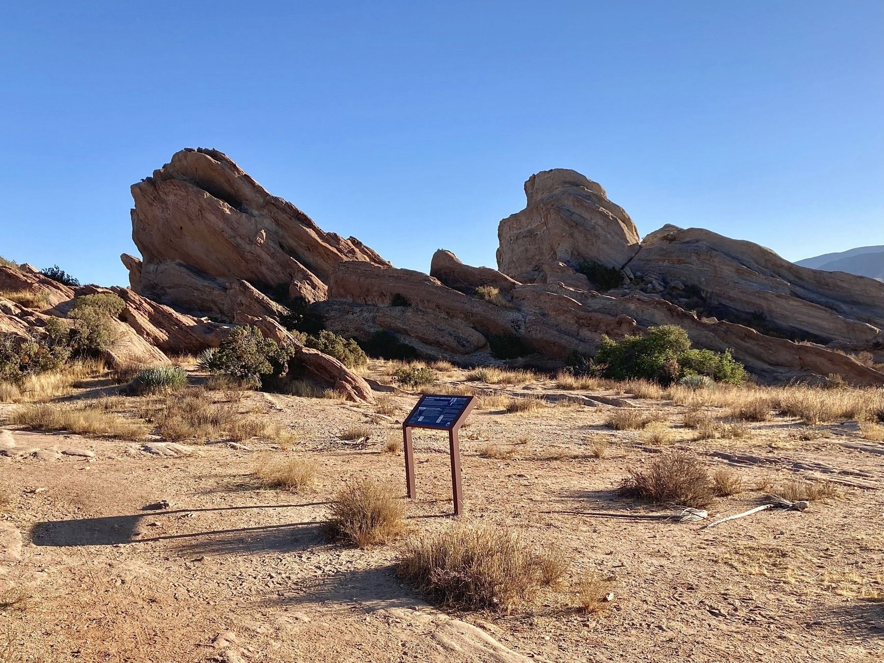
4. Mexican & Early American Eras Marker
Credits. This page was last revised on December 17, 2024. It was originally submitted on December 9, 2024, by Craig Baker of Sylmar, California. This page has been viewed 212 times since then and 22 times this year. Photos: 1, 2, 3, 4. submitted on December 9, 2024, by Craig Baker of Sylmar, California.
