Long Sands Beach in York in York County, Maine — The American Northeast (New England)
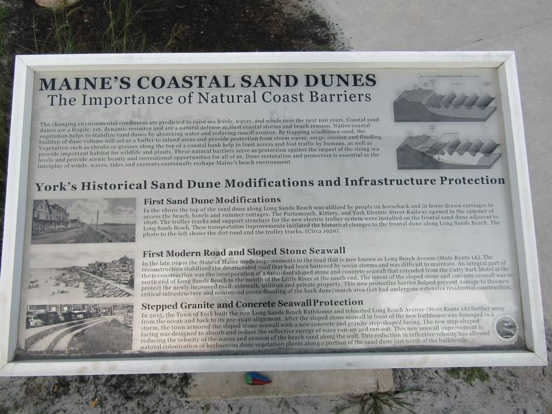
Maine's Coastal Sand Dunes
Photographed by Conrad Ward, August 17, 2024
1. Maine's Coastal Sand Dunes Marker
The Importance of Natural Coast Barriers
The changing environmental conditions are predicted to raise sea levels, waves, and winds over the next 100 years. Coastal sand dunes are a fragile, yet, dynamic resource and are a natural defense against coastal storms and beach erosion. Native coastal vegetation helps to stabilize sand dunes by absorbing water and reducing runoff erosion. By trapping windblown sand, the buildup of dune volume will act as a buffer to inland areas and provide protection from storm waves, surge, erosion and flooding. Vegetation such as shrubs or grasses along the top of a coastal bank help to limit access and foot traffic by humans, as well as provide important habitat for wildlife and plants. These natural barriers serve as protection against the impact of the rising sea levels and provide scenic beauty and recreational opportunities for all of us. Dune restoration and protection is essential as the interplay of winds, waves, tides and currents continually reshape Maine's beach environment.
York's Historical Sand Dune Modifications and Infrastructure Protection
First Sand Dune Modifications
In
this page online
First Modern Road and Sloped Stone Seawall
In the late 1940s the State of Maine made improvements to the road that is now known as Long Beach Avenue (State Route 1A). The reconstruction stabilized the deteriorated road that had been battered by ocean storms and was difficult to maintain. An integral part of the reconstruction was the incorporation of a 6100-foot sloped stone and concrete seawall that extended from the Cutty Sark Motel at the north end of Long Sands Beach to the mouth of the Little River at the south end. The intent of the sloped
Photographed by Conrad Ward, August 17, 2024
2. Maine's Coastal Sand Dunes Marker
Stepped Granite and Concrete Seawall Protection.
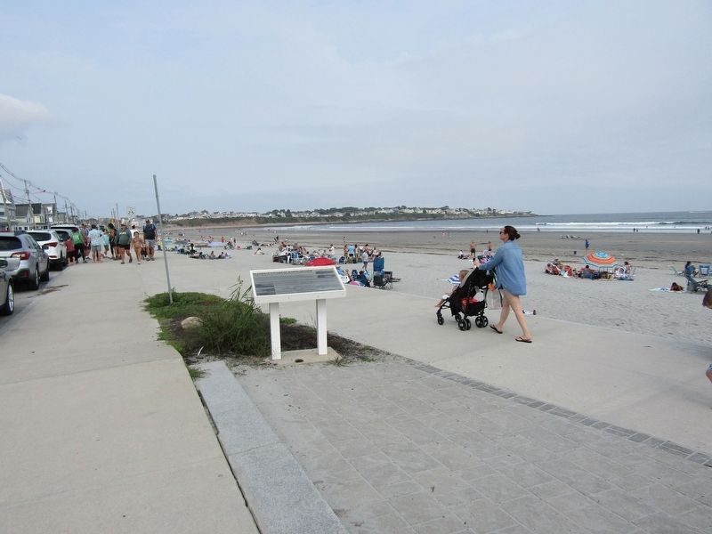
In 2015, the Town of York built the new Long Sands Beach Bathhouse and relocated Long Beach Avenue (State Route 1A) further away" from the ocean and back to its pre-1940 alignment. After the sloped stone seawall in front of the new bathhouse was damaged in a storm, the town armored the sloped stone seawall with a new concrete and granite step-shaped facing. The new step-shaped facing was designed to absorb and reduce the reflective energy of wave run-up and run-out. This new seawall improvement is reducing the velocity of the waves and erosion of the beach sand along the wall. This reduction in reflective velocity has allowed natural colonization of herbaceous dune vegetation plants along a portion of the sand dune just north of the bathhouse.
Erected by Town of York, Maine.
Topics. This historical marker is listed in these topic lists: Environment • Railroads & Streetcars • Roads & Vehicles. A significant historical year for this entry is 2015.
Location. 43° 9.87′ N, 70° 37.092′ W. Marker is in York, Maine, in York County. It is in Long Sands Beach. It is on Long Beach Avenue (U.S. 1A) north of Oceanside Avenue, on the right when traveling north. Located near the Long Sands Beach Bathhouse. Touch for map. Marker is in this post office area: York ME 03909, United States of America. Touch for directions.

Regionally, this marker is on Southern Maine Coast. It is also in the American Northeast, in New England, and on the Eastern Seaboard. Globally, it is in the North Atlantic Region, North America, the Western Hemisphere, the Western World, and the Anglosphere.
Other nearby markers. At least 8 other markers are within 3 miles of this marker, measured as the crow flies: Boon Island Light / Long Sands Beach / York's Big Hotel Era (approx. 0.4 miles away); "Beware The Savage Rocks" (approx. 1.2 miles away); "Nubble Light House" (approx. 1.3 miles away); Historic York Then and Now (approx. 2.2 miles away); Candlemas Massacre (approx. 2.2 miles away); The Redshirts of York (approx. 2.3 miles away); York Village & Corner Fire Department (approx. 2.3 miles away); The History of Harbor Hill (approx. 2.4 miles away). Touch for a list and map of all markers in York.
Credits. This page was last revised on December 24, 2024. It was originally submitted on December 20, 2024, by Conrad Ward of Guilford, Connecticut. This page has been viewed 184 times since then and 28 times this year. Photos: 1, 2. submitted on December 20, 2024, by Conrad Ward of Guilford, Connecticut. • Michael Herrick was the editor who published this page.
