Near Dyersville in Dubuque County, Iowa — The American Midwest (Upper Plains)
In Remembrance of Denise Miarecki Stillman
(1971-2018)
| — | An Inspiration All | — |

Photographed by Mark Parker, July 18, 2023
1. In Remembrance of Denise Miarecki Stillman Marker
Denise spent many of her days devoting love and attention to this farm and Field as it was her wish for all that visited that they may share the special feelings that many experience while standing on this sacred piece of baseball history. She adored sharing priceless memories of The Field with visitors from around the world. Denise's vision for giving back to the youth of the world, and her love for this amazing American baseball destination will live on for years to come.
So, as you play on this field hear Denise's words: "Reach for your dreams, no matter what they may be. Be true to yourself. And dare to make a difference in this world."
Topics. This historical marker is listed in these topic lists: Entertainment • Parks & Recreational Areas
this page online
Location. 42° 29.862′ N, 91° 3.271′ W. Marker is near Dyersville, Iowa, in Dubuque County. It can be reached from Lansing Road east of Dyersville East Road, on the left when traveling east. From Lansing Road, take the entrance road to the Field of Dreams site. The marker is along the sidewalk from the parking lot to the baseball field. Touch for map. Marker is at or near this postal address: 28995 Lansing Road, Dyersville IA 52040, United States of America. Touch for directions.

Regionally, this marker is in Eastern Iowa. It is also in the American Midwest, in the Corn Belt, and in the Great River Road Region. Globally, it is in North America, the Western Hemisphere, the Western World, and the Anglosphere. Historically, it finds itself in what was once the territory of the Mississippian Culture and also the Louisiana Purchase.
Other nearby markers. At least 4 other markers are within 8 miles of this marker, measured as the crow flies: Dyersville Veterans Memorial (approx. 3 miles away); All Veterans Memorial (approx. 4½ miles away); New Vienna Veterans Memorial
Photographed by Mark Parker, July 18, 2023
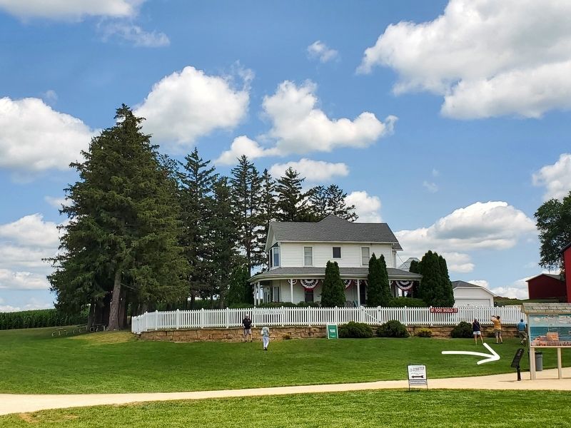
2. In Remembrance of Denise Miarecki Stillman Marker. Field of Dreams home in the background
Field of Dreams little league field to the left of the photo

Photographed by Mark Parker, July 18, 2023
3. Little League Field of Dreams

Photographed by Mark Parker, July 18, 2023
4. Little League Field of Dreams from the corn

Photographed by Mark Parker, July 18, 2023
5. Field of Dreams Little League Field and movie site home
Credits. This page was last revised on December 28, 2024. It was originally submitted on December 9, 2024, by Mark Parker of Hickory, North Carolina. This page has been viewed 272 times since then and 65 times this year. Last updated on December 21, 2024, by Mark Parker of Hickory, North Carolina. Photos: 1, 2, 3, 4, 5. submitted on December 9, 2024, by Mark Parker of Hickory, North Carolina. • J. Makali Bruton was the editor who published this page.
