Goffs in San Bernardino County, California — The American West (Pacific Coastal)
East Mojave History

Photographed by Craig Baker, December 20, 2024
1. East Mojave History Marker
First Inhabitants
Rock carvings and paintings found throughout this region are evidence that prehistoric man had once inhabited the East Mojave, perhaps as early as 10,000 years ago. Local populations of bighorn sheep and deer, along with native plants, provided these early Native Americans with the food, clothing and shelter essential for survival in the often harsh desert.
Boom and Bust
The discovery of silver near Wild Horse Canyon in the 1860's touched off a mining boom that peaked 20 years later with the Bonanza King Mine turning out 2,000 ounces of bullion a day. Working conditions were nothing to brag about. Though paid promptly and in coin, the men received only $3.50 a day; board cost $8 a week. A drop in silver prices by the late 1880's led to abandonment of several mines, the remains of which can still be seen throughout the East Mojave.
Gunfighter Leaves Mark on East Mojave
It wasn't Bob Hollimon's intention to settle in the East Mojave when he arrived in 1918 with a herd of cattle and a reputation as a gunfighter and cattle rustler, but he remained for
this page online
On The Range
By 1888, the Rock Springs Land and Cattle Company was grazing cattle on more than 1 million acres of desert in the East Mojave, including land along Wild Horse Canyon Byway. The dry desert conditions required the development of numerous wells and pipelines to provide water to the cattle in dry canyons like Wild Horse. The roads that were created to service these facilities have become some of the back-country byways of the East Mojave today. The windmills, corrals and fences seen along these roads are still needed by present day ranchers and provide the region with much of its Old West character.
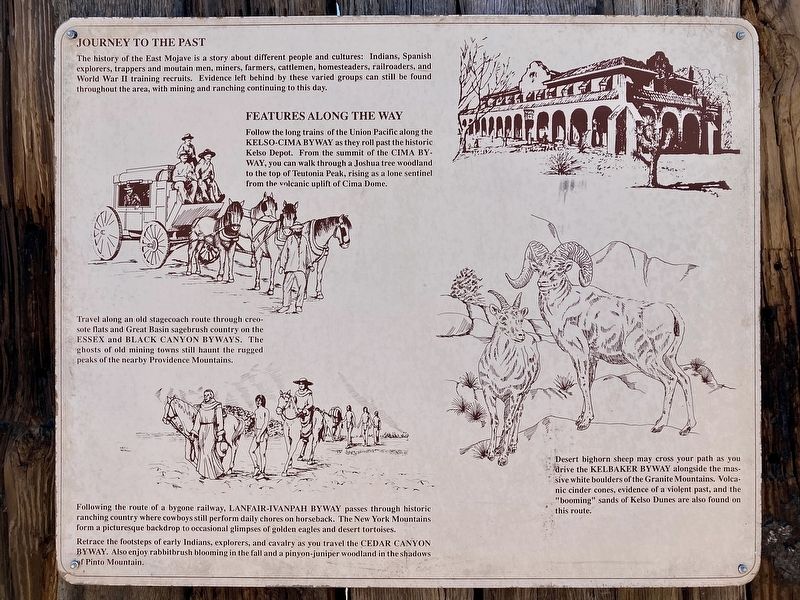
Journey to the Past
The history of the East Mojave is a story about different people and cultures: Indians, Spanish explorers, trappers and moutain men, miners, farmers, cattlemen, homesteaders, railroaders, and World War II training recruits.
Photographed by Craig Baker, December 20, 2024
2. East Mojave History Marker
Features Along the Way
Follow the long trains of the Union Pacific along the KELSO-CIMA BYWAY as they roll past the historic Kelso Depot. From the summit of the CIMA BY-WAY, you can walk through a Joshua tree woodland to the top of Teutonia Peak, rising as a lone sentinel from the volcanic uplift of Cima Dome.
Travel along an old stagecoach route through creosote flats and Great Basin sagebrush country on the ESSEX and BLACK CANYON BYWAYS. The ghosts of old mining towns still haunt the rugged peaks of the nearby Providence Mountains.
Following the route of a bygone railway, LANFAIR-IVANPAH BYWAY passes through historic ranching country where cowboys still perform daily chores on horseback. The New York Mountains form a picturesque backdrop to occasional glimpses of golden eagles and desert tortoises. Retrace the footsteps of early Indians, explorers, and cavalry as you travel the CEDAR CANYON BYWAY. Also enjoy rabbitbrush blooming in the fall and a pinyon-juniper

Photographed by Craig Baker, December 20, 2024
3. East Mojave History Marker
Topics. This historical marker is listed in these topic lists: Indigenous Peoples and Communities • Industry & Commerce • Parks & Recreational Areas • Settlements & Settlers. A significant historical year for this entry is 1918.
Location. 34° 55.33′ N, 115° 4.056′ W. Marker is in Goffs, California, in San Bernardino County. It can be reached from Lanfair Road 0.1 miles north of Goffs Road, on the left when traveling north. Located at Goffs Schoolhouse Museum. Touch for map. Marker is at or near this postal address: 37198 Lanfair Rd, Essex CA 92332, United States of America. Touch for directions.

Regionally, this marker is in Greater Los Angeles, in the Mojave Desert, in the Peninsular Ranges, and specifically in the Transverse Ranges. It is also in the American Southwest. Globally, it is in North America, on the Ring

Photographed by Craig Baker, December 19, 2024
4. First Inhabitants' Rock Paintings
Other nearby markers. At least 8 other markers are within 12 miles of this marker, measured as the crow flies: Goffs Schoolhouse, Essex, California (about 300 feet away, measured in a direct line); Dennis G. Casebier (about 400 feet away); a different marker also named Goffs Schoolhouse (about 500 feet away); Army Camp at Goffs (about 500 feet away); Pah-Ute Creek (about 600 feet away); Charlie Connell Mining District (about 700 feet away); The Original Mojave Cross (about 700 feet away); John Wilkie Safety Roadside Rest Area At Fenner (approx. 11.6 miles away). Touch for a list and map of all markers in Goffs.
Also see . . . Mojave Desert Heritage and Cultural Association. - Goffs Schoolhouse Museum. (Submitted on December 24, 2024.)

Photographed by Craig Baker, December 19, 2024
5. First Inhabitants' Rock Carvings
Credits. This page was last revised on August 22, 2026. It was originally submitted on December 24, 2024, by Craig Baker of Sylmar, California. This page has been viewed 286 times since then and 33 times this year. Photos: 1, 2, 3, 4, 5. submitted on December 24, 2024, by Craig Baker of Sylmar, California.
