Quinze-Vingts in Paris in Département de Paris, Île-de-France, France — Western Europe
Coulée Verte René-Dumont 1987-2000
Photographed by Andrew Ruppenstein, September 10, 2024
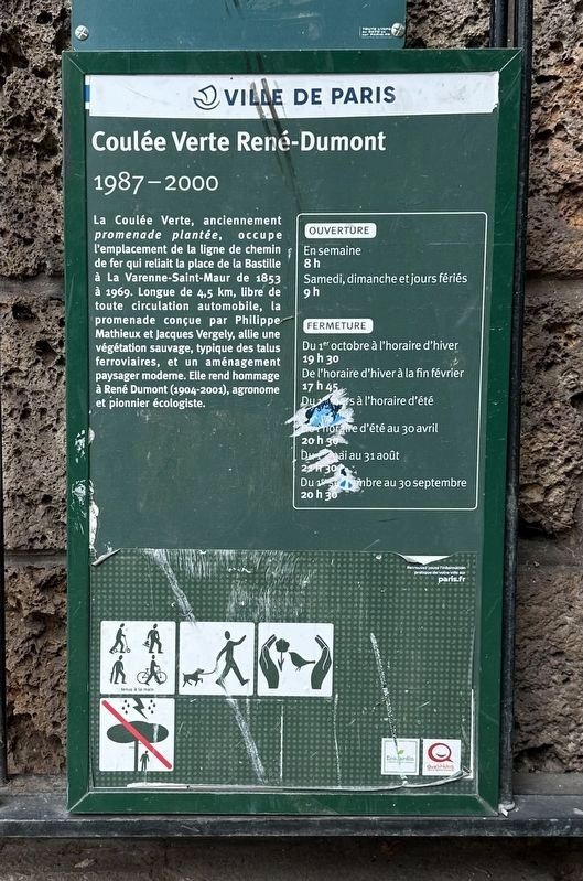
1. Coulée Verte René-Dumont Marker

The Coulée Verte, formerly a planted promenade, occupies the location of the railway line that connected the Place de la Bastille to La Varenne-Saint-Maur from 1853 to 1969. 4.5 km long, free of all car traffic, the promenade designed by Philippe Mathieux and Jacques Vergely, combines wild vegetation, typical of railway embankments, and modern landscaping. It pays homage to René Dumont (1904-2001), agronomist and environmental pioneer.
Erected by Ville de Paris.
Topics and series. This historical marker is listed in these topic lists: Parks & Recreational Areas • Railroads & Streetcars • Science & Medicine. In addition, it is included in the Parks and Squares of Paris series list. A significant historical year for this entry is 1853.
Location. 48° 50.929′ N, 2° 22.358′ E. Marker is in Paris, Île-de-France, in Département de Paris. It is in Quinze-Vingts. It is at the intersection of Avenue Daumesnil and Avenue Ledru Rollin, on the right when traveling north on Avenue Daumesnil. Touch for map. Marker is at or near this postal address: 11 Avenue Daumesnil, Paris, Île-de-France 75012, France. Touch for directions.

Regionally, it is in the North Atlantic Region, Europe, the European Union, Atlantic Europe, the Schengen Area, Western Europe, a coastal Mediterranean country, and the
this page online
Other nearby markers. At least 8 other markers are within walking distance of this marker: Unknown Frenchman Liberation Memorial (a few steps from this marker); A la mémoire des otages communistes fusillés / Executed Communist Hostages Memorial (about 150 meters away, measured in a direct line); Unknown Frenchmen Liberation Memorial (about 150 meters away); Paul Turgné (about 180 meters away); Commissaire Silvestri (approx. 0.3 kilometers away); Jean Jemini (approx. 0.3 kilometers away); a different marker also named Unknown Frenchman Liberation Memorial (approx. 0.3 kilometers away); Guy Tessier (approx. 0.4 kilometers away). Touch for a list and map of all markers in Paris.
Also see . . . Coulée verte René-Dumont (Wikipedia). Excerpt:
The Coulée verte René-Dumont or Promenade plantée René-Dumont (French for 'Planted walkway of René Dumont') is a 4.7 km (2.9 mi) elevated linear park built on top of obsolete railway infrastructure in the 12th arrondissement of Paris, France. It was inaugurated in 1993.(Submitted on December 26, 2024.)
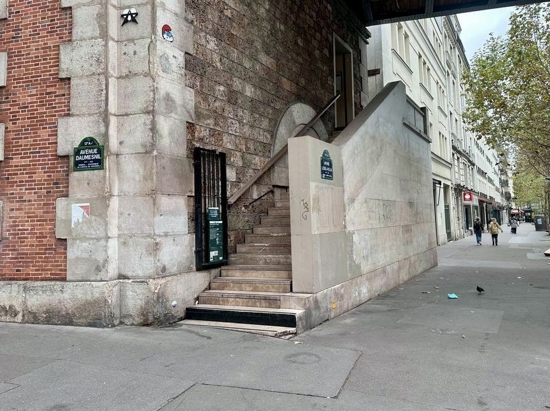
This PromenadePlantée is built on the former tracks of the Vincennes railway line, which, beginning in 1859, linked the Gare de la Bastille train station to Verneuil-l'Étang, after passing through Vincennes. It ceased operation on December 14, 1969; part of the line beyond Vincennes was integrated into Line A of the RER, while the Paris-Vincennes section was completely abandoned.Photographed by Andrew Ruppenstein, September 10, 20242. Coulée Verte René-Dumont 1987-2000 Marker - wide viewThe marker is visible here at the entrance to the steps leading up to the Coulée Verte (or as Google Maps calls it, the Paris Highline). There are identical makers at other access points.
Paris' promenade was the first project in the world to repurpose elevated old railway lines into urban gardens.…
Photographed by Andrew Ruppenstein, September 10, 2024
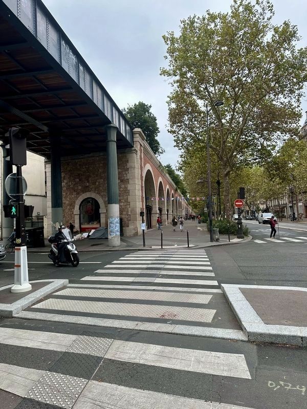
3. View of the Coulée Verte René-Dumont from below
Photographed by Andrew Ruppenstein, September 10, 2024
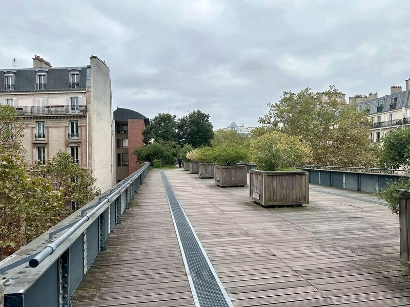
4. View of the elevated path on the Coulée Verte René-Dumont
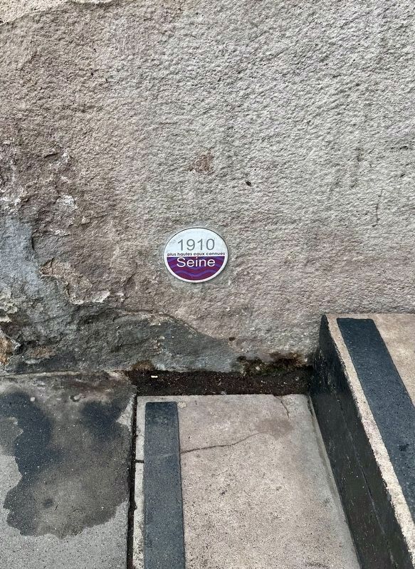
Photographed by Andrew Ruppenstein, September 10, 2024
5. Seine River Flood plaquette
Of minor interest, perhaps, but still worth noting - at the foot of the Coulée Vert marker is a plaquette indicating the high water mark of the Seine River in 1910.
Credits. This page was last revised on December 26, 2024. It was originally submitted on December 26, 2024, by Andrew Ruppenstein of Lamorinda, California. This page has been viewed 183 times since then and 15 times this year. Photos: 1, 2, 3, 4, 5. submitted on December 26, 2024, by Andrew Ruppenstein of Lamorinda, California.
