Burlington in Halton Region, Ontario — Central Canada (North America)
Brant Street Pier
Then and Now
Photographed by Tim Boyd, September 21, 2023
1. Brant Street Pier Marker
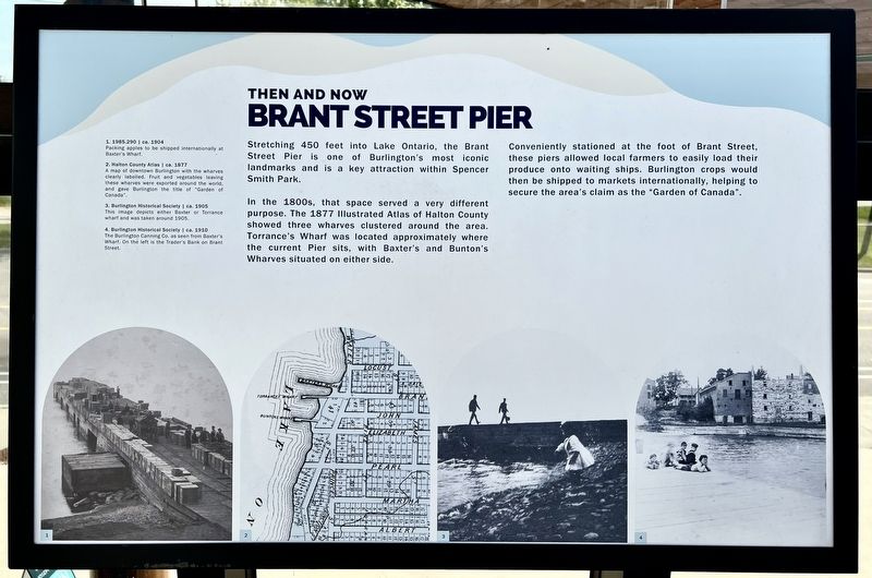
Stretching 450 feet into Lake Ontario, the Brant Street Pier is one of Burlington's most iconic landmarks and is a key attraction within Spencer Smith Park.
In the 1800s, that space served a very different purpose. The 1877 Illustrated Atlas of Halton County showed three wharves clustered around the area. Torrance's Wharf was located approximately where the current Pier sits, with Baxter's and Bunton's Wharves situated on either side.
Conveniently stationed at the foot of Brant Street, these piers allowed local farmers to easily load their produce onto waiting ships. Burlington crops would then be shipped to markets internationally, helping to secure the area's claim as the "Garden of Canada".
Topics. This historical marker is listed in these topic lists: Industry & Commerce • Parks & Recreational Areas • Waterways & Vessels. A significant historical year for this entry is 1877.
Location. 43° 19.115′ N, 79° 48.094′ W. Marker is in Burlington, Ontario, in Halton Region. It is on Lake Shore Road 0.1 kilometers North Shore Boulevard East, on the right when traveling south. The marker is on the upper level outdoor
this page online

Regionally, this marker is in Greater Toronto, specifically on the Golden Horseshoe, in the Hamilton-Halton-Brant Area, and specifically in the Toronto Metropolitan Area. It is also in Central Canada. Globally, it is in North America, on the Great Lakes, in the Western Hemisphere, in the Western World, and in the Anglosphere. Historically, it finds itself in what was once a British colony, the Viceroyalty of New France, the Haudenosaunee (Iroquois) Confederacy, and Rupert’s Land.
Other nearby markers. At least 8 other markers are within walking distance of this marker: Beach Strip (here, next to this marker); Joseph Brant Hospital (a few steps from this marker); The Brant House (a few steps from this marker); The Brant Inn (about 120 meters away, measured in a direct line); Victory at Burlington Bay (about 120 meters away); Terry Fox Marathon of Hope (about 120 meters away); a different marker also named The Brant Inn (about 120 meters away);

Photographed by Tim Boyd, September 21, 2023
2. Brant Street Pier Marker
Photographed by Tim Boyd, September 21, 2023
3. Joseph Brant Museum and House
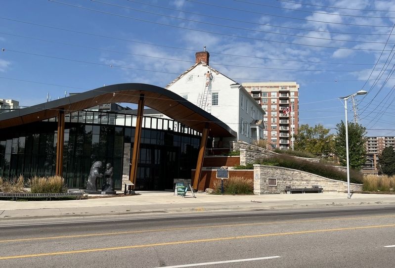
Marker is visible in approximately the centre of the photo

Photographed by Tim Boyd, March 24, 2024
4. Current Brant Street Pier, 2024
Credits. This page was last revised on December 28, 2024. It was originally submitted on December 28, 2024, by Tim Boyd of Hamilton, Ontario. This page has been viewed 223 times since then and 30 times this year. Photos: 1, 2, 3, 4. submitted on December 28, 2024, by Tim Boyd of Hamilton, Ontario. • Andrew Ruppenstein was the editor who published this page.
