Stillwater in Sussex County, New Jersey — The American Northeast (Mid-Atlantic)
Casper Shafer
(1712 - 1784)
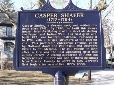
Photographed by Cheryl (Rome) Thom, February 4, 2010
1. Casper Shafer Marker
Erected 2004 by Sussex County Board of Chosen Freeholders and Sussex County Historic Marker Committee.
Topics and series. This historical marker is listed in these topic lists: Colonial Era • Government & Politics • Industry & Commerce • Settlements & Settlers • War, French and Indian. In addition, it is included in the New Jersey, Sussex County Board of Chosen Freeholders series list. A significant historical year for this entry is 1742.
Location. 41° 2.035′ N, 74° 52.503′ W.
this page online

Regionally, this marker is in North Jersey and in the New York City Metropolitan Area. It is also in the American Northeast and in the Mid-Atlantic. Globally, it is in North America, the Western Hemisphere, the Western World, and the Anglosphere. Historically, it finds itself in what was once New Netherland and also one of the original Thirteen Colonies.
Other nearby markers. At least 8 other markers are within 6 miles of this marker, measured as the crow flies: Yellow Frame Presbyterian Church (approx. 2.8 miles away); Fredon (approx. 3.1 miles away); Dark Moon Archaeological Site (approx. 4 miles away); Logg Gaol (approx. 4.8 miles away); Johnsonburg (approx. 5 miles away); Greendell Station (approx. 5 miles away); First Presbyterian Church of Blairstown (approx. 5.6 miles away); Simeon Cooke Residence (approx. 5.6 miles away).
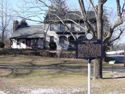
Photographed by Cheryl (Rome) Thom, February 4, 2010
2. Casper Shafer Marker
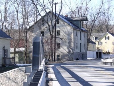
Photographed by Cheryl (Rome) Thom, February 4, 2010
3. Casper Shafer Grist Mill building.
Credits. This page was last revised on June 16, 2016. It was originally submitted on January 14, 2010, by Cheryl (Rome) Thom of Newton, New Jersey. This page has been viewed 1,806 times since then and 53 times this year. Photos: 1, 2, 3. submitted on February 4, 2010, by Cheryl (Rome) Thom of Newton, New Jersey. • Kevin W. was the editor who published this page.
