Near Dacula in Gwinnett County, Georgia — The American South (South Atlantic)
Fort Daniel
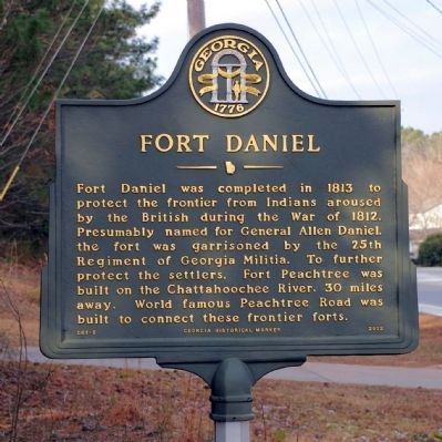
Photographed by David Seibert, January 12, 2010
1. Fort Daniel Marker
Erected 2002 by Georgia Department of Natural Resources. (Marker Number 067-5.)
Topics and series. This historical marker is listed in these topic lists: Forts and Castles • Roads & Vehicles • War of 1812 • Wars, US Indian. In addition, it is included in the Georgia Historical Society series list. A significant historical year for this entry is 1813.
Location. 34° 2.901′ N, 83° 56.044′ W. Marker is near Dacula, Georgia, in Gwinnett County. It is at the intersection of Braselton Highway (Georgia Route 124) and Dennis Drive, on the right when traveling north on Braselton Highway. Touch for map. Marker is in this post office area: Buford GA 30519, United States of America. Touch for directions.

Regionally, this marker
this page online
Other nearby markers. At least 8 other markers are within 3 miles of this marker, measured as the crow flies: A different marker also named Fort Daniel (about 600 feet away, measured in a direct line); Hog Mountain Baptist Church (approx. 0.6 miles away); The Elisha Winn House (approx. 2.2 miles away); a different marker also named The Elisha Winn House (approx. 2.2 miles away); a different marker also named The Elisha Winn House (approx. 2.2 miles away); a different marker also named The Elisha Winn House (approx. 2.3 miles away); a different marker also named Elisha Winn House (approx. 2.3 miles away); a different marker also named The Elisha Winn House (approx. 2.3 miles away). Touch for a list and map of
Photographed by David Seibert, January 12, 2010
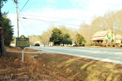
2. Fort Daniel Marker
Looking west on Braselton Highway (Georgia Highway 124)
More about this marker. This marker replaced an earlier marker of the same title and similar text on this location erected by the Georgia Historical Commission. A marker erected by the W.P.A in the 1930s also stood here until recently.
Photographed by David Seibert, January 12, 2010
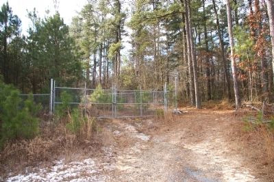
3. Fort Daniel
Site of Fort Daniel and the archaeological excavations
Credits. This page was last revised on June 29, 2024. It was originally submitted on January 15, 2010, by David Seibert of Sandy Springs, Georgia. This page has been viewed 2,443 times since then and 56 times this year. Photos: 1, 2, 3. submitted on January 15, 2010, by David Seibert of Sandy Springs, Georgia. • Craig Swain was the editor who published this page.
