Galewood in Chicago in Cook County, Illinois — The American Midwest (Great Lakes)
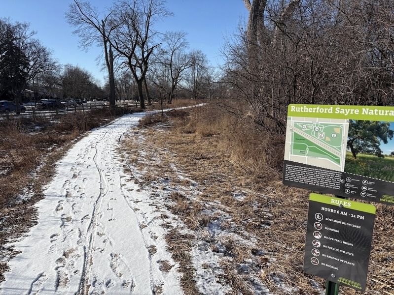
Rutherford Sayre Natural Area
Chicago Park District Natural Areas

Photographed by Sean P. Flynn, January 23, 2025
1. Rutherford Sayre Natural Area Marker
Topics. This historical marker is listed in these topic lists: Animals • Environment • Horticulture & Forestry • Parks & Recreational Areas. A significant historical year for this entry is 2019.
Location. 41° 55.158′ N, 87° 47.715′ W. Marker is in Chicago, Illinois, in Cook County. It is in Galewood. It is on Oak Park Avenue north of Shakespeare Avenue, on the right when traveling south. The marker is near the east entrance to the natural area. Touch for map. Marker is in this post office area: Elmwood Park IL 60707, United States
this page online

Regionally, this marker is on Chicago’s West Side. It is also in the American Midwest. Globally, it is in North America, on the Great Lakes, in the Western Hemisphere, in the Western World, and in the Anglosphere. Historically, it finds itself in what was once the Viceroyalty of New France, the territory of the Mississippian Culture, and the Northwest Territory.
Other nearby markers. At least 8 other markers are within walking distance of this marker: Native Plants Reduce Flooding (about 600 feet away, measured in a direct line); Rutherford Sayre Nature Garden and Natural Area (about 600 feet away); Habitat Types (about 600 feet away); Montclare World War I Honor Roll (approx. 0.2 miles away); A Historical Vision Realized (approx. 0.2 miles away); a different marker also named Rutherford Sayre Natural Area (approx. 0.2 miles away); The Miracle House (approx. 0.4 miles away); Jacob A. Riis (approx. 0.7 miles away). Touch for a list and map of all markers in Chicago.
More about this marker. An identical sign can be found at the west entrance to the pathway, near Newland Avenue.
Regarding Rutherford Sayre Natural Area. This
Photographed by Sean P. Flynn, January 23, 2025
2. Rutherford Sayre Natural Area Marker
Rutherford Sayre Park straddles the Chicago, Milwaukee and St. Paul Railroad tracks that run northwest from downtown Chicago. It is named after two families, the Rutherfords and Sayres, farming families who donated the land for this park. The northern portion of the park includes playing fields and a fieldhouse.
Also see . . . Chicago Park District: Rutherford Sayre Park Natural Area. (Submitted on January 23, 2025, by Sean P. Flynn of Oak Park, Illinois.)

Photographed by Sean P. Flynn, January 23, 2025
3. Rutherford Sayre Natural Area Marker
The old Chicago, Milwaukee and St. Paul railroad line, known historically as the "Milwaukee Road," cuts through Rutherford Sayre Park.

Photographed by Sean P. Flynn, January 23, 2025
4. Rutherford Sayre Natural Area Marker
The Mars Candy Factory is across Oak Park Avenue from the park. Mars Wrigley departed the Chicago Landmark structure in 2024.
Credits. This page was last revised on January 23, 2025. It was originally submitted on January 23, 2025, by Sean P. Flynn of Oak Park, Illinois. This page has been viewed 104 times since then and 22 times this year. Photos: 1, 2, 3, 4. submitted on January 23, 2025, by Sean P. Flynn of Oak Park, Illinois.
