
Gravesend in Brooklyn in Kings County, New York — The American Northeast (Mid-Atlantic)
Ketchum Triangle
.057 acre
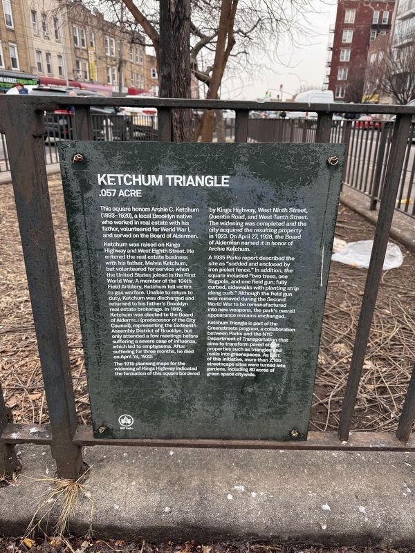
This square honors Archie C. Ketchum (1893-1920), a local Brooklyn native who worked in real estate with his father, volunteered for World War I, and served on the Board of Aldermen.
Ketchum was raised on Kings Highway and West Eighth Street. He entered the real estate business with his father, Melvin Ketchum but volunteered for service when the United States joined in the First World War. A member of the 104th Field Artillery, Ketchum fell victim to gas warfare. Unable to return to duty, Ketchum was discharged and returned to his father's Brooklyn real estate brokerage. In 1919, Ketchum was elected to the Board of Aldermen (predecessor of the City Council), representing the Sixteenth Assembly District of Brooklyn, but only attended a few meetings before suffering a severe case of influenza, which led to emphysema. After suffering for three months, he died on April 18, 1920.
The 1915 planning maps for the widening of Kings Highway indicated the formation of this square bordered by Kings Highway, West Ninth Street, Quentin Road, and West Tenth Street. The widening was completed and the City acquired the resulting
this page online
A 1935 Parks report described the site as "sodded and enclosed by iron picket fence." In addition, the square included "two trees, one flagpole, and one field gun; fully curbed, sidewalks with planting strip along curb." Although the field gun was removed during the Second World War to be remanufactured into new weapons, the park's overall appearance remains unchanged.
Ketchum Triangle is part of the Greenstreets program, a collaboration between Parks and the NYC Department of Transportation that aims to transform paved street properties such as triangles and malls into greenspaces. As part of this initiative, more than 2,100 Streetscape sites were turned into gardens, including 80 acres of green space citywide.
Erected by NYC Parks.
Topics and series. This historical marker is listed in these topic lists: Government & Politics • Parks & Recreational Areas • Roads & Vehicles • War, World I. In addition, it is included in the NYC Parks series list. A significant historical date for this entry is April 18, 1920.
Location. 40° 36.331′ N, 73° 58.933′ W.
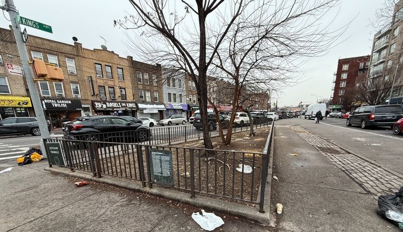

Regionally, this marker is in New York City and on Long Island. It is also in the American Northeast, in the Mid-Atlantic, and on the Eastern Seaboard. Globally, it is in the North Atlantic Region, North America, the Western Hemisphere, the Western World, and the Anglosphere. Historically, it finds itself in what was once New Netherland and also one of the original Thirteen Colonies.
Other nearby markers. At least 8 other markers are within walking distance of this marker: Seth Low Playground (approx. 0.3 miles away); a different marker also named Seth Low Playground (approx. 0.3 miles away); McDonald Playground (approx. 0.6 miles away); PO Jeff Herman Ballfield (approx. 0.6 miles away); Meucci Triangle (approx. 0.7 miles away); Gravesend Veterans Memorial (approx. ¾ mile away); Gravesend (approx. ¾ mile away); Lady Moody Square (approx. ¾ mile away). Touch for a list and map of all markers in Brooklyn.
Credits. This page was last revised on January 23, 2025. It was originally submitted on January 23, 2025, by Devry Becker Jones of Washington, District of Columbia. This page has been viewed 129 times since then and 22 times this year. Photos: 1, 2. submitted on January 23, 2025, by Devry Becker Jones of Washington, District of Columbia.
