Near Zonnebeke in West-Vlaanderen, Flanders, Belgium — Northwestern Europe
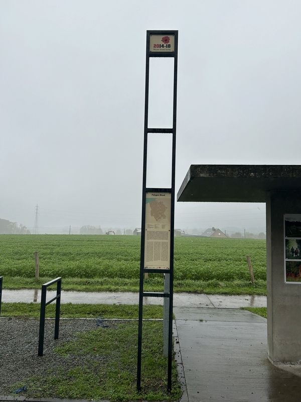
Polygon Wood
2014-18
| — | 100 jaar Groot Oorlog | — |
Photographed by Steve Stoessel, November 14, 2024
1. Polygon Wood Marker
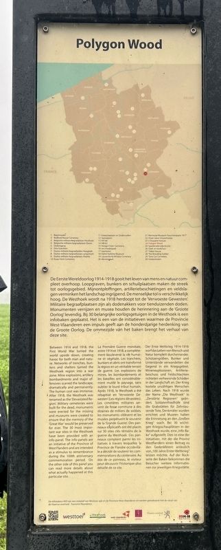
De Eerste Wereldoorlog 1914-1918 gooit het leven van mens en natuur compleet overhoop. Loopgraven, bunkers en schuilplaatsen maken de streek tot oorlogsgebied. Mijnontploffingen, artilleriebeschietingen en veldslagen verminken het landschap ingrijpend. De menselijke tol is verschrikkelijk hoog. De Westhoek wordt na 1918 herdoopt tot de Verwoeste Gewesten. Militaire begraafplaatsen zijn als dodenakkers voor tienduizenden doden. Monumenten verrijzen en musea houden de herinnering aan de 'Groote Oorlog' levendig. Bij 30 belangrijke oorlogsgetuigen in de Westhoek is een infobaken geplaatst. Het is een van de initiatieven waarmee de Provincie West-Vlaanderen een impuls geeft aan de honderdjarige herdenking van de Groote Oorlog. De ommezijde van het baken brengt het verhaal van deze site.
Between 1914 and 1918, the First World War turned the world upside down, creating havoc for both man and nature. Networks of trenches, bunkers and shelters turned the Westhoek region into a war zone. Mine explosions, artillery bombardments and major offensives scarred the landscape, dramatically and permanently. The human cost was immense. After 1918, the Westhoek was renamed as the 'Devastated Region. Military cemeteries were built for the dead, monuments were erected for the missing and museums were created to ensure that the memory of the 'Great War' would be preserved for ever. The 30 most important war sites in the Westhoek have been provided with an info-panel. The info-panels are an initiative of the Province of West Flanders and are intended as a stimulus to remembrance during the 100th anniversary commemoration period. On the other side of this panel you can read more details about what actually happened at this particular site.
La Première Guerre mondiale, entre 1914 et 1918, a complètement bouleversé la vie humaine
this page online
Der Erste Weltkrieg 1914-1918 warf das Leben von Mensch und Natur komplett durcheinander. Schützengräben, Bunker und Unterstände verwandelten die Gegend in ein Kriegsgebiet. Minenexplosionen, Artilleriebeschuss und Feldschlachten richteten verheerende Schäden in der Landschaft an. Der Krieg kostete unzähligen
Photographed by Steve Stoessel, November 14, 2024
2. Polygon Wood Marker
De infobakens WOl zijn een Initiatief van Westtoer apb en de Provincie West-Vlaanderen en werden gerealiseerd met de steun van de Vlaamse overheid - Toerisme Vlaanderen.
The WOl information panels are an initiative of Westtoer apb and the Province of West Flanders and were realized with the support of the Viaam government - Tourism Flanders.
[Side 2]
Polygon Wood
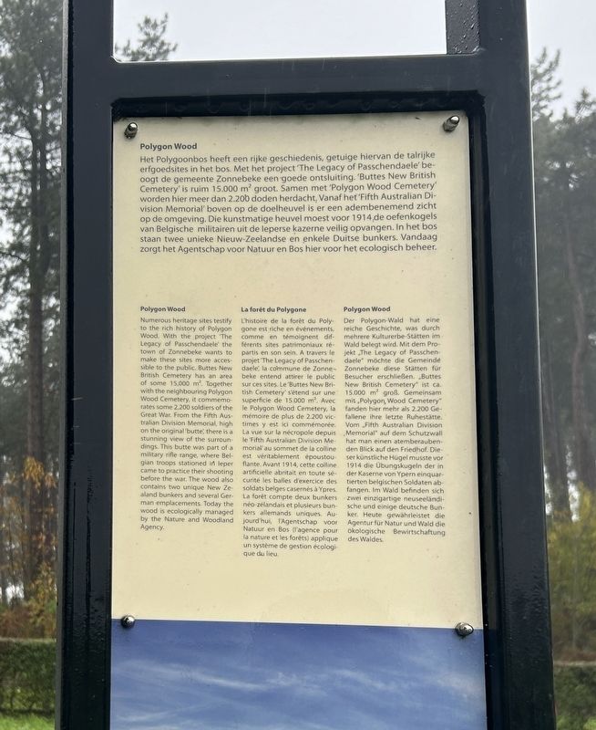
Het Polygoonbos heeft een rijke geschiedenis, getuige hiervan de talrijke erfgoedsites in het bos. Met het project 'The Legacy of Passchendaele' beoogt de gemeente Zonnebeke een
Photographed by Steve Stoessel, November 14, 2024
3. Polygon Wood Marker
Polygon Wood
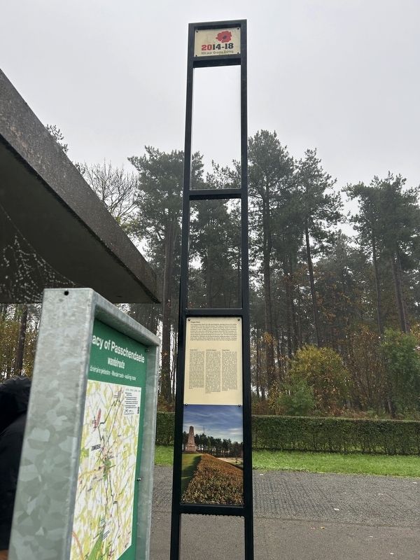
Numerous heritage sites testify to the rich history of Polygon Wood. With the project The Legacy of Passchendaele the town of Zonnebeke wants to make these sites more accessible to the public. Buttes New British Cemetery has an area of some 15,000 m2. Together with the neighboring Polygon Wood Cemetery, it commemorates some 2,200 soldiers of the Great War. From the Fifth Australian Division Memorial, high on the original “butte”, there is a stunning view of the surroundings. This butte was part of a military rifle range, where Belgian troops stationed in Ieper came to practice their shooting
Photographed by Steve Stoessel, November 14, 2024
4. Polygon Wood Marker
La forêt du Polygone
L'histoire de la forêt du Polygone est riche en événements, comme en témoignent différents sites patrimoniaux répartis en son sein. A travers le projet The « Legacy of Passchendaele », la commune de Zonnebeke entend attirer le public sur ces sites. Le « Buttes New British Cemetery » s'étend sur une superficie de 15.000 m2. Avec le Polygon Wood Cemetery, la mémoire de plus de 2.200 victimes y est ici commémorée. La vue sur la nécropole depuis le « Fifth Australian Division Memorial » au sommet de la colline est véritablement époustouflante. Avant 1914, cette colline artificielle abritait en toute sécurité les balles d'exercice des soldats belges casernés à Ypres. La forêt compte deux bunkers néo-zélandais et plusieurs bunkers allemands uniques. Aujourd'hui, l'Agentschap voor Natuur en Bos (l'agence pour la nature et les forêts) applique un système de gestion écologique du lieu.
Polygon Wood
Der Polygon-Wald hat eine reiche Geschichte,
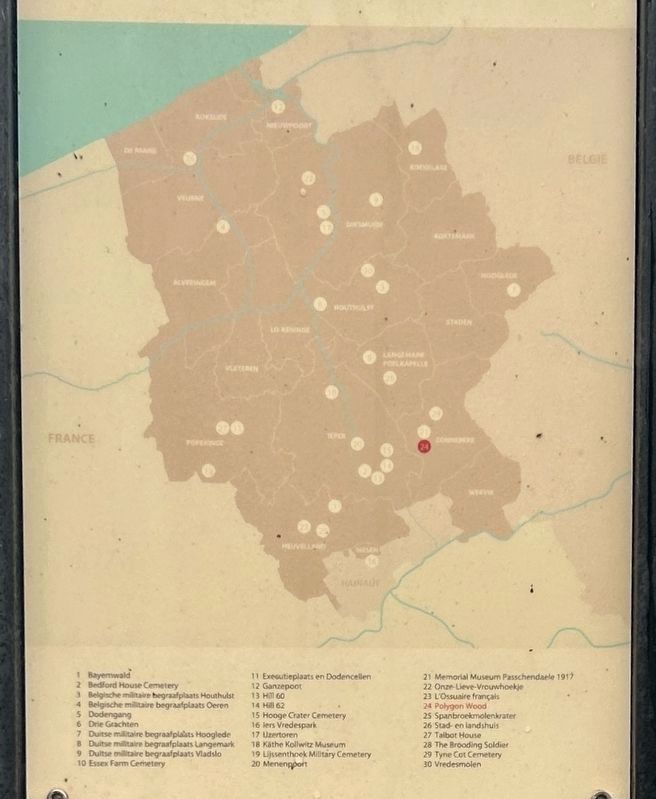
Photographed by Steve Stoessel, November 14, 2024
5. 30 Most Important WW1 Sites in Belgium
Erected by Province of West Flanders.
Topics. This memorial is listed in these topic lists: Cemeteries & Burial Sites • Parks & Recreational Areas • War, World I. A significant historical year for this entry is 1918.
Location. 50° 51.467′ N, 2° 59.596′ E. Memorial is near Zonnebeke, Vlaanderen (Flanders), in West-Vlaanderen. It is at the intersection of Lange Dreve and Splitstraat, on the right when traveling west on Lange Dreve. Marker is in the parking area / bus stop. Touch for map. Memorial is at or near this postal address: Lange Dreve 1, Zonnebeke, Vlaanderen 8980, Belgium. Touch for directions.

Regionally, it is in Europe, the European Union, Atlantic Europe, the Benelux Low Countries, the Schengen Area, Western Europe, and the Western World. Historically, it finds itself in what was once the Roman Empire and specifically also the Holy Roman Empire.
Other nearby markers. At least 8 other markers are within walking distance of this marker: A different marker also named Polygon Wood (here, next to this marker); Australische Silhouet (about 120 meters away, measured in a direct line); Fifth Australian Division Monument (about 210 meters away); Buttes New British Cemetery (approx. 0.3 kilometers away); New Zealand Bunkers (approx. half a kilometer away); Scott Post (approx. 0.6 kilometers away); a different marker also named Polygon Wood (approx. 0.6 kilometers away); Polygons Ruiterpad (approx. 1.1 kilometers away). Touch for a list and map of all markers in Zonnebeke.
Credits. This page was last revised on January 31, 2025. It was originally submitted on January 30, 2025, by Steve Stoessel of Niskayuna, New York. This page has been viewed 96 times since then and 10 times this year. Photos: 1, 2, 3, 4, 5. submitted on January 30, 2025, by Steve Stoessel of Niskayuna, New York.
