Ripa in Roma in Città metropolitana di Roma Capitale, Latium, Rome, Italy — Central Italy (Tyrrhenian Coast)
L'Acqua Mariana
⎯⎯⎯
The Mariana Water
Photographed by James Hulse, February 27, 2024
1. L'Acqua Mariana / The Mariana Water Marker

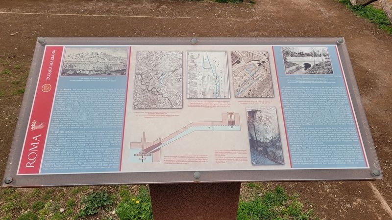
La Storia. Nel corso del XII secolo la città fu dotata di un nuovo acquedotto in gran parte a cielo aperto, chiamato Acqua Mariana o Ponte sull'acqua Mariana nei pressi di S. Maria in Tempulo. Il fiume rimase a cielo aperto fino al primo '900. (Archivio Fotografico Sovrintendenza Capitolina) Marana o Marrana. Il nome deriva probabilmente dal luogo presso cui nasceva - l'ager o fundus Maranus alle pendici dei colli albani. Si tratta del primo vero acquedotto medievale di Roma, talmente noto che in seguito il termine "marrana" nel linguaggio popolare è passato ad indicare tutti i fossi della campagna romana. La paternità dell'opera è attribuita al breve pontificato di Callisto II (1119-1124) egli "derivò le acque per antiche condutture e lo condusse fino a Porta Asinaria; e li fece approntare un lago per far abbeverare i cavalli e lungo lo stesso costrui anche molte piccole mole".
Il Percorso. L'intervento papale era destinato a risolvere le problematiche idriche del Laterano, anche in vista del Concilio del 1123. Da qui il corso d'acqua proseguiva costeggiando le mura Aureliane, vi entrava a Porta Metronia,
this page online
Il Sistema Idraulico. Dietro le colonne dell'arco si vedono i due condotti affiancati, ed il fondo pavimentato con scaglie di marmo, lava e materiali antichi di recupero. Le acque venivano in parte convogliate verso la valle ed in parte gestite attraverso un sistema di chiuse e cisterne ricavate in alcuni ambienti del circo in disuso. In questo modo si potevano irrigare gli orti, che occupavano buona parte della pista romana, ormai coperta dal terreno, senza togliere forza motrice al mulino che si trovava presso la Torre Frangipane, conosciuta anche come Torre della Moletta.
Le Piante. A partire dal XV secolo il fosso della Mariana compare
Photographed by James Hulse, February 27, 2024
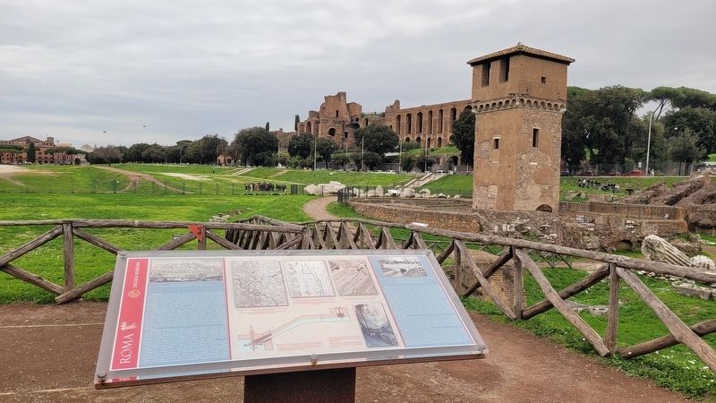
2. L'Acqua Mariana / The Mariana Water Marker
Didascalie
(Foto #1) La valle del circo nel XVI secolo (E. Dupérac)
(Foto #2) La Marrana fiume fuori le Mura Aureliane nella Mappa della Campagna Romana di Eufrosino della Volpala, 1547
(Foto #3) Gli orti del Circo Massimo con le divisioni di proprietà e le destinazioni agricole nella pianta di T. Maffei 1648 (Archivio di Stato di Roma)
(Foto #4) L'emiciclo nella pianta di Roma di Roma di G.B. Nolli (1748)
(Foto #5) Sezione ricostruttiva di una paratoia e del condotto di accelerazione per la mola a turbina (ritrecine) lungo il percorso dell'acqua Mariana
(Foto #6) Tracce delle scanalature verticali per lo scorrimento della paratoia realizzata sul fondo del muro di una taberna del circo per conservare e gestire l'acqua per l'irrigazione
(Foto #7) Ponte sull'acqua Mariana nei pressi di S. Maria in Tempulo. Il fiume rimase a cielo aperto fino al primo '900. (Archivio Fotografico Sovrintendenza Capitolina)
History.
Photographed by James Hulse, February 27, 2024
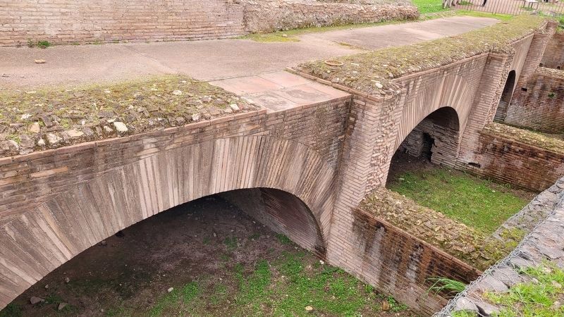
3. Covered Arches located near the marker
The Route. The aqueduct was built by the pope to solve the problem of the Lateran Palace's water supply, especially in view of the upcoming First Lateran Council in 1123. The channel proceeded to run along the Aurelian Walls, enter the city at the Metronia Gate and run downhill behind the church of San Sisto Vecchio, through the monastery's old garden, where there were two mills (the Mola di Sopra and the Mola di Sotto). After passing another monastery, Santa Maria in Tempulo, the watercourse reached the Circus Maximus and flowed under the main arch of the Arch of Titus, following the same route as earlier post-Roman aqueducts. Once it had crossed the entire Valle Murcia from end to end, it fed the last three mills at Santa Maria in Cosmedin and emptied into the Tibur near the Cloaca Maxima.
The Hydraulics. Behind the columns of the Arch of Titus two conduits are visible side by side, along with the remains of a floor paved with slabs of marble, lava and other spolia materials. The waters were partly directed towards the valley and partly managed via a system of locks and wells built in parts of the circus no longer in use. This allowed for the irrigation of the gardens that covered much of the original race track at this time, now buried, without diminishing the water-power of the mill situated near the Frangipane Tower, also known as the Torre della Moletta.
The Maps. Starting in the 15th century, the acqua Mariana irrigation channel appeared in most of the maps and views of Rome. In the 18th century, for the length of the channel, roughly 25 km, thirteen mills of different kinds and sizes are recorded, used by numerous factories. The presence of this channel and the access to its waters would determine the use of the valley for centuries to come: factories and workshops would continue to be built there, until the entire valley was turned into an industrial area. With the advent of electrical power in 1909, the Mariana aqueduct would no longer be used to produce energy and would be used for irrigation purposes only, then diverted and partially covered over.
Captions
(Photo #1) The valley occupied by the Circus Maximus in the 16th century (E. Dupérac)
(Photo #2) The Marrana stream outside the Aurelian walls in the map of the Roman Campagna by Eufrosino della Volpaia, 1547
(Photo #3) The fruit and vegetable gardens in the Circus Maximus, with property lines and agricultural land use in the map by T. Maffei, 1648 (Photo Archivio di Stato di Roma).
(Photo #4) The hemicycle in the 18th century (by G.B. Nolli 1748)
(Photo #5) A reconstruction of a cross-section of a sluice gate and the sloping conduit for the turbine (waterwheel) equipped water mill along the course of the acqua Mariana aqueduct.
(Photo #6) Traces of the vertical grooves where the sluice-gate was fitted into an opening in a wall of the circus, at the back of a taberna, to store and manage irrigation water
(Photo #7) A bridge over the acqua Mariana aqueduct in the vicinity of Santa Maria in Tempulo. The stream was not paved over until the early 1900s. (Photo Archives of the Superintendency of Cultural Heritage for the City of Rome)
Erected by Rome.
Topics. This historical marker is listed in these topic lists: Anthropology & Archaeology • Waterways & Vessels.
Location. 41° 53.058′ N, 12° 29.299′ E. Marker is in Roma, Lazio (Latium, Rome), in Città metropolitana di Roma Capitale. It is in Ripa. It is at the intersection of Viale Aventino and Via del Circo Massimo on Viale Aventino. The marker is located on the south end of the Circus Maximus Archaeological Site. Touch for map. Marker is in this post office area: Roma, Lazio 00186, Italy. Touch for directions.

Regionally, it is in Europe, the European Union, the Schengen Area, a coastal Mediterranean country, and the Western World. Historically, it finds itself in what was once the Roman Empire.
Other nearby markers. At least 8 other markers are within walking distance of this marker: La Struttura / The Circus Structure (here, next to this marker); L'Arco di Tito / The Arch of Titus (within shouting distance of this marker); La Torre della Moletta / The Moletta Tower (within shouting distance of this marker); Il Mulino e le Macine / The Mill and the Millstones (within shouting distance of this marker); Il Circo Massimo / The Circus Maximus (within shouting distance of this marker); L'Emiciclo / The Hemicycle (within shouting distance of this marker); Frammenti Dell'Arco di Tito / Fragments From the Arch of Titus (within shouting distance of this marker); I Giochi nel Circo / The Games Held in the Circus Maximus (within shouting distance of this marker). Touch for a list and map of all markers in Roma.
More about this marker. There is a small entry fee to visit the Circus Maximus Archaeological Site.
Also see . . . Circus Maximus. Wikipedia
The Circus Maximus (Latin for "largest circus"; Italian: Circo Massimo) is an ancient Roman chariot-racing stadium and mass entertainment venue in Rome, Italy. In the valley between the Aventine and Palatine hills, it was the first and largest stadium in ancient Rome and its later Empire. It measured 621 m (2,037 ft) in length and 118 m (387 ft) in width and could accommodate over 150,000 spectators. In its fully developed form, it became the model for circuses throughout the Roman Empire.(Submitted on February 4, 2025, by James Hulse of Medina, Texas.)
Credits. This page was last revised on February 5, 2025. It was originally submitted on February 3, 2025, by James Hulse of Medina, Texas. This page has been viewed 150 times since then and 33 times this year. Photos: 1, 2, 3. submitted on February 4, 2025, by James Hulse of Medina, Texas.
