Branford in South Central Region, Connecticut — The American Northeast (New England)
Outer Island
World of Wonder and Beauty
Photographed by Conrad Ward, August 12, 2024
1. Outer Island Marker
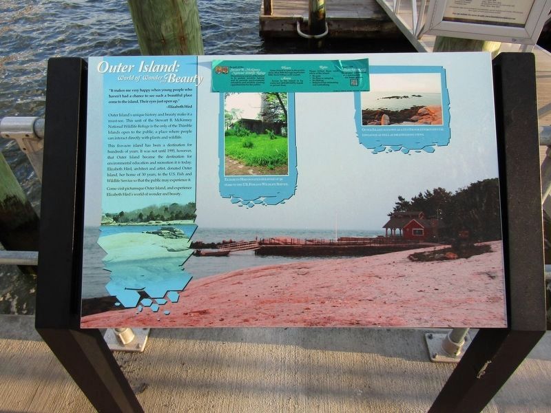
"Be very happy when young people who haven't had a chance to see such a beautiful place come to the island. Their eyes just open up."
Outer Island's unique history and beauty make it a must-see. This unit of the Stewart B. McKinney National Wildlife Refuge is the only of the Thimble Islands open to the public, a place where people can directly interact with plants and wildlife.
This five-acre island has been a destination for hundreds of years. It was not until 1995, however, that Outer Island became the destination for environmental education and recreation it is today. Elizabeth Hird, architect and artist, donated Outer Island, her home of 30 years, to the U.S. Fish and Wildlife Service so that the public may experience it.
Come visit picturesque Outer Island, and experience Elizabeth Hird's world of wonder and beauty.
(Middle photo)
Elizabeth Hird donated her home of 30 years to the U.S. Fish and Wildlife Service.
(Right photo)
Outer Island is known as a center for environmental education as well as breathtaking views.
Topics. This historical marker is listed in these topic lists:
this page online
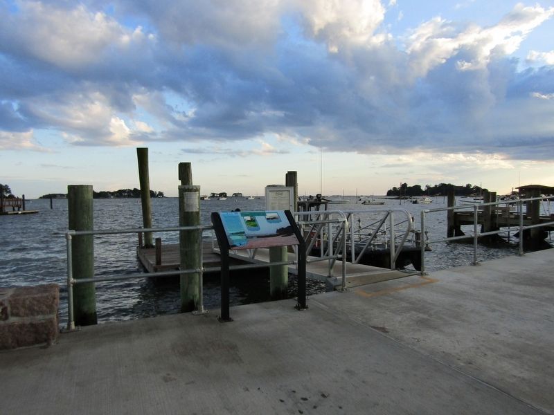
Location. 41° 15.848′ N, 72° 45.17′ W. Marker is in Branford in South Central Region, Connecticut. It is on Indian Point Road. The marker is located next to the Thimble Islands Ferry Co. dock. Touch for map. Marker is in this post office area: Branford CT 06405, United States of America. Touch for directions.

Regionally, this marker is in the Connecticut River Valley, on the Connecticut Shoreline, and in Greater New Haven. It is also in the American Northeast, in New England, and on the Eastern Seaboard. Globally, it is in the North Atlantic Region, North America, the Western Hemisphere, the Western World, and the Anglosphere. Historically, it finds itself in what was once New Haven County and also one of the original Thirteen Colonies.
Other nearby markers. At least 8 other markers are within 3 miles of this marker, measured as the crow flies: Stony Creek: An Historic Village (here, next to this marker); Stony Creek World War I Memorial (approx. 0.3 miles away); Stony Creek Civil War & Persian Gulf Memorial
Photographed by Conrad Ward, August 12, 2024
2. Outer Island Marker
Credits. This page was last revised on May 19, 2026. It was originally submitted on February 1, 2025, by Conrad Ward of Guilford, Connecticut. This page has been viewed 167 times since then and 17 times this year. Last updated on February 4, 2025, by Conrad Ward of Guilford, Connecticut. Photos: 1, 2. submitted on February 1, 2025, by Conrad Ward of Guilford, Connecticut. • J. Makali Bruton was the editor who published this page.
