Ripa in Roma in Città metropolitana di Roma Capitale, Latium, Rome, Italy — Central Italy (Tyrrhenian Coast)
Il Mulino e le Macine
⎯⎯⎯
The Mill and the Millstones
Photographed by James Hulse, February 27, 2024
1. Il Mulino e le Macine / The Mill and the Millstones Marker

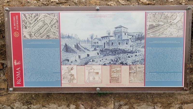
Il Mulino. Nel XIII secolo è documentata la presenza di un mulino localizzato ai piedi della Torre, appartenente nel 1217 a Jacopa de' Normanni de' Settesoli, terziaria francescana e moglie di Graziano Frangipane de' Settesoli, una pia donna famosa per aver ospitato nel suo Palazzo San Francesco d'Assisi. Allo stesso edificio fa ancora riferimento un documento del 1264 dove si apprende che tale Saracena Frangipane, vedova di Giovanni Frangipane, reclama i propri diritti di usufrutto su tutta la proprietà del fortilizio circense, compreso "il mulino posto ai piedi di detta Torre". Un secondo mulino, denominato Mola di S. Gregorio, è documentato nella medesima area alla fine del XIV secolo. La pianta di Roma di Mario Cartaro del 1576 restituisce l'immagine di una struttura in prossimità dell'emiciclo meridionale, dotata di una ruota dentata e posta lungo la Marrana. Interessante è anche la lettura della pianta di Roma di G.B. Falda del 1676, in cui si può osservare un canale d'acqua che attraversa la base della Torre per attivare, verosimilmente, una mola posta all'interno dell'edificio. Tale sistemazione
this page online
Le Macine. In un documento del 1266, si apprende che Saracena Frangipane è impegnata a vendere le macine del suo mulino, ormai in dismissione. Le mole erano considerate ingranaggi di grande valore all'interno della struttura produttiva, perché garantivano il corretto funzionamento dell'impianto e una molitura di qualità, quando sottoposte ad una costante manutenzione e ad un'adeguata martellatura della superficie. Non di rado, infatti, negli atti notarili si ricorreva a stimatori in grado di fissare l'esatto costo delle macine.
Didascalie
(Foto #1) La valle del Circo Massimo nel XVII sec. (F. De Paoli, post 1623)
(Foto #2) Le strutture molitorie intorno alla torre nel 1934 (A. Montrone, Sovrintendenza Capitolina)
(Foto #3) Particolare delle macine di un mulino, da una illustrazione dell'Encyclopédie del 1763
(Foto #4) Schema di mulino, da una illustrazione dell'Encyclopédie del 1763
(Foto #5) Schema di mulino, incisione del XVI secolo
(Foto #6) Il complesso intorno alla Torre alla fine del XVI sec. (M. Cartaro, 1576)
The Mill.

Photographed by James Hulse, February 27, 2024
2. Il Mulino e le Macine / The Mill and the Millstones Marker
The marker is located on the right side of the two markers.
Photographed by James Hulse, February 27, 2024
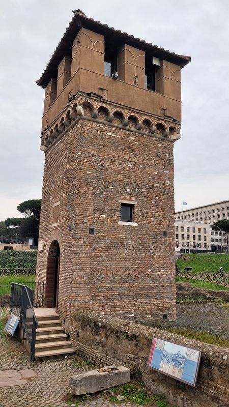
3. The Marker with the tower in the background
The Millstones. A document from 1266 reveals that Saracena Frangipane was attempting to sell the millstones from her mill, which had ceased operations. Millstones were considered to be highly valuable pieces of equipment, as they guaranteed the smooth functioning of the mill and produced a finely-ground flour. Hence they were perfectly maintained and their surfaces suitably dressed. Indeed, it was not uncommon for notarial deeds to include professional appraisals of the exact worth of the millstones.
Captions
(Photo #1) The valley occupied by the Circus Maximus in the 17th century (F. De Paoli, post-1623)
(Photo #2) Structures pertaining to the mill in 1934 (A. MontroneSuperintendency of Cultural Heritage for the City of Rome)
(Photo #3) Particular of the millstones, from a picture of the Encyclopédie, 1763
(Photo #4) The workings of the mill, from a picture of the Encyclopédie, 1763
(Photo #5) The workings of the mill in a 16th-century engraving
(Photo #6) The structures built around the Torre della Moletta in the late 16th century (M. Cartaro, 1576)
Erected by Rome.
Photographed by James Hulse, February 27, 2024
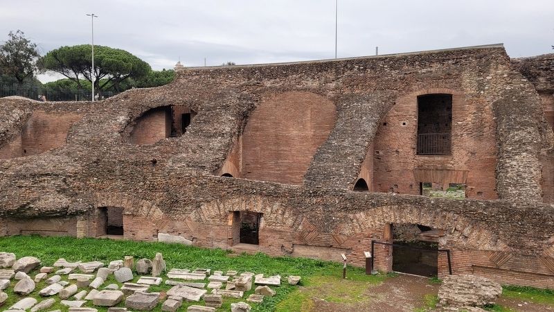
4. The view of the back side of the tower
Topics. This historical marker is listed in these topic lists: Agriculture • Anthropology & Archaeology. A significant historical year for this entry is 1217.
Location. 41° 53.085′ N, 12° 29.297′ E. Marker is in Roma, Lazio (Latium, Rome), in Città metropolitana di Roma Capitale. It is in Ripa. It is at the intersection of Viale Aventino and Via del Circo Massimo on Viale Aventino. The marker is located on the south end of the Circus Maximus Archaeological Site. Touch for map. Marker is in this post office area: Roma, Lazio 00186, Italy. Touch for directions.

Regionally, it is in Europe, the European Union, the Schengen Area, a coastal Mediterranean country, and the Western World. Historically, it finds itself in what was once the Roman Empire.
Other nearby markers. At least 8 other markers are within walking distance of this marker: La Torre della Moletta / The Moletta Tower (a few steps from this marker); Frammenti Dell'Arco di Tito / Fragments From the Arch of Titus (a few steps from this marker); L'Arco di Tito / The Arch of Titus (a few steps from this marker); Circo Massimo (within shouting distance of this marker); Le Latrine / The Latrines (within shouting distance of this marker); L'Emiciclo / The Hemicycle (within shouting distance of this marker); Il Fornice XII / Vaulted Chamber XII (within shouting distance of this marker); L'Età Moderna / The Modern Age (within shouting distance of this marker). Touch for a list and map of all markers in Roma.
More about this marker. There is a small entry fee to visit the Circus Maximus Archaeological Site.
Also see . . . Circus Maximus. Wikipedia
The Circus Maximus (Latin for "largest circus"; Italian: Circo Massimo) is an ancient Roman chariot-racing stadium and mass entertainment venue in Rome, Italy. In the valley between the Aventine and Palatine hills, it was the first and largest stadium in ancient Rome and its later Empire. It measured 621 m (2,037 ft) in length and 118 m (387 ft) in width and could accommodate over 150,000 spectators. In its fully developed form, it became the model for circuses throughout the Roman Empire.(Submitted on February 5, 2025, by James Hulse of Medina, Texas.)
Credits. This page was last revised on February 5, 2025. It was originally submitted on February 5, 2025, by James Hulse of Medina, Texas. This page has been viewed 92 times since then and 6 times this year. Photos: 1, 2, 3, 4. submitted on February 5, 2025, by James Hulse of Medina, Texas.
