Yorktown in York County, Virginia — The American South (Mid-Atlantic)
The Betsy
Photographed by J. Makali Bruton, October 23, 2016
1. The Betsy Marker
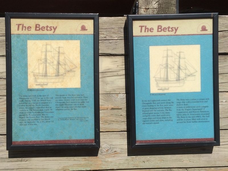
The marker is made up of two panels.
Panel 1:
The Betsy was built in the port of Whitehaven in 1772 for use in the coal trade. During 1780, the British Navy leased her as a transport assigned to a convoy bound for North America, where she joined Cornwallis’s fleet at Yorktown. The British sunk nearly 50 ships between Yorktown and Gloucester during the Revolutionary War to impede the French fleet. The Betsy, one of these, was scuttled by her British crew on September 16, 1781, about ½ mile east of this site.
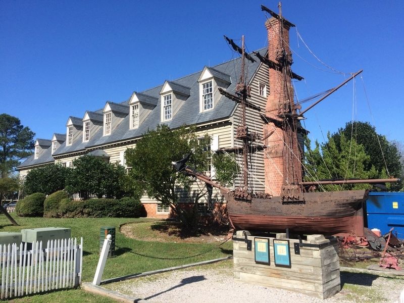
This model of The Betsy was built entirely from recycled materials. There are many creative ways to protect the Chesapeake Bay’s natural resources and this model illustrates one of these ways – re-using materials that might otherwise pollute the Bay
Constructed and donated to the Watermen’s Museum by Tim Rindfleisch, Biologist, York County, VA, May 16, 2001
Panel 2:
In the mid eighteenth century the Chesapeake bay, and ports along the rivers leading to the Bay, were areas of great shipping activity between England and the colonies. The Bay offered great access to the many navigable rivers that could carry cargo ships and
this page online
The Betsy was a collier, a unique style cargo ship with a rounded bow and shallow draft.
A team of underwater archaeologists from the Virginia Department of Conservation and Historic Resources, led by John D. Broadwater excavated The Betsy in the mid 1980’s. Her hull still lies in place, filled with sand to protect her from further deterioration.
Both photos of The Betsy carry captions of “©1995 John D. Broadwater”
Topics. This historical marker is listed in these topic lists: Colonial Era • Industry & Commerce • War, US Revolutionary. A significant historical date for this entry is May 16, 2001.
Location. Marker has been permanently removed. It was located near 37° 14.347′ N, 76° 30.623′ W. Marker was in Yorktown, Virginia, in York County. It was on Water Street, on the right when traveling west. The marker has been permanently removed and replaced with another marker titled “The Collier Betsy.” The marker and replica are on the grounds of the Watermen's Museum, to the right of the museum. The museum is on Water Street, to the right going west, just after
Photographed by J. Makali Bruton, October 23, 2016
2. The Betsy Marker
Note the replica of The Betsy made of recycled materials. The Watermen's Museum can be seen in the background.
We have been informed that this marker is no longer there and will not be replaced. This page is an archival view of what was.
Regionally, this marker was on Virginia’s Peninsula, in Coastal Virginia, and in the Hampton Roads Metropolitan Area. It was also in the American South, specifically in the Upper South, in the Tidewater, and on the Eastern Seaboard. Globally, it was in the North Atlantic Region, North America, the Western Hemisphere, the Western World, and the Anglosphere. Historically, it found itself in what was once the territory of the Mississippian Culture, one of the original Thirteen Colonies, one of the Confederate States of America, and the Antebellum South.

Other nearby markers. At least 8 other markers are within walking distance of this location: The Collier Betsy (here, next to this marker); Oysters and the Chesapeake Bay (a few steps from this marker); Virginia Chesapeake Bay Patent Tong Work Boats (within shouting distance of this marker); Pale Moon (within

Photographed by Brandon D Cross
3. The Collier Betsy Marker
Credits. This page was last revised on February 9, 2025. It was originally submitted on November 30, 2016, by J. Makali Bruton of Washington, District of Columbia. This page has been viewed 1,761 times since then and 160 times this year. Last updated on February 8, 2025, by Brandon D Cross of Flagler Beach, Florida. Photos: 1, 2. submitted on November 30, 2016, by J. Makali Bruton of Washington, District of Columbia. 3. submitted on February 8, 2025, by Brandon D Cross of Flagler Beach, Florida.
