Morrison in Jefferson County, Colorado — The American Mountains (Southwest)
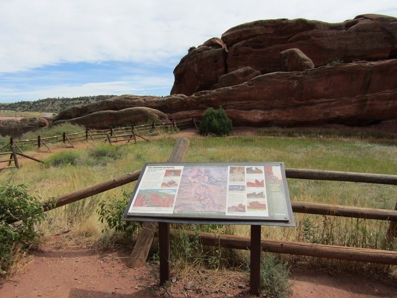
The Naming of Rocks

Photographed by Conrad Ward, August 25, 2024
1. The Naming of Rocks Panel
Through time and imagination, these rocks have been named, and often renamed
Red Rocks is full of "gateway" rocks and others that have been compared to ships, or named for their parks, caves, and other features. Cracks become crevices, then enlarge to grottos, caves, and labyrinths, inspiring fanciful names like Fat Man's Misery or Demon's Grotto.
Early in the 1900s, when J.B. Walker named his park Garden of the Titans, many of the features were named after those ancient Greek gods, including Rock of Cronus, Rock of Mnemosyne, Cave of Saturn, Spring of Rhea, and Rock of Tethys.
1) Lizard Head Rock: Its current name, Tunnel Rock, is purely descriptive. You drive through the tunnel as you approach the upper parking lot at the amphitheatre.
2) Seat of Pluto, the Toadstool: The postcard suggests early photo fakery for this small poised rock.
3) Ship Rock: on the south, once known as Rock of Coios (Coeus), with a Lover's Leap on the north edge.
4) Creation Rock: north of the amphitheatre, may be the oldest name applied to this highest rock; by 1901 it was called Mammoth King Rock. Called Rock of Cronus during Titan era, its High Cave was renamed Cave of Saturn.
5) Stage Rock:
this page online
6) Rock of Tethys: lies just east of Stage Rock; named for the Titan goddess of rivers, has no current name.
7) Ladder Cave Rock: Seven Ladders Rock, Rock of the Erinnyes. Named for the climbs constructed inside the rock a century ago (no longer there); many names were applied to the features inside as well, e.g. Jacob's Ladder, Toboggan Slide.
8) Nine Parks Rock, Rock of Mnemosyne: This enormous rock is riddled with nine openings called parks. The rock was once named for Mnemosyne, mother of the nine muses.
What is a park? A grassy open space within a large outcrop is often called a park. Nine Parks Rock has nine of these gardens. Can you spot miniature parks on the rocks nearby? These spots are where moisture collects, plants grow, and animals find islands of habitat among the barren rocks.
9) Picnic Rocks: Rock of Cronus, Promontory Rock, Forbidden Climb, Coves of the Melian Nymphs, Lover's Leap.
10) Gog and Magog: The pillar rocks across the valley were likely given this biblical name in the late 1800's, when the park was known as Garden of the Angels. View from the main trail looking north. Gog, known as Sphinx from the east, is also a smokestack on the rock often known as the Sinking Titanic.
11) Frog Rock is the large rock at the south end of the park.
12)
Photographed by Conrad Ward, August 25, 2024
2. The Naming of Rocks Panel
13) Sinking Titanic and Iceberg: April 1912, when the "unsinkable" ship went down, left an impression in the park.
14) Park Cave Rock: Also known as Crown Rock, this is the easternmost rock in the park.
Topics. This historical marker is listed in these topic lists: Environment • Parks & Recreational Areas.
Location. 39° 39.643′ N, 105° 12.204′ W. Marker is in Morrison, Colorado, in Jefferson County. It can be reached from Trading Post Trail. Located in Red Rocks Park on the Trading Post Trail. Touch for map. Marker is in this post office area: Golden CO 80401, United States of America. Touch for directions.

Regionally, this marker is in the Front Range. It is also in the American Mountain West. Globally, it is in North America, the Rocky Mountains, the Western Hemisphere, the Western World, and the Anglosphere. Historically, it finds itself in what was once the Louisiana Purchase.
Other nearby markers. At least 8 other markers are within 2 miles of this marker, measured as the crow flies: Red Rocks Park (approx. ¼ mile away); Red Rocks Trading Post (approx. ¼ mile away); Historic Incinerator: We've Come A Long Way (approx. ¼ mile away); Red Rocks Amphitheatre (approx. 0.4 miles away); Front Range Foothills (approx. 0.8 miles away); Cretaceous Time (approx. 1.2 miles away); The Rocky Mountains (approx. 1.3 miles away); Volcanic Ash (approx. 1.3 miles away). Touch for a list and map of all markers in Morrison.
Credits. This page was last revised on February 18, 2025. It was originally submitted on February 15, 2025, by Conrad Ward of Guilford, Connecticut. This page has been viewed 234 times since then and 38 times this year. Photos: 1, 2. submitted on February 15, 2025, by Conrad Ward of Guilford, Connecticut. • Andrew Ruppenstein was the editor who published this page.
