North Shore in Duluth in Saint Louis County, Minnesota — The American Midwest (Upper Plains)
Boatwatching
Photographed by Cosmos Mariner, June 24, 2024
1. Boatwatching Marker
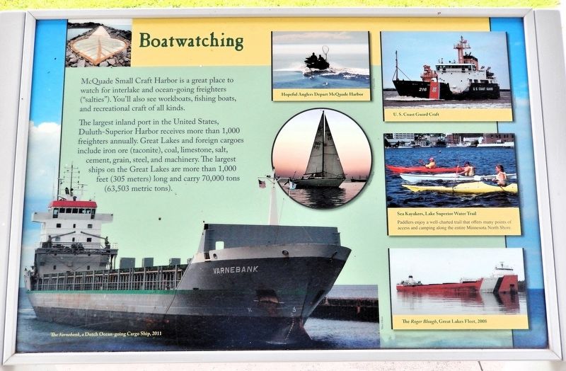
McQuade Small Craft Harbor is a great place to watch for interlake and ocean-going freighters ("salties"). You'll also see workboats, fishing boats, and recreational craft of all kinds.
The largest inland port in the United States, Duluth-Superior Harbor receives more than 1,000 freighters annually. Great Lakes and foreign cargoes include iron ore (taconite), coal, limestone, salt, cement, grain, steel, and machinery. The largest ships on the Great Lakes are more than 1,000 feet (305 meters) long and carry 70,000 tons (63,503 metric tons).
[photo and illustration captions]
• The Varnebank, a Dutch Ocean-going Cargo Ship, 2011
• Hopeful Anglers Depart McQuade Harbor
• U. S. Coast Guard Craft
• Sea Kayakers, Lake Superior Water Trail
Paddlers enjoy a well-charted trail that offers many points, of access and camping along the entire Minnesota North Shore.• The Roger Blough, Great Lakes Fleet, 2008
Topics. This historical marker is listed in these topic lists: Industry & Commerce • Parks & Recreational Areas • Waterways & Vessels.
Location. 46° 52.876′ N, 91° 55.131′ W.
this page online

Regionally, this marker is in the Arrowhead Region and in the Iron Range. It is also in the American Midwest and in the Corn Belt. Globally, it is in North America, in the Great North Woods, on the Great Lakes, in the Western Hemisphere, in the Western World, and in the Anglosphere. Historically, it finds itself in what was once the Viceroyalty of New France, Rupert’s Land, the territory of the Mississippian Culture, and the Northwest Territory.
Other nearby markers. At least 8 other markers are within 7 miles of this marker, measured as the crow flies: Superior: One Great Lake (here, next to this marker); Safe Haven from Wild Winds and Waves (here,

Photographed by Cosmos Mariner, June 24, 2024
2. Boatwatching Marker
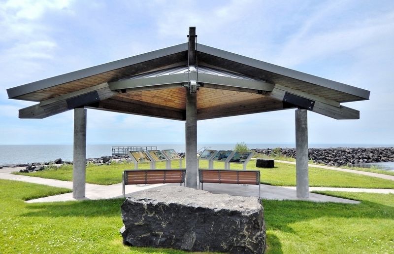
This is the rightmost of three panels on the north side of the McQuade Small Craft Harbor interpretive kiosk. The harbor is visible in the background.
Photographed by Cosmos Mariner, June 24, 2024
3. McQuade Small Craft Harbor Interpretive Kiosk
The interpretive kiosk is on the south side of North Shore Drive, overlooking Lake Superior. Access to the kiosk is from the parking lot on the north side of North Shore Drive. There is a pedestrian access tunnel under the highway. This is the rightmost of six interpretive panels in the kiosk.
Credits. This page was last revised on February 24, 2025. It was originally submitted on February 23, 2025, by Cosmos Mariner of Cape Canaveral, Florida. This page has been viewed 118 times since then and 18 times this year. Photos: 1, 2, 3. submitted on February 23, 2025, by Cosmos Mariner of Cape Canaveral, Florida.
