Sint Willibrordus, Curaçao, Dutch Caribbean — Caribbean (Dutch Caribbean)
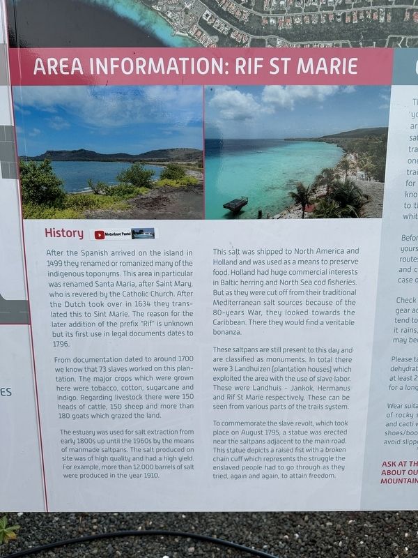
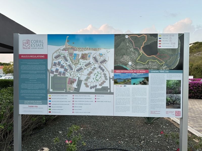
Area Information: Rif St Marie
History
Photographed by Pete Skillman, February 21, 2025
1. Area Information: Rif St Marie Marker
From documentation dated to around 1700 we know that 73 slaves worked on this plantation. The major crops which were grown here were tobacco, cotton, sugarcane and indigo. Regarding livestock there were 150 heads of cattle, 150 sheep and more than 180 goats which grazed the land.
The estuary was used for salt extraction from early 1800s up until the 1960s by the means of manmade saltpans. The salt produced on site was of high quality and had a high yield. For example, more than 12.000 barrels of salt were produced in the year 1910.
This salt was shipped to North America and Holland and was used as a means to preserve food. Holland had huge commercial interests in Baltic herring and North Sea cod fisheries. But as they
this page online
These saltpans are still present to this day and are classified as monuments. In total there were 3 Landhuizen (plantation houses) which exploited the area with the use of slave labor. These were Landhuis - Jankok, Hermanus and Rif St Marie respectively. These can be seen from various parts of the trails system.
To commemorate the slave revolt, which took place on August 1795, a statue was erected near the saltpans adjacent to the main road. This statue depicts a raised fist with a broken chain cuff which represents the struggle the enslaved people had to go through as they tried, again and again, to attain freedom.
Topics. This historical marker is listed in these topic lists: Agriculture • Colonial Era • Industry & Commerce • Settlements & Settlers. A significant historical year for this entry is 1499.
Location. 12° 11.925′ N, 69° 4.669′ W. Marker is in Sint Willibrordus, Curaçao (Curaçao). It can be reached from Weg Zonder Naam. Touch for map.
Photographed by Pete Skillman, February 21, 2025
2. Area Information: Rif St Marie Marker - wide view

Regionally, it is one of the Lesser Antilles on the Caribbean Sea, on in the Atlantic Ocean, and in North America.
Other nearby markers. At least 8 other markers are within 18 kilometers of this marker, measured as the crow flies: Headquarters & Meeting with Father Schinck (approx. 2.5 kilometers away); 1st Battle won by Freedom Fighters (approx. 3.1 kilometers away); Rif St.Marie (approx. 3.2 kilometers away); USS Erie PG-50 (approx. 15.6 kilometers away); Tribute to the Martyrs of 1795 (approx. 17.3 kilometers away); Tula's Rehabilitation Monument (approx. 17.3 kilometers away); Tula Freedom Monument (approx. 17.3 kilometers away); Free at Last (approx. 17.3 kilometers away). Touch for a list and map of all markers in Sint Willibrordus.
Credits. This page was last revised on February 26, 2025. It was originally submitted on February 26, 2025, by Pete Skillman of Wilmington, Delaware. This page has been viewed 156 times since then and 30 times this year. Photos: 1, 2. submitted on February 26, 2025, by Pete Skillman of Wilmington, Delaware.
