
Laurel Bloomery in Johnson County, Tennessee — The American South (East South Central)
Boone Trail Highway
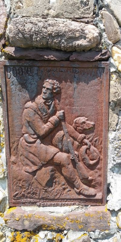
Photographed by Mark Parker, June 25, 2020
1. Boone Trail Highway Marker
Metal from Battleship Maine in Tablet
• Daniel Boone •
Topics. This historical marker is listed in these topic lists: Roads & Vehicles • War, Spanish-American • Waterways & Vessels.
Location. 36° 34.029′ N, 81° 45.571′ W. Marker is in Laurel Bloomery, Tennessee, in Johnson County. It is at the intersection of Tennessee Route 91 and Bertie Morefield Lane, on the left when traveling north on Tennessee Route 91. Touch for map. Marker is at or near this postal address: 7200 TN-91, Laurel Bloomery TN 37680, United States of America. Touch for directions.

Regionally, this marker is in East Tennessee. It is also in the American South, specifically in the Upper South, in Appalachia, and specifically in Southern Appalachia. Globally, it is in North America, the Western Hemisphere, the Western World, and the Anglosphere. Historically, it finds itself in what was once the original Cherokee Nation, the territory of the Mississippian Culture, one of the Confederate States of America, the State of Franklin, and the Antebellum South.
Other nearby markers. At least 8 other markers are within 5 miles of this marker, measured as the crow flies: Laurel Bloomery (a few steps from this marker); Washington County, Virginia / Tennessee (approx. 3.1 miles away); Backbone Rock (approx. 3.6 miles away); Transition from Rail to Trail (approx. 4.4 miles away in Virginia); Norfolk & Western Camp Car 1940 (approx. 4.6 miles away in Virginia); Virginia Creeper Trail (approx. 4.9 miles away in Virginia); Legion Island (approx. 4.9 miles away in Virginia); Churches of Damascus (approx. 5 miles away in Virginia). Touch for a list and map of all markers in Laurel Bloomery.
Also see . . . Boone Trail (Wikipedia).
Between 1913 and(Submitted on March 2, 2025, by Mark Parker of Hickory, North Carolina.)1938, Joseph Hampton Rich, a resident of Mocksville, North Carolina, placed 358 metal tablets between Virginia Beach, Virginia and San Francisco, California, in honor of Daniel Boone and his travels. This was an effort to help promote coast to coast highway improvement, tourist travel, patriotism, remembrance of the Battleship Maine, education, memorializing pioneer hero Daniel Boone, and community unity and spirit. The tablets were (at least partially) constructed from metal salvaged from the battleship USS Maine sunk during the Spanish–American War in 1898. The tablets were typically located near schools, government buildings, or along old highway routes.
Click or scan to see
this page online
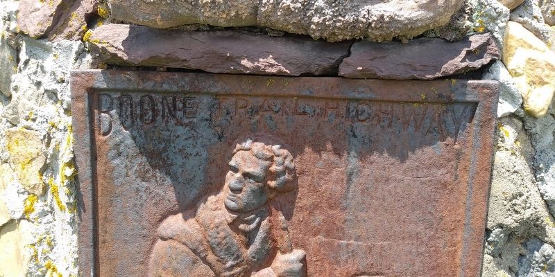
Photographed by Mark Parker, June 25, 2020
2. Close of top text "Boone Trail Highway Marker"
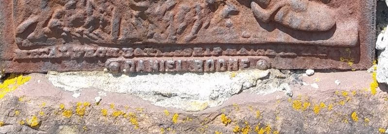
Photographed by Mark Parker, June 25, 2020
3. Closeup of bottom text "Metal from Battleship Maine in Tablet Daniel Boone"
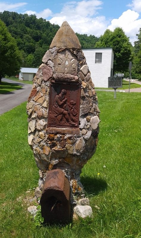
Photographed by Mark Parker, June 25, 2020
4. Full view of Boone Trail Highway Marker and Arrowhead
Credits. This page was last revised on March 17, 2025. It was originally submitted on February 28, 2025, by Mark Parker of Hickory, North Carolina. This page has been viewed 175 times since then and 32 times this year. Photos: 1, 2, 3, 4. submitted on February 28, 2025, by Mark Parker of Hickory, North Carolina. • James Hulse was the editor who published this page.
