Near Sardis in Panola County, Mississippi — The American South (East South Central)
Sardis Dam
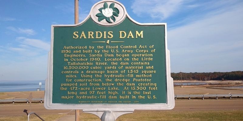
Photographed by Mark Parker, November 5, 2020
1. Sardis Dam Marker. Sardis Lake is in the background
Erected 2004 by Mississippi Department of Archives and History.
Topics. This historical marker is listed in these topic lists: Man-Made Features • Waterways & Vessels. A significant historical month for this entry is October 1940.
Location. 34° 24.09′ N, 89° 47.19′ W. Marker is near Sardis, Mississippi, in Panola County. It is on Scenic Mississippi Route 315 north of Route 35. The marker is at the Arty R. Tapp Overlook. Touch for map. Marker is in this post office area: Sardis MS 38666, United States of America. Touch for directions.

Regionally, this marker is in the American South, specifically in the Deep
this page online
Other nearby markers. At least 8 other markers are within 11 miles of this marker, measured as the crow flies: Andrew Johnson (Anders Jönssen) (approx. 7.6 miles away); Sardis (approx. 7.9 miles away); Archeology (approx. 8.6 miles away); The History (approx. 8.6 miles away); Discovery (approx. 8.6 miles away); Batesville Mounds (approx. 8.7 miles away); Bates House (approx. 10.9 miles away); Batesville (approx. 11.1 miles away). Touch for a list and map of all markers in Sardis.
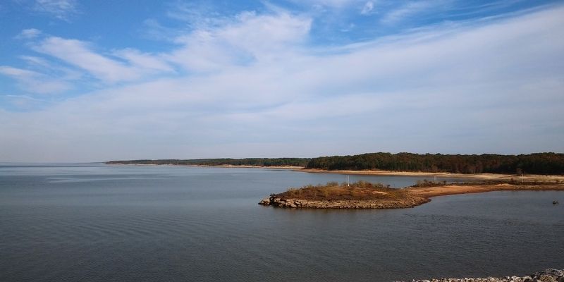
Photographed by Mark Parker, November 5, 2020
2. Sardis Lake from the overlook
Credits. This page was last revised on March 2, 2025. It was originally submitted on March 1, 2025, by Mark Parker of Hickory, North Carolina. This page has been viewed 193 times since then and 38 times this year. Photos: 1, 2. submitted on March 1, 2025, by Mark Parker of Hickory, North Carolina. • James Hulse was the editor who published this page.
