Grand Portage in Cook County, Minnesota — The American Midwest (Upper Plains)
20th-Century Grand Portage
Photographed by Cosmos Mariner, June 21, 2024
1. 20th-Century Grand Portage Marker
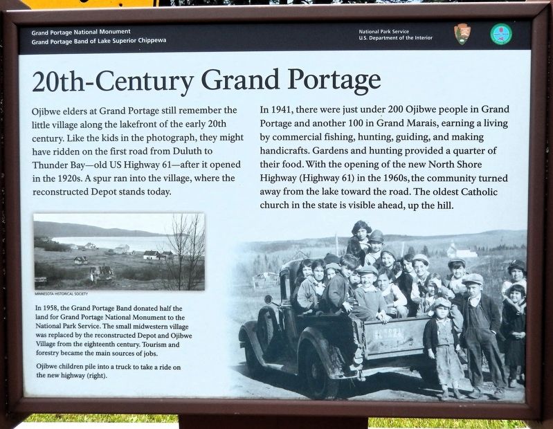
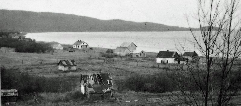
Ojibwe elders at Grand Portage still remember the little village along the lakefront of the early 20th century. Like the kids in the photograph, they might have ridden on the first road from Duluth to Thunder Bay — old US Highway 61 — after it opened in the 1920s. A spur ran into the village, where the reconstructed Depot stands today.
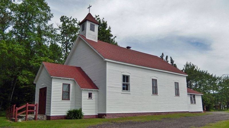
In 1941, there were just under 200 Ojibwe people in Grand Portage and another 100 in Grand Marais, earning a living by commercial fishing, hunting, guiding, and making handicrafts. Gardens and hunting provided a quarter of their food. With the opening of the new North Shore Highway (Highway 61) in the 1960s, the community turned away from the lake toward the road. The oldest Catholic church in the state is visible ahead, up the hill.
In 1958, the Grand Portage Band donated half the land for Grand Portage National Monument to the National Park Service. The small midwestern village was replaced by the reconstructed Depot and Ojibwe Village from the eighteenth century. Tourism and forestry became the main sources of jobs.
Erected by National Park Service, U.S. Department of the Interior.
this page online
Topics. This historical marker is listed in these topic lists: Indigenous Peoples and Communities • Industry & Commerce • Religion & Religious Structures • Roads & Vehicles. A significant historical year for this entry is 1941.
Location. 47° 57.815′ N, 89° 40.979′ W. Marker is in Grand Portage, Minnesota, in Cook County. It is at the intersection of Mile Creek Road (County Road 17) and Upper Road (County Road 17), on the right when traveling east on Mile Creek Road. The marker is located in a pull-out on the south side of the road, overlooking Grand Portage National Monument. Touch for map. Marker is in this post office area: Grand Portage MN 55605, United States of America. Touch for directions.

Regionally, this marker is on the Boundary Waters Canoe Area Wilderness, in the Arrowhead Region, in the Iron Range, and in the North Shore. It is also in the American Midwest and in the Corn Belt. Globally, it is in North America, in the Great North Woods, on the Great Lakes, on Lake Superior’s North Shore, in the Western Hemisphere, in the Western World, and in the Anglosphere. Historically, it finds itself in
Minnesota Historical Society
2. Marker detail: Early 20th Century Lakefront Village
Other nearby markers. At least 8 other markers are within walking distance of this marker: From Slog to Grog (a few steps from this marker); The Grand Portage (about 500 feet away, measured in a direct line); Guard the Gate (about 500 feet away); North West Company Fur Press (about 700 feet away); North West Company Depot (about 800 feet away); The Birchbark Canoe (about 800 feet away); The North West Company (approx. 0.2 miles away); Voyageurs at Grand Portage (approx. 0.2 miles away). Touch for a list and map of all markers in Grand Portage.
Related markers. Click here for a list of markers that are related to this marker.
Also see . . . Minnesota State Highway 61 (Wikipedia).
Excerpt: Minnesota State Highway 61 is a 150-mile-long highway in northeast Minnesota, which runs from Duluth to its northern terminus at the Canadian border near Grand Portage, connecting to Ontario Highway 61 at the Pigeon River Bridge and continuing to Thunder Bay. The route is a scenic highway, following(Submitted on March 2, 2025, by Cosmos Mariner of Cape Canaveral, Florida.)the North Shore of Lake Superior, and is part of the Lake Superior Circle Tour designation that runs through Minnesota, Ontario, Michigan, and Wisconsin. This roadway was designated U.S. Highway 61 (US 61) until 1991.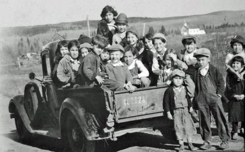 3. Marker detail: Ojibwe children pile into a truck to take a ride on the new highway
Photographed by Cosmos Mariner, June 21, 2024
4. 20th-Century Grand Portage Marker
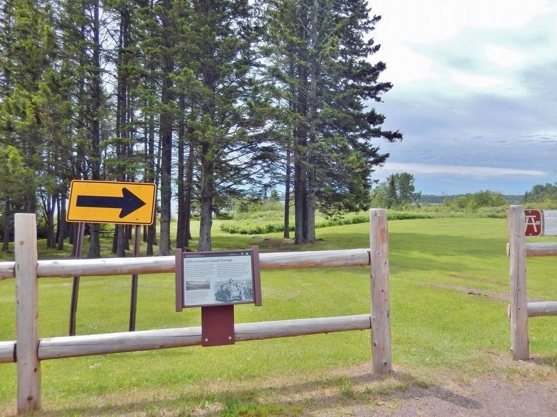
Looking south from Mile Creek Road; Grand Portage Bay is visible in the distant background.
Photographed by Cosmos Mariner, June 21, 2024
5. Holy Rosary Catholic Church
The oldest existing log church in Minnesota. The log structure was built in 1865, during the pastorate of Father Dominic Du Ranquet from Canada.
Credits. This page was last revised on March 2, 2025. It was originally submitted on March 1, 2025, by Cosmos Mariner of Cape Canaveral, Florida. This page has been viewed 155 times since then and 19 times this year. Photos: 1, 2, 3, 4, 5. submitted on March 2, 2025, by Cosmos Mariner of Cape Canaveral, Florida.
