Grand Portage in Cook County, Minnesota — The American Midwest (Upper Plains)
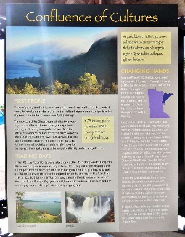
Confluence of Cultures
Photographed by Cosmos Mariner, June 21, 2024
1. Confluence of Cultures Marker
First People
Pieces of pottery found in this area show that humans have lived here for thousands of years. Archaeological evidence of ancient pits tell us that people mined copper from Isle Royale — visible on the horizon — some 4,500 years ago.
The ancestors of the Ojibwe people who live here today migrated from the east thousands of years ago. Food, clothing, and housing were produced solely from the natural environment and bark structures called wigwams provided shelter. Extensive travel routes provided access to annual harvesting, gathering, and hunting locations. With an intimate knowledge of land and lake, they plied the waves in birch bark canoes while traversing this hilly land and rugged shore.
Trading Days
In the 1700s, the North Woods was a valued source of furs for clothing wealthy Europeans. Ojibwe and European Americans trapped beaver from the great forests of Canada and hauled pelts by the thousands via the Grand Portage (Git-chi O-ni-ga-miing, translated as "the great carrying place") to the sheltered bay on the other side of Hat Point. From 1784 to 1803, the British North West Company maintained headquarters
this page online
Changing Hands
After the War of 1812, the U.S. government took control of this region. Through the Treaty of 1854, the Ojibwe people ceded lands to the United States government in exchange for designated reservation homeland, and the retention of rights to hunt, fish, and harvest throughout the ceded territory.
Later, as a result of the Dawes Act of 1887 and the Nelson Act of 1889, reservation lands were opened to settlement. Band members received one 80-acre allotment, with the remaining lands given to non-Ojibwe settlers for a $1 filing fee. With the passage of the Indian Reorganization Act of 1934 the Grand Portage Band voted to join the Minnesota Chippewa Tribe. By 1939, a new tribal government was in place at Grand Portage. Tribal Chairman Alton Bramer provided strong leadership and led the Tribal Council to buy back much of the reservation land. This initiative has continued
Photographed by Cosmos Mariner, June 21, 2024
2. Confluence of Cultures Marker
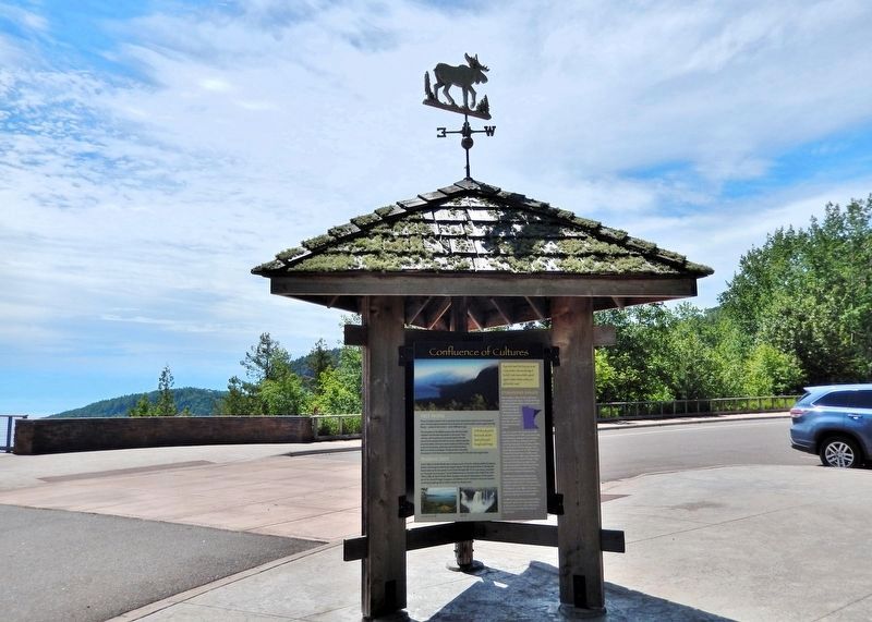
The marker is mounted in this interpretive kiosk at the Susie Islands Overlook — a scenic wayside on Minnesota Highway 61.
In 1958 the Grand Portage Band of Lake Superior Chippewa donated some of the reservation land to the U.S. government to establish a national monument. Construction of Highway 61 in the 1960s in its present alignment opened the doors to tourism as a source of income for the local people.
In 1989 the Federal Bureau of Indian Affairs, acting for the Grand Portage Band, leased a 278-acre tract to the state of Minnesota for Grand Portage State Park along the Pigeon River.
As you look toward Hat Point, you can see a clump of white cedar near the edge of the bluff. Cedar trees are held in special regard in Ojibwe tradition, as they are a gift from the Creator..
—————
[photo captions]
• Stockade & Great Hall
• High Falls
Topics. This historical marker is listed in these topic lists: Anthropology & Archaeology • Indigenous Peoples and Communities • Industry & Commerce • Settlements & Settlers.
Location. 47° 59.231′ N, 89° 39.142′ W. Marker is in Grand Portage, Minnesota, in Cook County. It is on Voyageur Highway (State Highway 61) 1½ miles north of Joes Road, on the right when traveling north. The marker is mounted in an interpretive kiosk at the Susie Islands Overlook. Touch for map. Marker is in this post office area: Grand Portage MN 55605, United States of America. Touch for directions.

Regionally, this marker is on the Boundary Waters Canoe Area Wilderness, in the Arrowhead Region, in the Iron Range, and in the North Shore. It is also in the American Midwest and in the Corn Belt. Globally, it is in North America, in the Great North Woods, on the Great Lakes, on Lake Superior’s North Shore, in the Western Hemisphere, in the Western World, and in the Anglosphere. Historically, it finds itself in what was once the Viceroyalty of New France, Rupert’s Land, the territory of the Mississippian Culture, and the Northwest Territory.
Other nearby markers. At least 8 other markers are within 3 miles of this marker, measured as the crow flies: Holy Rosary Catholic Church (approx. 2 miles away); 20th-Century Grand Portage (approx. 2.2 miles away); From Slog to Grog (approx. 2.2 miles away); The Grand Portage (approx. 2.3 miles away); Guard the Gate (approx. 2.3 miles away); North West Company Fur Press (approx. 2.3 miles away); The Birchbark Canoe (approx. 2.3 miles away); North West Company Depot (approx. 2.3 miles away). Touch for a list and map of all markers in Grand Portage.
Credits. This page was last revised on March 3, 2025. It was originally submitted on March 2, 2025, by Cosmos Mariner of Cape Canaveral, Florida. This page has been viewed 151 times since then and 21 times this year. Photos: 1, 2. submitted on March 2, 2025, by Cosmos Mariner of Cape Canaveral, Florida.
