Bridgton in Cumberland County, Maine — The American Northeast (New England)
White Pine
Pinus strobus
Photographed by Conrad Ward, September 27, 2024
1. White Pine Marker
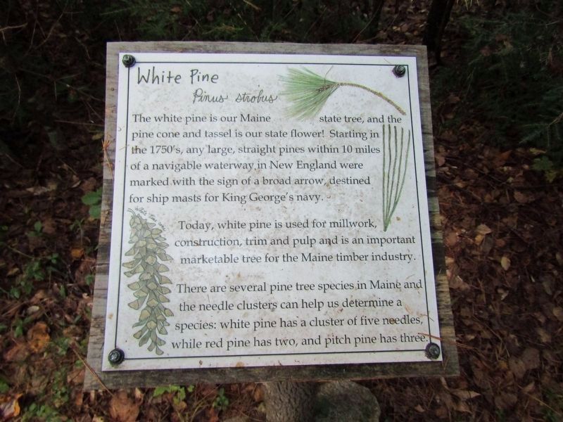
The white pine is our Maine state tree, and the pine cone and tassel is our state flower! Starting in the 1750's, any large, straight pines within 10 miles of a navigable waterway in New England were marked with the sign of a broad arrow, destined for ship masts for King George's navy.
Today, white pine is used for millwork, construction, trim and pulp and is an important marketable tree for the Maine timber industry.
There are several pine tree species in Maine and the needle clusters can help us determine a species: white pine has a cluster of five needles, while red pine has two, and pitch pine has three.
Erected by Lakes Environmental Association.
Topics. This historical marker is listed in these topic lists: Colonial Era • Horticulture & Forestry • Waterways & Vessels.
Location. 44° 6.624′ N, 70° 44.849′ W. Marker is in Bridgton, Maine, in Cumberland County. It can be reached from Commons Drive. Located in the Highland Research Forest. Touch for map. Marker is in this post office area: Bridgton ME 04009, United States of America. Touch for directions.

Regionally,
this page online
Other nearby markers. At least 8 other markers are within 4 miles of this marker, measured as the crow flies: Hemlock (about 500 feet away, measured in a direct line); Walker Memorial Hall (approx. 2.2 miles away); North Bridgton Community Club (approx. 2.4 miles away); 1st Lt. Roger F. Woodbury (approx. 2.4 miles away); Leroy A. Allen Park (approx. 2.4 miles away); Roll of Honor (approx. 3.3 miles away); Veterans Bench (approx. 3.3 miles away); The Forge Blacksmith Shop (approx. 3.4 miles away). Touch for a list and map of all markers in Bridgton.
Also see . . . Highland Research Forest (Lakes Environmental Association).
The Highland Research Forest is a 420-acre preserve in Bridgton, Maine and part of the headwaters for Highland Lake. The land was donated to LEA by the Hancock Family Foundation in 2016 and another 80 acres were added by the(Submitted on March 3, 2025.)Hatch Family in 2018.Photographed by Conrad Ward, September 27, 20242. White Pine Marker
Credits. This page was last revised on April 8, 2025. It was originally submitted on March 3, 2025, by Conrad Ward of Guilford, Connecticut. This page has been viewed 139 times since then and 31 times this year. Photos: 1, 2. submitted on March 3, 2025, by Conrad Ward of Guilford, Connecticut. • Andrew Ruppenstein was the editor who published this page.
