Sherman in Sangamon County, Illinois — The American Midwest (Great Lakes)
An Oasis on Route 66
Sherman Wayside Park
Photographed by Jason Voigt, February 23, 2025
1. An Oasis on Route 66 Marker
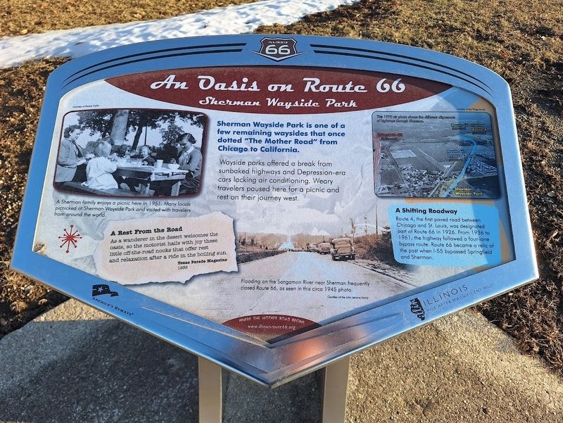
Wayside parks offered a break from sunbaked highways and Depression-era cars lacking air conditioning. Weary travelers paused here for a picnic and rest on their journey west.
A Shifting Road
Route 4, the first paved road between Chicago and St. Louis, was designated part of Route 66 in 1926. From 1936 to 1961, the highway followed a four-lane bypass route. Route 66 became a relic of the past when I-55 bypassed Springfield and Sherman.
A Rest From the Road
As a wanderer in the desert welcomes the oasis, so the motorist hails with joy these little off-the-road nooks that offer rest and relaxation after a ride in the boiling sun. - Texas Parade Magazine, 1936
(photo captions:)
·A Sherman family enjoys a picnic here in 1951. Many locals picnicked at Sherman Wayside Park and visited with travelers from around the world.
·Flooding on the Sangamon River near Sherman frequently closed Route 66, as seen in this circa 1945 photo.
Erected by Illinois Route 66 Scenic Byway.
Topics and series.
this page online
Location. 39° 53.804′ N, 89° 36.03′ W. Marker is in Sherman, Illinois, in Sangamon County. It is at the intersection of South Sherman Boulevard (Business Interstate 55) and East Andrew Road, on the right when traveling north on South Sherman Boulevard. Marker is located off a small old segment of Route 66 that is accessible from Andrew Road, by taking a hard left from the stoplight. Touch for map. Marker is at or near this postal address: 2816 Andrew Road, Sherman IL 62684, United States of America. Touch for directions.

Regionally, this marker is in Central Illinois and in Greater Springfield. It is also in the American Midwest and in the Corn Belt. Globally, it is in North America, the Western Hemisphere, the Western World, and the Anglosphere. Historically, it finds itself in what was once the territory of the Mississippian Culture and also the Northwest Territory.
Other nearby markers. At least 8 other markers

Photographed by Jason Voigt, February 23, 2025
2. An Oasis on Route 66 Marker
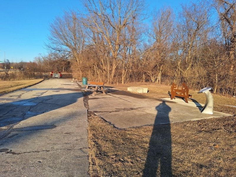
Wide view, with its supplemental interpretive statue.
Regarding An Oasis on Route 66. Marker was originally missing (was not there in 2020) but the Illinois Route 66 Scenic Byway association had replaced some of the markers that have been damaged or removed since then.
Photographed by Jason Voigt, February 23, 2025
3. An Oasis on Route 66 Marker
Marker is located off old Route 66 roadbed (where a roadside park once was).
Credits. This page was last revised on March 7, 2025. It was originally submitted on March 7, 2025, by Jason Voigt of Glen Carbon, Illinois. This page has been viewed 274 times since then and 42 times this year. Photos: 1, 2, 3. submitted on March 7, 2025, by Jason Voigt of Glen Carbon, Illinois.
