Bethel Township near New Carlisle in Miami County, Ohio — The American Midwest (Great Lakes)
The Old National Road
Photographed by William Fischer, Jr., March 6, 2010
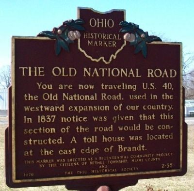
1. The Old National Road Marker
You are now traveling U.S. 40, the Old National Road, used in the westward expansion of our country. In 1837 notice was given that this section of the road would be constructed. A toll house was located at the east edge of Brandt.
Erected 1976 by Bethel Township, Miami County Citizens and The Ohio Historical Society. (Marker Number 2-55.)
Topics and series. This historical marker is listed in these topic lists: Exploration • Immigration • Notable Places • Roads & Vehicles. In addition, it is included in the Ohio Historical Society / The Ohio History Connection, and the The Historic National Road series lists. A significant historical year for this entry is 1837.
Location. 39° 54.174′ N, 84° 5.162′ W. Marker is near New Carlisle, Ohio, in Miami County. It is in Bethel Township. It is at the intersection of National Road (U.S. 40) and Ohio Route 201, on the left when traveling east on National Road. Touch for map. Marker is at or near this postal address: 7045 U.S Hwy 40, New Carlisle OH 45344, United States of America. Touch for directions.

Regionally, this marker is in the Dayton Metro, in the Miami
this page online
Other nearby markers. At least 8 other markers are within 4 miles of this marker, measured as the crow flies: Phoneton (approx. 2.4 miles away); a different marker also named Phoneton (approx. 2.6 miles away); Veterans Memorial (approx. 3.3 miles away); Honey Creek Presbyterian Church (approx. 3.3 miles away); Bethel Township Civil War Memorial (approx. 3.4 miles away); John Paul, First White Settler in Clark County, Ohio (approx. 3½ miles away); Honey Creek Presbyterian Historical Marker (approx. 3.9 miles away); Gordon I. Henslee (approx. 3.9 miles away). Touch for a list and map of all markers in New Carlisle.
Also see . . . National Road. Touring Ohio website entry (Submitted on November 22, 2024, by Larry Gertner of New York, New York.)
via Ohio History Central, unknown
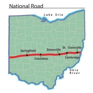
2. The National Road in Ohio
Photographed by William Fischer, Jr., March 6, 2010
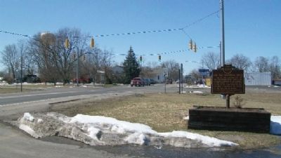
3. The Old National Road Marker
Looking west across Ohio Route 201.
Credits. This page was last revised on March 16, 2025. It was originally submitted on March 8, 2010, by William Fischer, Jr. of Reynoldsburg, Ohio. This page has been viewed 1,668 times since then and 71 times this year. Last updated on March 12, 2025, by Arch Bishop Robert Douglas Purk of New Carlisle, Ohio. Photos: 1. submitted on March 8, 2010, by William Fischer, Jr. of Reynoldsburg, Ohio. 2. submitted on July 11, 2022, by Larry Gertner of New York, New York. 3. submitted on March 8, 2010, by William Fischer, Jr. of Reynoldsburg, Ohio. • Devry Becker Jones was the editor who published this page.
