
Crystal City in Arlington in Arlington County, Virginia — The American South (Mid-Atlantic)
New and Renewed Land
Photographed by J. Makali Bruton, November 24, 2024
1. New and Renewed Land Marker
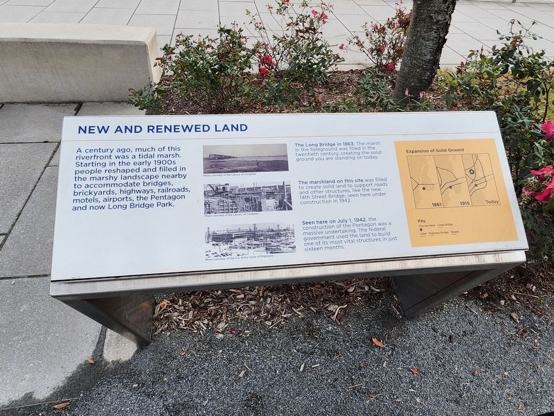
A century ago, much of this riverfront was a tidal marsh. Starting in the early 1900s people reshaped and filled in the marshy landscape nearby to accommodate bridges, brickyards, highways, Railroad's, motels, airports, the Pentagon and now Long Bridge Park.
The Long Bridge in 1863. The marshy in the foreground was filled in the twentieth century, creating the solid ground you are standing on today.
The marshland on this site was filled to create solid land to support roads and other structures like the new 14th Street Bridge, seen here under construction in 1942.
Seen here on July 1, 1942, the construction of the Pentagon was a massive undertaking. The federal government used the land to build one of its most vital structures in just sixteen months.
Erected by Arlington County.
Topics. This historical marker is listed in these topic lists: Bridges & Viaducts • Industry & Commerce • Parks & Recreational Areas • Roads & Vehicles. A significant historical date for this entry is July 1, 1942.
Location. 38° 51.802′ N, 77° 2.879′ W. Marker is in Arlington, Virginia, in Arlington County. It is in Crystal
this page online

Regionally, this marker is in the Washington Metropolitan Area and in Northern Virginia. It is also in the American South, specifically in the Upper South, in the Mid-Atlantic, and on the Eastern Seaboard. Globally, it is in the North Atlantic Region, North America, the Western Hemisphere, the Western World, and the Anglosphere. Historically, it finds itself in what was once the territory of the Mississippian Culture, one of the original Thirteen Colonies, one of the Confederate States of America, and the Antebellum South.
Other nearby markers. At least 8 other markers are within walking distance of this marker: Significance of Roaches Run Sanctuary (about 300 feet away, measured in a direct line); Fort Runyon after the Civil War (approx. 0.2 miles away); Known Units Garrisoned at Fort Runyon (approx. 0.2 miles away); The Union Soldier (approx. 0.2 miles away); Arlington Transformed by War
Other markers no longer nearby. New and Renewed Land (has been replaced with this marker); A Historic Junction (was within shouting distance of this marker but has been replaced with another marker now near it).
Related marker. Click here for another marker that is related to this marker. This marker has replaced the linked marker. There are slight differences in the inscriptions.
Credits. This page was last revised on March 13, 2025. It was originally submitted on March 13, 2025, by J. Makali Bruton of Washington, District of Columbia. This page has been viewed 136 times since then and 20 times this year. Photos: 1. submitted on November 24, 2024, by J. Makali Bruton of Washington, District of Columbia. 2. submitted on March 13, 2025, by Devry Becker Jones of Washington, District of Columbia. • Devry Becker Jones was the editor who published this page.
