Near Altamont in Albany County, New York — The American Northeast (Mid-Atlantic)
Bozenkill Preserve

Photographed by Steve Stoessel, March 15, 2025
1. Bozenkill Preserve Marker
This 225-acre Bond Road property was added to T Mohawk Hudson Land Conservaney's Bozen Kill Preserve in 2024. MHLC is grateful to neighboring landowners Bryan Swift and Lauren Lyons-Swift, along with Marti and Kevin McLoughlin, who initiated the process of preserving this land
This addition to the Bozen Kill Preserve has expanded the Bozen Kill Conservation Corridor to nearly 700 acres. The corridor currently includes protected land between MHLC's Bozen Kill Preserve and Wolf Creek Falls Preserve and is one of the Conservancy's priority protection areas.
Protecting the Bozenkill Kill
The Bozen Kill flows from the Helderberg Mountains over the traditional lands of the Mohawk and Mohican peoples. The dense forests along the steep-sided ravine formed by the Bozen Kill help protect water quality. Forest roots hold stream banks, reducing erosion in this rugged terrain and keeping waters cool and clean as they flow to the Waterviet Reservoir. Protecting water quality is critical as this source serves more than 30,000 residents in the Town of Guilderland and City of Watervliet.
Early European settlers clear cut much
this page online
Protecting Wildlife
The Nature Conservancy identifies the Bozen Kill Conservation Corridor as an area of high value for biological diversity and climate resiliency. Resilient and connected areas are critical to ensuring clean water and habitat for wildlife and people as the climate changes. The New York State Open Space Plan also identifies the corridor as a conservation priority. Black bears, bobcats, and fishers call this landscape home—all animals that require large tracts of land and limited human disturbance to carry out their life cycles.
Trails are limited to only a section of the property,
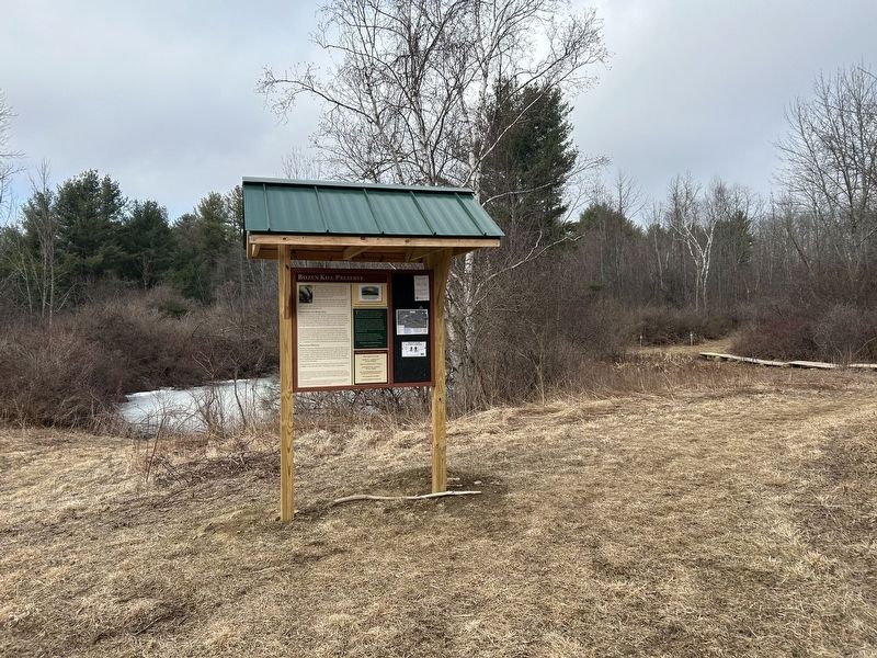
Photographed by Steve Stoessel, March 15, 2025
2. Bozenkill Preserve Marker
The acquisition of this property was made possible thanks to funding from The Nature Conservancy, Scenic Hudson Inc., the Land Trust Alliance, The William Gundry Broughton Private Charitable Foundation, The Weill Foundation, Fields Pond Foundation, and generous support from community members and the Town of Guilderland This project was also supported by Albany County American Rescue Plan Act (ARPA) Funding provided by the U.S. Department of Treasury.
This kiosk was supported with funding from the New York State Conservation Partnership Program (NYSCPP) and New York's Environmental Protection Fund. The NYSCPP is administered by the Land Trust Alliance, in coordination with the state Department of Environmental Conservation.
[Right Inset]
The Mohawk Hudson Land Conservancy's mission is to conserve and steward lands and waters of the Mohawk and Hudson River Valleys for the benefit of people and the environment.
MHLC's commitment to preserving these natural resources honors the legacy of the Mohican and Mohawk peoples as the stewards who nurtured this land since time immemorial. We honor and respect their care of the natural world and commit our efforts to making these lands a more inclusive and equitable environment for all.
This preserve is one of many properties the Conservancy owns and opens to the public for hiking and outdoor recreation.
Erected 2025.
Topics. This historical marker is listed in these topic lists: Environment • Parks & Recreational Areas. A significant historical year for this entry is 2024.
Location. 42° 43.565′ N, 74° 4.141′ W. Marker is near Altamont, New York, in Albany County. It is on Bond Road. Marker is at the end of Bond Road at the trailhead for the preserve. Touch for map. Marker is in this post office area: Altamont NY 12009, United States of America. Touch for directions.

Regionally, this marker is in Upstate New York, in the Capital District, and in the Albany Metropolitan Area. It is also in the American Northeast and in the Mid-Atlantic. Globally, it is in North America, the Western Hemisphere, the Western World, and the Anglosphere. Historically, it finds itself in what was once New Netherland and also one of the original Thirteen Colonies.
Other nearby markers. At least 8 other markers are within 3 miles of this marker, measured as the crow flies: Wolf Creek Falls Preserve (approx. 0.9 miles away); Patriot Burials (approx. 1.2 miles away); Van Auken Brothers (approx. 1.4 miles away); Liberty's Women (approx. 1.4 miles away); a different marker also named Patriot Burials (approx. 1.6 miles away); Settles Hill (approx. 1.6 miles away); Toll Gate #3 (approx. 2.1 miles away); Whipple Farm (approx. 2.2 miles away). Touch for a list and map of all markers in Altamont.
Credits. This page was last revised on March 17, 2025. It was originally submitted on March 16, 2025, by Steve Stoessel of Niskayuna, New York. This page has been viewed 229 times since then and 61 times this year. Photos: 1. submitted on March 16, 2025, by Steve Stoessel of Niskayuna, New York. 2. submitted on March 17, 2025, by Steve Stoessel of Niskayuna, New York.
