Midtown East in Manhattan in New York County, New York — The American Northeast (Mid-Atlantic)
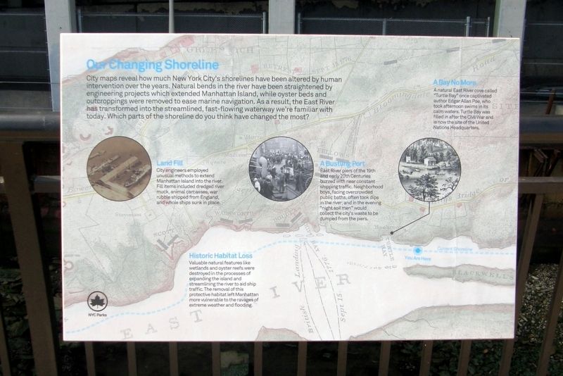
Our Changing Coastline
Photographed by Larry Gertner, September 4, 2024
1. Our Changing Coastline wayside
City maps reveal how much New York City’s shorelines have been altered by human intervention over the years. Natural bends in the river have been straightened by engineering projects which extended Manhattan Island, while oyster beds and outcroppings were removed to improve marine navigation. As a result, the East River has transformed into the streamlined, fast-flowing waterway we’re familiar with today. Which parts of the shoreline do you think have changed the most?
Land Fill
City engineers employed unusual methods to extend Manhattan Island into the river. Fill items included dredged river muck, animal carcasses, war rubble shipped from England, and whole ships sunk in place.
A Bustling Port
East River piers of the 19th and early 20th centuries buzzed with near constant shipping traffic. Neighborhood boys, facing overcrowded public baths, often took dips in the river; and in the evening “night soil men” would collect the city’s waste to be dumped from the piers.
A Bay No More
A natural East River cove called “Turtle Bay” once captivated author Edgar Allen Poe, who also took afternoon swims in its calm waters.
this page online
Historic Habitat Loss
Valuable natural features like wetlands and oyster reefs were destroyed in the processes of expanding the island and streamlining the river to aid ship traffic. The removal of this protective habitat left Manhattan more vulnerable to the ravages of extreme weather and flooding.
Erected 2024 by NYC Parks.
Topics. This historical marker is listed in these topic lists: Environment • Waterways & Vessels.
Location. 40° 45.341′ N, 73° 57.638′ W. Marker is in Manhattan, New York, in New York County. It is in Midtown East. It is on East River Greenway, on the right. Touch for map. Marker is in this post office area: New York NY 10022, United States of America. Touch for directions.

Regionally, this marker is in New York City. It is also in the American Northeast, in the Mid-Atlantic, and on the Eastern Seaboard. Globally, it is in the North Atlantic Region, North America, the Western Hemisphere, the Western World, and the Anglosphere. Historically,
Photographed by Larry Gertner, September 4, 2024
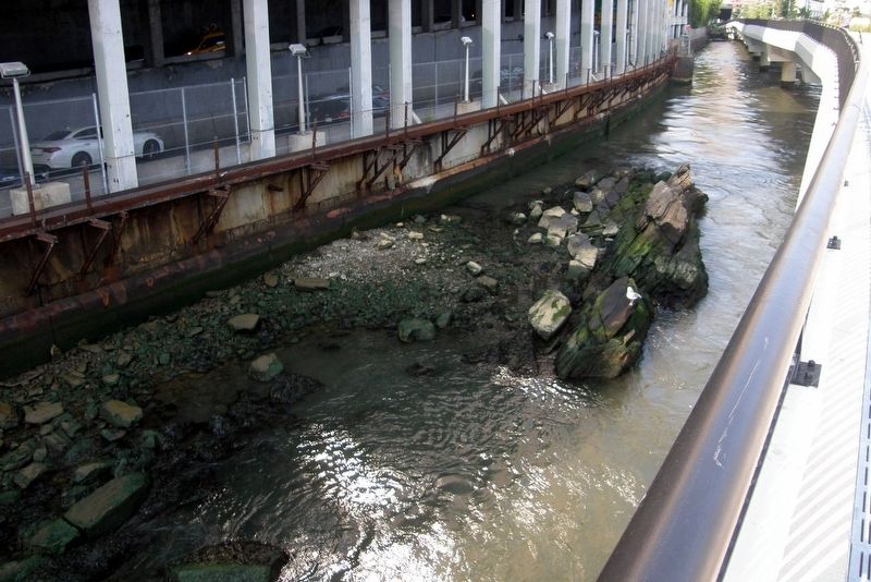
2. A Manhattan Island outcropping
Other nearby markers. At least 8 other markers are within walking distance of this marker: A River in Name Only (about 500 feet away, measured in a direct line); Diatom Lace (about 500 feet away); Ieoh Ming (I.M.) Pei (about 700 feet away); Designing for Nature (approx. 0.2 miles away); Southpoint Park (approx. 0.2 miles away); Cornell Tech / Blackwell's Island Penitentiary / Goldwater Hospital / WPA-Era Murals (approx. 0.2 miles away); FDR Hope Memorial (approx. ¼ mile away); The Neighborhood Playhouse School of the Theatre & Sanford Meisner (approx. ¼ mile away). Touch for a list and map of all markers in Manhattan.
Also see . . .
1. Bristol Basin. Atlas Obscura website entry:
A small part of lower Manhattan is actually made from a bit of England - war debris from the city of Bristol. (Submitted on March 17, 2025, by Larry Gertner of New York, New York.)
2. East River Park. The former site of many piers, the park was destroyed to rebuilt as a bulwark against future flooding. (Submitted on March 17, 2025, by Larry Gertner of New York, New York.)
3. Turtle Bay History. Turtle Bay Association website entry:
From a pastoral setting of wealthy farms in the 1700s to the site of the United Nations. (Submitted on March 17, 2025, by Larry Gertner of New York, New York.)
4. Billion Oyster Project. Website entry:
Restoring oyster reefs to NY Harbor through public education initiatives. (Submitted on March 17, 2025, by Larry Gertner of New York, New York.)
Credits. This page was last revised on March 20, 2025. It was originally submitted on March 17, 2025, by Larry Gertner of New York, New York. This page has been viewed 160 times since then and 26 times this year. Photos: 1, 2. submitted on March 17, 2025, by Larry Gertner of New York, New York.
