St. Michaels in Talbot County, Maryland — The American Northeast (Mid-Atlantic)
The Miles River
Photographed by Don Morfe, November 4, 2011
1. The Miles River Marker
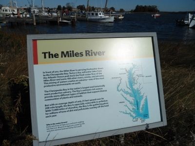
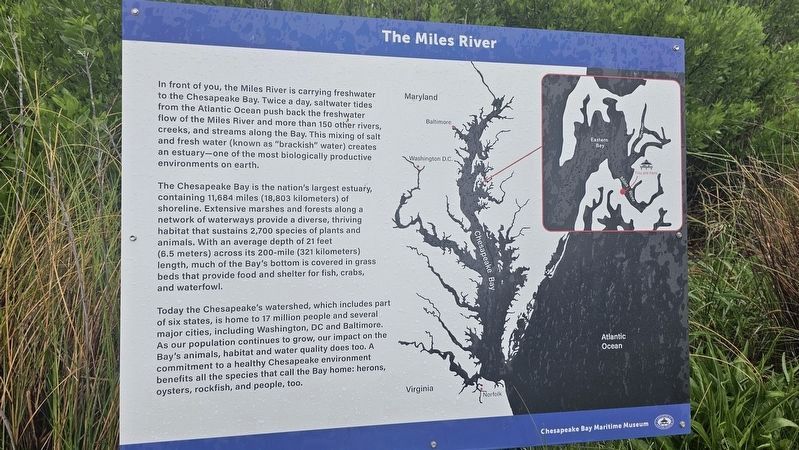
In front of you, the Miles River is carrying freshwater down to the Chesapeake Bay. Twice a day, saltwater tides from the Atlantic Ocean push back the fresh water flow of the Miles River and some 150 other rivers, creeks, and streams along the Bay. This mixing of salt and fresh water (known as “brackish” water) creates an estuary—one of the most biologically productive environments on earth.
The Chesapeake Bay is the nation’s largest estuary, containing 11,684 miles (18,803 kilometers) of shoreline. Extensive marshes and forests along a network of waterways provide a diverse, thriving habitat that sustains 2,700 species of plants and animals. With an average depth of 21 feet (6.5 meters) across its 200-mile (321 kilometers) length, much of the Bay's bottom is covered in grass beds that provide food and shelter for fish, crabs, and waterfowl.
Today the Chesapeake's watershed, which includes part of six states, is home to 17 million people and several major cities, including Washington, DC and Baltimore. As our population continues to grow, our impact on the Bay's animals habitat and water quality does too. A commitment
this page online
Erected by Chesapeake Bay Maritime Museum.
Topics. This historical marker is listed in these topic lists: Environment • Waterways & Vessels.
Location. Marker has been permanently removed. It was located near 38° 47.226′ N, 76° 13.158′ W. Marker was in St. Michaels, Maryland, in Talbot County. It was on Mill Street. Touch for map. Marker was in this post office area: Saint Michaels MD 21663, United States of America.
We have been informed that this marker is no longer there and will not be replaced. This page is an archival view of what was.
Regionally, this marker was on the Eastern Shore. It was also in the American Mid-Atlantic, on the Delmarva Peninsula, in the Tidewater, in the Chesapeake Bay Region, and on the Eastern Seaboard. Globally, it was in the North Atlantic Region, North America, the Western Hemisphere, the Western World, and the Anglosphere. Historically, it found itself in what was once one of the original Thirteen


Photographed by Don Morfe, November 4, 2011
2. The Miles River Marker
Other nearby markers. At least 8 other markers are within walking distance of this location: Rebuilding Rosie Parks (within shouting distance of this marker); Too Much of a Good Thing (within shouting distance of this marker); Delaware (within shouting distance of this marker); How the Screwpile Lighthouse Got Its Name (within shouting distance of this marker); Iconic Chesapeake Light (within shouting distance of this marker); Dorothy Lee (within shouting distance of this marker); 1879 Hooper Strait Lighthouse (within shouting distance of this marker); a different marker also named Point Lookout Fog Bell Tower (within shouting distance of this marker). Touch for a list and map of all markers in St. Michaels.
Other markers no longer nearby. Miniature Skipjack, Spat (was within shouting distance of this marker but has been permanently removed); Hooper Strait Lighthouse (was within shouting distance of this marker but has been replaced with another marker now near it); Point Lookout Fog Bell Tower (was within shouting distance of this marker but has been permanently removed).
More about this marker.

Photographed by Don Morfe, November 4, 2011
3. The Miles River Marker
Additional commentary.
1. About the marker
When the sign was included in the database, displays that exclusively interpreted natural history and natural features were welcomed. However, they no longer are. The replacing plaque does not fit the current guidelines for HMdb.
— Submitted March 31, 2025, by Devry Becker Jones of Washington, District of Columbia.
Photographed by Ian Lefkowitz, May 5, 2024
4. The replacing Miles River signage
Credits. This page was last revised on March 31, 2025. It was originally submitted on December 1, 2012, by Don Morfe of Baltimore, Maryland. This page has been viewed 1,345 times since then and 61 times this year. Last updated on March 19, 2025, by Ian Lefkowitz of New York, New York. Photos: 1, 2, 3. submitted on December 1, 2012, by Don Morfe of Baltimore, Maryland. 4. submitted on March 19, 2025, by Ian Lefkowitz of New York, New York. • Devry Becker Jones was the editor who published this page.
