Des Plaines in Cook County, Illinois — The American Midwest (Great Lakes)
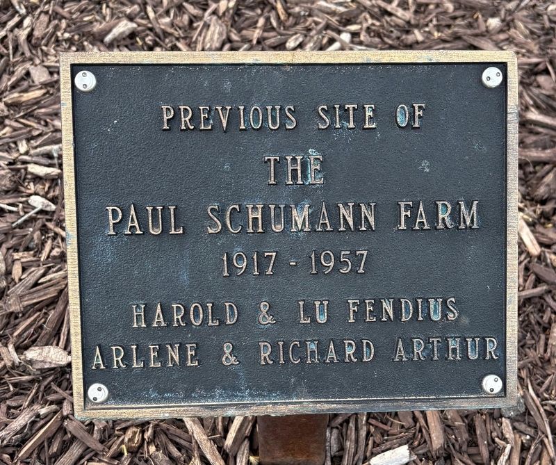
Paul Schumann Farm
Photographed by Sean P. Flynn, March 21, 2025
1. Paul Schumann Farm Marker
1917-1957
Erected by Harold and Lu Fendius; Arlene and Richard Arthur.
Topics. This historical marker is listed in these topic lists: Agriculture • Parks & Recreational Areas. A significant historical year for this entry is 1917.
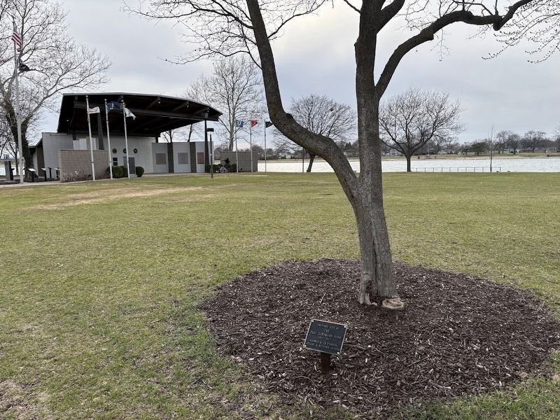
Location. 42° 0.807′ N, 87° 53.662′ W. Marker is in Des Plaines, Illinois, in Cook County. It is on Lee Street north of Fargo Avenue, on the right when traveling south. The marker is in front of a tree in Lake Park, about 50 yards northeast of the pavilion. Touch for map. Marker is in this post office area: Des Plaines IL 60018, United States of America. Touch for directions.

Regionally, this marker is in Greater Chicago. It is also in the American Midwest. Globally, it is in North America, on the Great Lakes, in the Western Hemisphere, in the Western World, and in the Anglosphere. Historically, it finds itself in what was once the Viceroyalty of New France, the territory of the Mississippian Culture, and the Northwest Territory.
Other nearby markers. At least 8 other markers are within walking distance of this marker: Illinois Remembers POW/MIA
this page online
More about this marker. Paul Schumann farmed here until the late 1950s, when the land was acquired for the construction of Interstate 90 (the Jane Addams Tollway) and its interchange with Lee Street. Lake Opeka, which makes up most of this park, was created to provide dirt for the interstate construction. The Des Plaines Park District acquired 60 acres (including the 39-acre lake) for $1 in 1960. In 2007 it acquired land owned by Good Shepherd Church; in 2021 it acquired the church building itself, which is now home to a restaurant.
Also see . . .
1. Paul Schumann at Lake Park.
Photographed by Sean P. Flynn, March 21, 2025
2. Paul Schumann Farm Marker
2. Des Plaines Yacht Club history. The story includes a history of Lake Park and its man-made lake, Lake Opeka. (Submitted on March 23, 2025, by Sean P. Flynn of Oak Park, Illinois.)
Credits. This page was last revised on September 15, 2025. It was originally submitted on March 23, 2025, by Sean P. Flynn of Oak Park, Illinois. This page has been viewed 253 times since then and 40 times this year. Photos: 1, 2. submitted on March 23, 2025, by Sean P. Flynn of Oak Park, Illinois.
