West Central in Fort Wayne in Allen County, Indiana — The American Midwest (Great Lakes)
The First French Fort
⎯⎯⎯
The First Playground in Fort Wayne
Photographed by Dale K. Benington, July 20, 2009
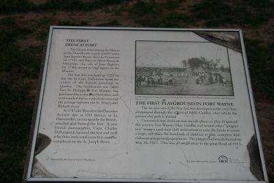
1. The First French Fort / The First Playground in Fort Wayne Marker
The First French Fort
The French lived among the Miami at the Three Rivers as early as 1697 when Jean Baptiste Bissot, Sieur de Vincennes (d. 1719), and Francois Marie Bissot de Vincennes, the son of Jean Baptiste (d. 1736), served as royal agents to the Miamis.
The first fort was built in 1722 on this site by Capt. Dubuisson upon the orders of the French governor in Quebec. The fortification was called Fort St. Philippe or Fort Miamis, was garrisoned by as many as thirty men, and commanded the fur trade in the area and the portage between the St. Mary’s and Wabash rivers.
In 1747, the Wyandot chief Sanosket (known also as Old Britain or La Damoiselle), encouraged by the British, attacked and burned the fort. A new French commandant, Capt. Charles DeRaimond, repaired the fort and used it for three years until a new fort could be completed on the St. Joseph.
The First Playground in Fort Wayne
The six-acre site of the first fort was developed as the city’s first playground through the efforts of Addie Guldlin, after whom the present-day park is named.
Concerned that children had no safe places to play in
this page online
Topics. This historical marker is listed in these topic lists: Forts and Castles • Parks & Recreational Areas • War, French and Indian. A significant historical month for this entry is May 1925.
Location. 41° 4.859′ N, 85° 9.069′ W. Marker is in Fort Wayne, Indiana, in Allen County. It is in West Central. It is at the intersection of Van Buren Street and Michaels Avenue, on the right when traveling north on Van Buren Street. This historical marker is located at the southeastern end of the Sherman Boulevard Bridge, right next to a state of Indiana historic marker entitled "Fort Miamis.". Touch for map. Marker is in this post office area: Fort Wayne IN 46802, United States of America. Touch for directions.

Regionally, this marker is in Northern Indiana. It is also in the American Midwest and in
Photographed by Dale K. Benington, July 20, 2009
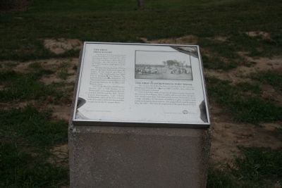
2. The First French Fort / The First Playground in Fort Wayne Marker
Other nearby markers. At least 8 other markers are within walking distance of this marker: Fort Miamis (here, next to this marker); Post Miami (within shouting distance of this marker); The Hugh McCulloch House (about 700 feet away, measured in a direct line); Old Aqueduct Club Memorial (approx. ¼ mile away); Carole Lombard (approx. ¼ mile away); Trinity Episcopal Churh (approx. 0.3 miles away); John Claus Peters House (approx. 0.3 miles away); The Samuel Brenton Home (approx. 0.3 miles away). Touch for a list and map of all markers in Fort Wayne.
Photographed by Dale K. Benington, July 20, 2009
3. The First French Fort / The First Playground in Fort Wayne Marker
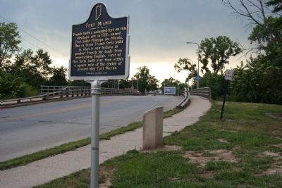
View of historical marker seen along Van Buren Street, between the "Fort Miamis" historical marker and the Sherman Boulevard Bridge.
Credits. This page was last revised on March 3, 2024. It was originally submitted on January 24, 2010, by Dale K. Benington of Toledo, Ohio. This page has been viewed 4,248 times since then and 41 times this year. Last updated on February 17, 2024, by Trevor L Whited of Kokomo, Indiana. Photos: 1, 2, 3. submitted on January 24, 2010, by Dale K. Benington of Toledo, Ohio. • Devry Becker Jones was the editor who published this page.
